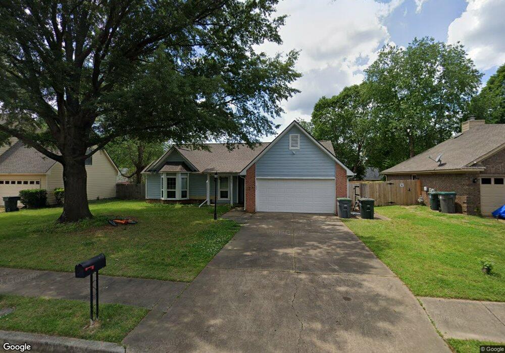
2587 Laurelcrest Dr Memphis, TN 38133
Estimated Value: $230,761 - $263,000
3
Beds
2
Baths
1,736
Sq Ft
$139/Sq Ft
Est. Value
About This Home
This home is located at 2587 Laurelcrest Dr, Memphis, TN 38133 and is currently estimated at $240,690, approximately $138 per square foot. 2587 Laurelcrest Dr is a home located in Shelby County with nearby schools including Kate Bond Elementary School, Kate Bond Middle School, and Cordova High School.
Ownership History
Date
Name
Owned For
Owner Type
Purchase Details
Closed on
Mar 16, 2023
Sold by
Peters Melissa Gail
Bought by
Melissa G Peters Revocable Living Trust
Current Estimated Value
Purchase Details
Closed on
Apr 16, 2017
Sold by
Peters Kevin Neil
Bought by
Peters Melissa Gail
Create a Home Valuation Report for This Property
The Home Valuation Report is an in-depth analysis detailing your home's value as well as a comparison with similar homes in the area
Home Values in the Area
Average Home Value in this Area
Purchase History
| Date | Buyer | Sale Price | Title Company |
|---|---|---|---|
| Melissa G Peters Revocable Living Trust | -- | -- | |
| Peters Melissa Gail | -- | None Available |
Source: Public Records
Tax History
| Year | Tax Paid | Tax Assessment Tax Assessment Total Assessment is a certain percentage of the fair market value that is determined by local assessors to be the total taxable value of land and additions on the property. | Land | Improvement |
|---|---|---|---|---|
| 2025 | -- | $61,475 | $8,750 | $52,725 |
| 2024 | -- | $41,500 | $6,125 | $35,375 |
| 2023 | $2,528 | $41,500 | $6,125 | $35,375 |
| 2022 | $2,528 | $41,500 | $6,125 | $35,375 |
| 2021 | $2,558 | $41,500 | $6,125 | $35,375 |
| 2020 | $2,148 | $29,650 | $6,125 | $23,525 |
| 2019 | $2,148 | $29,650 | $6,125 | $23,525 |
| 2018 | $2,148 | $29,650 | $6,125 | $23,525 |
| 2017 | $1,219 | $29,650 | $6,125 | $23,525 |
| 2016 | $1,117 | $25,550 | $0 | $0 |
| 2014 | $1,117 | $25,550 | $0 | $0 |
Source: Public Records
Map
Nearby Homes
- 2596 Appling Glen Dr
- 7503 Appling Estate Dr
- 7551 Meadowland Dr
- 7533 Meadowland Dr
- 2442 Green Glen Dr
- 7513 Meadowland Dr
- 2565 Lakeside Dr
- 2593 Kate Bond Rd
- 7360 Vondel Cove
- 2718 Kate Bond Rd
- 2695 van Hersh Dr
- 2412 Kate Bond Rd
- 2717 Deer Glade Ln
- 0 Appling Rd Unit 10214193
- 0 Appling Rd Unit 10214089
- 2776 Deer Glade Ln
- 7250 Hillshire Dr
- 7251 Hillshire Dr
- 7061 Texel Cove
- 7065 Petten Dr
- 2579 Laurelcrest Dr
- 2593 Laurelcrest Dr
- 2580 Appling Crest Dr
- 2586 Appling Crest Dr
- 2573 Laurelcrest Dr
- 2574 Appling Crest Dr
- 2601 Laurelcrest Dr
- 2592 Appling Crest Dr
- 2590 Laurelcrest Dr
- 2584 Laurelcrest Dr
- 2568 Appling Crest Dr
- 2600 Laurelcrest Dr
- 2576 Laurelcrest Dr
- 2565 Laurelcrest Dr
- 2600 Appling Crest Dr
- 2607 Laurelcrest Dr
- 2562 Appling Crest Dr
- 2606 Laurelcrest Dr
- 2581 Appling Crest Dr
- 2575 Appling Crest Dr
Your Personal Tour Guide
Ask me questions while you tour the home.