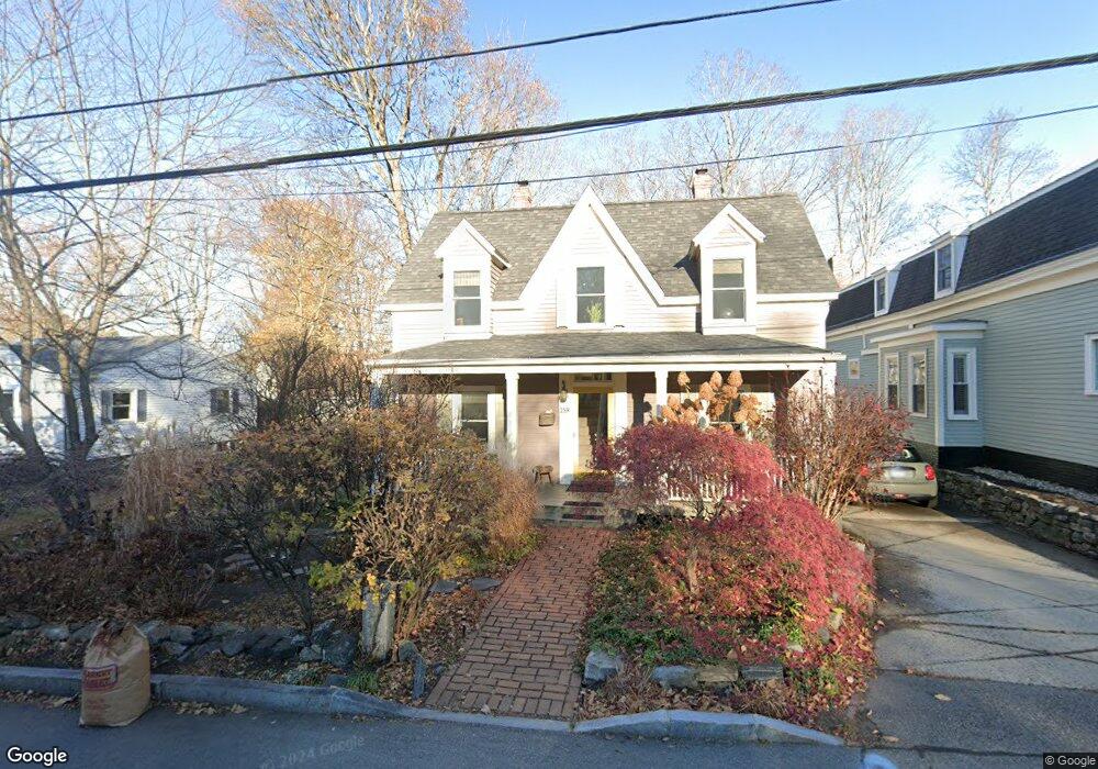
259 Broad St Portsmouth, NH 03801
Estimated Value: $1,102,113 - $1,198,000
3
Beds
2
Baths
1,636
Sq Ft
$709/Sq Ft
Est. Value
About This Home
This home is located at 259 Broad St, Portsmouth, NH 03801 and is currently estimated at $1,159,278, approximately $708 per square foot. 259 Broad St is a home located in Rockingham County with nearby schools including Little Harbour School, Portsmouth Middle School, and Portsmouth High School.
Ownership History
Date
Name
Owned For
Owner Type
Purchase Details
Closed on
May 1, 1998
Sold by
Anderson Joanne M
Bought by
Hoppenwasser Ann P
Current Estimated Value
Home Financials for this Owner
Home Financials are based on the most recent Mortgage that was taken out on this home.
Original Mortgage
$220,500
Interest Rate
7.04%
Mortgage Type
Purchase Money Mortgage
Create a Home Valuation Report for This Property
The Home Valuation Report is an in-depth analysis detailing your home's value as well as a comparison with similar homes in the area
Home Values in the Area
Average Home Value in this Area
Purchase History
| Date | Buyer | Sale Price | Title Company |
|---|---|---|---|
| Hoppenwasser Ann P | $245,000 | -- |
Source: Public Records
Mortgage History
| Date | Status | Borrower | Loan Amount |
|---|---|---|---|
| Open | Hoppenwasser Ann P | $200,000 | |
| Closed | Hoppenwasser Ann P | $220,500 |
Source: Public Records
Tax History Compared to Growth
Tax History
| Year | Tax Paid | Tax Assessment Tax Assessment Total Assessment is a certain percentage of the fair market value that is determined by local assessors to be the total taxable value of land and additions on the property. | Land | Improvement |
|---|---|---|---|---|
| 2024 | $11,917 | $1,065,900 | $627,000 | $438,900 |
| 2023 | $9,663 | $599,100 | $373,200 | $225,900 |
| 2022 | $9,106 | $599,100 | $373,200 | $225,900 |
| 2021 | $9,004 | $599,100 | $373,200 | $225,900 |
| 2020 | $8,807 | $599,100 | $373,200 | $225,900 |
| 2019 | $8,903 | $599,100 | $373,200 | $225,900 |
| 2018 | $8,554 | $540,000 | $339,200 | $200,800 |
| 2017 | $8,305 | $540,000 | $339,200 | $200,800 |
| 2016 | $7,605 | $446,300 | $268,800 | $177,500 |
| 2015 | $7,493 | $446,300 | $268,800 | $177,500 |
| 2014 | $6,958 | $384,400 | $230,900 | $153,500 |
| 2013 | $6,885 | $384,400 | $230,900 | $153,500 |
| 2012 | $6,750 | $384,600 | $230,900 | $153,700 |
Source: Public Records
Map
Nearby Homes
- 161 Wibird St
- 219 Sagamore Ave
- 34 Highland St
- 21 Madison St
- 149 Jones Ave
- 5 Old Parish Way
- 238 Austin St
- 210 South St
- 320 Thaxter Rd
- 97 Middle Rd
- 6 Rockaway St
- 115 Court St
- 198 Islington St Unit 6
- 4 Rock St Unit B
- 405 Pleasant St
- 490 Islington St Unit 1
- 325 Marcy St
- 51 Islington St Unit 406
- 199 Mcdonough St
- 90 Fleet St Unit 4-5
- 253 Broad St
- 295 Broad St
- 239 Broad St
- 354 Miller Ave
- 354 Miller Ave Unit 1
- 260 Broad St
- 396 Miller Ave
- 352 Miller Ave Unit 2
- 352 Miller Ave Unit 1
- 336 Miller Ave
- 250 Broad St
- 675 South St Unit 8
- 675 South St Unit 7
- 675 South St Unit 6
- 675 South St Unit 5
- 675 South St Unit 15
- 675 South St Unit 15
- 675 South St
- 677 South St Unit 9
- 677 South St Unit 12