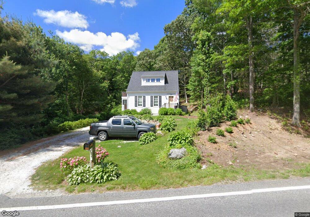
259 Main St West Barnstable, MA 02668
West Barnstable NeighborhoodEstimated Value: $745,000 - $891,000
2
Beds
2
Baths
1,798
Sq Ft
$468/Sq Ft
Est. Value
About This Home
This home is located at 259 Main St, West Barnstable, MA 02668 and is currently estimated at $841,301, approximately $467 per square foot. 259 Main St is a home located in Barnstable County with nearby schools including West Barnstable Elementary School, Barnstable United Elementary School, and Barnstable Intermediate School.
Ownership History
Date
Name
Owned For
Owner Type
Purchase Details
Closed on
Jan 31, 2019
Sold by
Superior Hotel Management
Bought by
Aaria Hospitality Llc
Current Estimated Value
Create a Home Valuation Report for This Property
The Home Valuation Report is an in-depth analysis detailing your home's value as well as a comparison with similar homes in the area
Home Values in the Area
Average Home Value in this Area
Purchase History
| Date | Buyer | Sale Price | Title Company |
|---|---|---|---|
| Aaria Hospitality Llc | $7,700,000 | -- |
Source: Public Records
Tax History
| Year | Tax Paid | Tax Assessment Tax Assessment Total Assessment is a certain percentage of the fair market value that is determined by local assessors to be the total taxable value of land and additions on the property. | Land | Improvement |
|---|---|---|---|---|
| 2025 | $7,702 | $824,600 | $262,700 | $561,900 |
| 2024 | $6,809 | $793,600 | $262,700 | $530,900 |
| 2023 | $6,699 | $735,400 | $259,900 | $475,500 |
| 2022 | $6,279 | $565,200 | $166,500 | $398,700 |
| 2021 | $6,053 | $516,500 | $176,900 | $339,600 |
| 2020 | $6,461 | $533,100 | $187,300 | $345,800 |
| 2019 | $6,238 | $508,000 | $197,700 | $310,300 |
| 2018 | $5,785 | $466,900 | $197,200 | $269,700 |
| 2017 | $5,622 | $459,300 | $202,700 | $256,600 |
| 2016 | $5,527 | $461,000 | $204,400 | $256,600 |
| 2015 | $5,271 | $440,700 | $198,600 | $242,100 |
Source: Public Records
Map
Nearby Homes
- 50 Wayside Ln
- 510 Cedar St
- 75 Old Toll Rd
- 3 Mulberry Cir
- 6 Harpers Hollow
- 46 Service Rd
- 4 Wing Blvd
- 566 Route 6a
- 0 Captain Kidd Rd
- 29 Fish House Rd
- 159 Great Hill Rd
- 282 Parker Rd
- 507 Route 6a Unit 9
- 74 Saddler Ln
- 19 Cedarville Rd
- 29 Appaloosa Way
- 6 George Gallant Rd
- 80 Branch Terrace
- 174 N Shore Blvd Unit 1
- 36 Atkins Rd Unit D2
- 280 Old King's Hwy
- 280 Main St Rte 6a
- 280 Main St Rte 6a (W Barn )
- 285 Main St
- 285 Route 6a
- 285 Massachusetts 6a
- 280 Main St
- 229 Main St
- 229 Main St
- 300 Way Off Main St
- 180 High St
- 285 Main Route 6a St
- 210 High St
- 176 High St
- 200 High St
- 200 Main St
- 21 Isabel Ln
- 0,21,39 Isabel Ln
- 317 Main St
- 150 High St
Your Personal Tour Guide
Ask me questions while you tour the home.