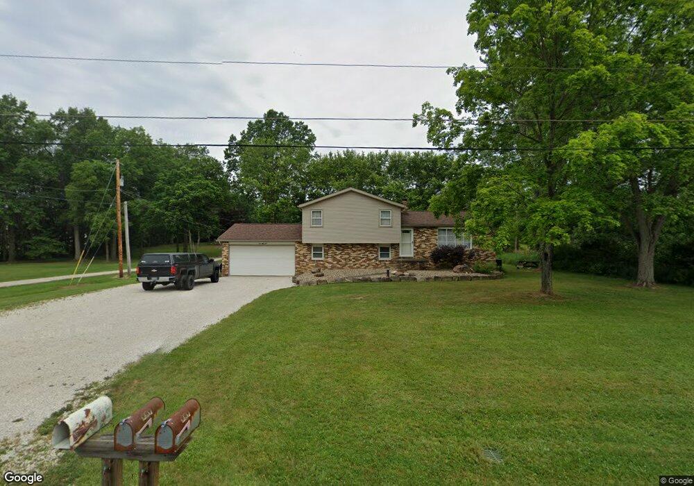
259 Maxwell Rd Atwater, OH 44201
Estimated Value: $272,000 - $362,000
3
Beds
2
Baths
1,600
Sq Ft
$187/Sq Ft
Est. Value
About This Home
This home is located at 259 Maxwell Rd, Atwater, OH 44201 and is currently estimated at $298,460, approximately $186 per square foot. 259 Maxwell Rd is a home located in Portage County with nearby schools including Waterloo Elementary School, Waterloo Middle School, and Waterloo High School.
Ownership History
Date
Name
Owned For
Owner Type
Purchase Details
Closed on
May 21, 2004
Sold by
Riggle Roy W and Riggle Gloria D
Bought by
Allen Russell H and Allen Sarah E
Current Estimated Value
Home Financials for this Owner
Home Financials are based on the most recent Mortgage that was taken out on this home.
Original Mortgage
$128,800
Outstanding Balance
$62,125
Interest Rate
5.91%
Mortgage Type
Purchase Money Mortgage
Estimated Equity
$236,335
Purchase Details
Closed on
Sep 21, 1988
Bought by
Riggle Roy W and Riggle Gloria D
Create a Home Valuation Report for This Property
The Home Valuation Report is an in-depth analysis detailing your home's value as well as a comparison with similar homes in the area
Home Values in the Area
Average Home Value in this Area
Purchase History
| Date | Buyer | Sale Price | Title Company |
|---|---|---|---|
| Allen Russell H | $161,000 | -- | |
| Riggle Roy W | $67,000 | -- |
Source: Public Records
Mortgage History
| Date | Status | Borrower | Loan Amount |
|---|---|---|---|
| Open | Allen Russell H | $128,800 | |
| Closed | Allen Russell H | $32,200 |
Source: Public Records
Tax History Compared to Growth
Tax History
| Year | Tax Paid | Tax Assessment Tax Assessment Total Assessment is a certain percentage of the fair market value that is determined by local assessors to be the total taxable value of land and additions on the property. | Land | Improvement |
|---|---|---|---|---|
| 2024 | $3,230 | $83,720 | $16,940 | $66,780 |
| 2023 | $2,783 | $61,400 | $13,060 | $48,340 |
| 2022 | $2,852 | $61,400 | $13,060 | $48,340 |
| 2021 | $2,859 | $61,400 | $13,060 | $48,340 |
| 2020 | $2,405 | $53,350 | $13,060 | $40,290 |
| 2019 | $2,422 | $53,350 | $13,060 | $40,290 |
| 2018 | $2,302 | $50,330 | $9,800 | $40,530 |
| 2017 | $2,290 | $50,330 | $9,800 | $40,530 |
| 2016 | $2,285 | $50,330 | $9,800 | $40,530 |
| 2015 | $2,311 | $50,330 | $9,800 | $40,530 |
| 2014 | $2,277 | $48,020 | $9,800 | $38,220 |
| 2013 | $2,206 | $48,020 | $9,800 | $38,220 |
Source: Public Records
Map
Nearby Homes
- 5615 Laubert Rd
- 0 New Milford Rd Unit 5119787
- 4829 Laubert Rd
- 14350 Reeder Ave NE
- 5296 Eberly Rd
- German Church Street North E Unit LotWP001
- 1015 Stroup Rd
- 5457 Waterloo Rd
- 3952 Laubert Rd
- 1628 New Milford Rd
- 1683 New Milford Rd
- 0 German Church St NE
- 1851 Industry Rd
- 1291 State Route 44
- 0 Industry Rd
- 6727 Waterloo Rd
- 4324 Abbey Ln
- 0 Waterloo Rd
- 12252 Snode St NE
- 3459 Laubert Rd
- 223 Maxwell Rd
- 247 Maxwell Rd
- 252 Maxwell Rd
- 305 Maxwell Rd
- 5356 Laubert Rd
- VL 1&2 Maxwell Rd
- V/L Maxwell Rd
- 5292 Laubert Rd
- 209 Maxwell Rd
- 0 Maxwell Rd
- 5230 Laubert Rd
- 191 Maxwell Rd
- 159 Maxwell Rd
- 5303 Laubert Rd
- 5224 Laubert Rd
- 5339 Laubert Rd
- 5365 Laubert Rd
- 233 Industry Rd
- 5273 Laubert Rd
- 5212 Laubert Rd