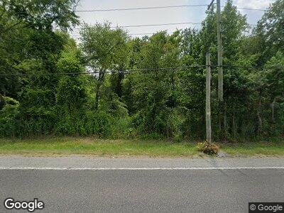
259 Wheat Rd Vineland, NJ 08360
Estimated Value: $180,000 - $234,000
2
Beds
1
Bath
858
Sq Ft
$230/Sq Ft
Est. Value
About This Home
This home is located at 259 Wheat Rd, Vineland, NJ 08360 and is currently estimated at $197,623, approximately $230 per square foot. 259 Wheat Rd is a home with nearby schools including Buena Regional Middle School, Buena Regional High School, and Emmanuel Day School.
Ownership History
Date
Name
Owned For
Owner Type
Purchase Details
Closed on
Apr 12, 2018
Sold by
Rivera Carmelo Ortiz
Bought by
Macario Amandor
Current Estimated Value
Home Financials for this Owner
Home Financials are based on the most recent Mortgage that was taken out on this home.
Original Mortgage
$68,732
Outstanding Balance
$61,264
Interest Rate
5.5%
Mortgage Type
FHA
Estimated Equity
$136,359
Purchase Details
Closed on
May 29, 2001
Sold by
Castro Theodore and Castro Irene
Bought by
Rivera Carmelo Ortiz
Home Financials for this Owner
Home Financials are based on the most recent Mortgage that was taken out on this home.
Original Mortgage
$65,550
Interest Rate
7.08%
Purchase Details
Closed on
Jun 30, 1995
Sold by
Sullivan Luis A and Rivera Carmen D
Bought by
Castro Theodore and Castro Irene
Purchase Details
Closed on
Apr 15, 1991
Sold by
Abricola Carrie
Bought by
Sullivan Luis A and Sullivan Rivera,Carmen D
Create a Home Valuation Report for This Property
The Home Valuation Report is an in-depth analysis detailing your home's value as well as a comparison with similar homes in the area
Home Values in the Area
Average Home Value in this Area
Purchase History
| Date | Buyer | Sale Price | Title Company |
|---|---|---|---|
| Macario Amandor | $70,000 | Sjs Title Llc | |
| Rivera Carmelo Ortiz | $69,000 | -- | |
| Castro Theodore | $59,000 | Homestead Title Agency | |
| Sullivan Luis A | $39,000 | -- |
Source: Public Records
Mortgage History
| Date | Status | Borrower | Loan Amount |
|---|---|---|---|
| Open | Macario Amandor | $68,732 | |
| Previous Owner | Rivera Carmelo | $82,000 | |
| Previous Owner | Rivera Carmelo Ortiz | $65,550 |
Source: Public Records
Tax History Compared to Growth
Tax History
| Year | Tax Paid | Tax Assessment Tax Assessment Total Assessment is a certain percentage of the fair market value that is determined by local assessors to be the total taxable value of land and additions on the property. | Land | Improvement |
|---|---|---|---|---|
| 2024 | $2,924 | $85,000 | $35,000 | $50,000 |
| 2023 | $2,851 | $85,000 | $35,000 | $50,000 |
| 2022 | $2,851 | $85,000 | $35,000 | $50,000 |
| 2021 | $2,724 | $85,000 | $35,000 | $50,000 |
| 2020 | $2,818 | $85,000 | $35,000 | $50,000 |
| 2019 | $3,320 | $101,900 | $48,000 | $53,900 |
| 2018 | $3,315 | $101,900 | $48,000 | $53,900 |
| 2017 | $3,275 | $101,900 | $48,000 | $53,900 |
| 2016 | $3,110 | $101,900 | $48,000 | $53,900 |
| 2015 | $2,983 | $101,900 | $48,000 | $53,900 |
| 2014 | $2,852 | $101,900 | $48,000 | $53,900 |
Source: Public Records
Map
Nearby Homes
- 0 Block 173 Lot 40 03
- 201 W Arctic Ave
- 211 W Pacific Ave
- 200 E Pacific Ave
- 370 Wheat Rd
- 384 Wheat Rd
- 380 Wheat Rd
- 157 Lincoln Ave
- 105 S East Blvd
- 126 Wheat Rd
- 161 Country Ln
- 153 Country Ln
- 160 Country Ln
- 126 Country Ln
- 119 Wheat Rd
- 434 Country Ln
- 112 Kimberly Ln
- 453 Priscilla Ln
- 120 Melini Ave
- 116 Melini Ave
