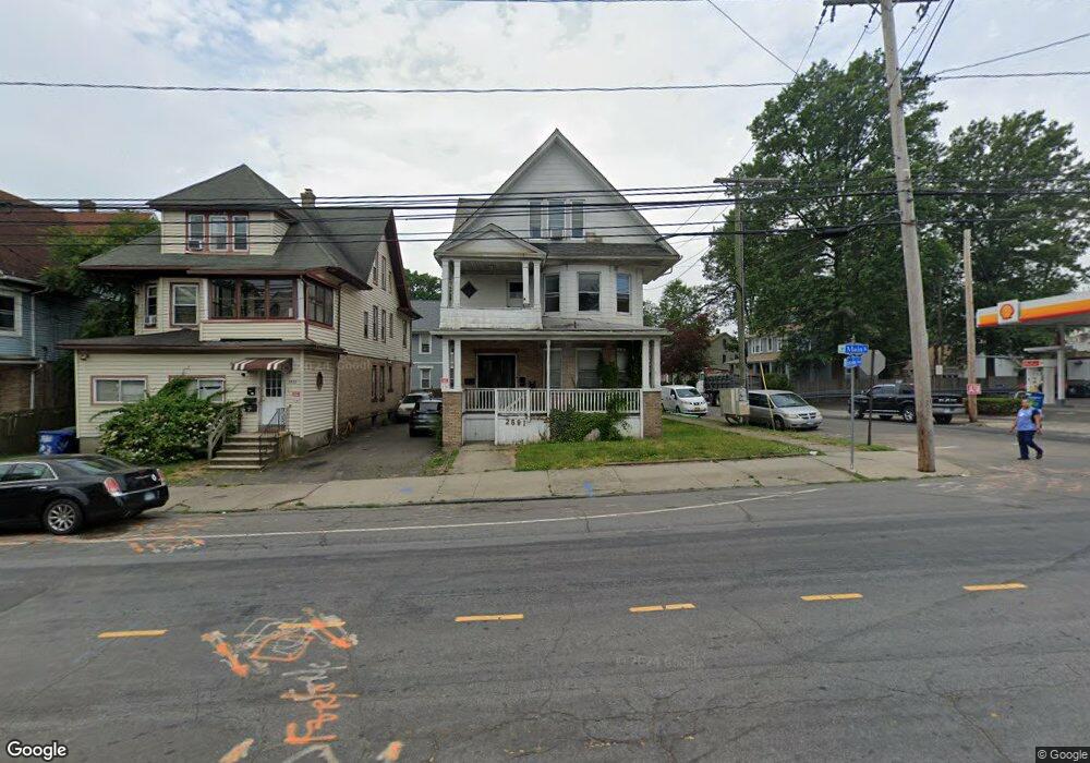
2591 Main St Bridgeport, CT 06606
Brooklawn-Saint Vincent NeighborhoodEstimated Value: $309,658 - $671,000
3
Beds
3
Baths
3,419
Sq Ft
$148/Sq Ft
Est. Value
About This Home
This home is located at 2591 Main St, Bridgeport, CT 06606 and is currently estimated at $505,665, approximately $147 per square foot. 2591 Main St is a home located in Fairfield County with nearby schools including Madison School, Central High School, and Catholic Academy of Bridgeport-St. Raphael Academy.
Ownership History
Date
Name
Owned For
Owner Type
Purchase Details
Closed on
Aug 22, 2002
Sold by
Welsh Ralph S and Welsh Jane C
Bought by
Perez Diego
Current Estimated Value
Home Financials for this Owner
Home Financials are based on the most recent Mortgage that was taken out on this home.
Original Mortgage
$139,500
Interest Rate
6.57%
Create a Home Valuation Report for This Property
The Home Valuation Report is an in-depth analysis detailing your home's value as well as a comparison with similar homes in the area
Home Values in the Area
Average Home Value in this Area
Purchase History
| Date | Buyer | Sale Price | Title Company |
|---|---|---|---|
| Perez Diego | $155,000 | -- | |
| Perez Diego | $155,000 | -- |
Source: Public Records
Mortgage History
| Date | Status | Borrower | Loan Amount |
|---|---|---|---|
| Open | Perez Diego | $205,000 | |
| Closed | Perez Diego | $139,500 |
Source: Public Records
Tax History Compared to Growth
Tax History
| Year | Tax Paid | Tax Assessment Tax Assessment Total Assessment is a certain percentage of the fair market value that is determined by local assessors to be the total taxable value of land and additions on the property. | Land | Improvement |
|---|---|---|---|---|
| 2025 | $6,143 | $141,370 | $55,650 | $85,720 |
| 2024 | $6,143 | $141,370 | $55,650 | $85,720 |
| 2023 | $6,143 | $141,370 | $55,650 | $85,720 |
| 2022 | $6,143 | $141,370 | $55,650 | $85,720 |
| 2021 | $6,143 | $141,370 | $55,650 | $85,720 |
| 2020 | $7,714 | $142,870 | $33,730 | $109,140 |
| 2019 | $7,714 | $142,870 | $33,730 | $109,140 |
| 2018 | $7,768 | $142,870 | $33,730 | $109,140 |
| 2017 | $7,768 | $142,870 | $33,730 | $109,140 |
| 2016 | $7,768 | $142,870 | $33,730 | $109,140 |
| 2015 | $7,880 | $186,730 | $34,020 | $152,710 |
| 2014 | $7,880 | $186,730 | $34,020 | $152,710 |
Source: Public Records
Map
Nearby Homes
- 330 French St
- 2395 Main St Unit 2397
- 724 Capitol Ave Unit 726
- 119 Madison Terrace
- 390 Charles St Unit 106
- 508 Hawley Ave
- 76 Porter St
- 936 Lindley St
- 106 Manhattan Ave Unit 108
- 90 Tom Thumb St
- 123 Harlem Ave
- 78 Fairmount Ave
- 203 Wayne St
- 31 Taft Ave
- 252 Harlem Ave Unit B6
- 252 Harlem Ave Unit B5
- 926 Hart St
- 916 Hart St
- 178 Island Brook Ave
- 105 Tremont Ave Unit E
- 2583 Main St
- 25 Lincoln Ave Unit 27
- 2575 Main St
- 31 Lincoln Ave Unit 33
- 2567 Main St Unit 3
- 2567 Main St
- 2624 Main St Unit 2624
- 30 Lincoln Ave
- 37 Lincoln Ave
- 2559 Main St
- 22 Garfield Ave Unit 24
- 30 Garfield Ave Unit 32
- 41 Lincoln Ave
- 44 Lincoln Ave
- 2606 Main St Unit 2608
- 2616 Main St
- 2568 Main St
- 2635 Main St
- 57 Lincoln Ave Unit 59