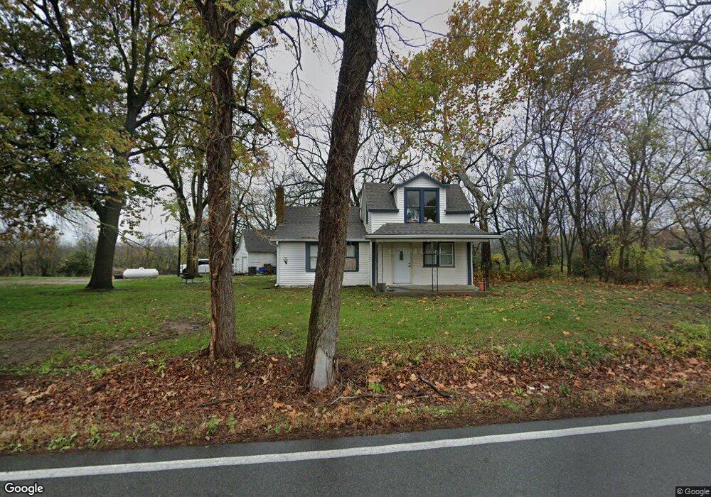
25939 Wolcott Rd Leavenworth, KS 66048
Estimated Value: $201,447 - $429,000
3
Beds
1
Bath
1,124
Sq Ft
$273/Sq Ft
Est. Value
About This Home
This home is located at 25939 Wolcott Rd, Leavenworth, KS 66048 and is currently estimated at $306,362, approximately $272 per square foot. 25939 Wolcott Rd is a home located in Leavenworth County with nearby schools including Lansing Elementary School, Lansing Middle 6-8, and Lansing High 9-12.
Ownership History
Date
Name
Owned For
Owner Type
Purchase Details
Closed on
May 20, 2020
Sold by
Anaya Real Estate Llc
Bought by
Fausett Matthew Thale
Current Estimated Value
Home Financials for this Owner
Home Financials are based on the most recent Mortgage that was taken out on this home.
Original Mortgage
$128,250
Outstanding Balance
$113,647
Interest Rate
3.3%
Mortgage Type
New Conventional
Estimated Equity
$192,715
Purchase Details
Closed on
Apr 1, 2004
Bought by
Anaya Real Estate Llc
Create a Home Valuation Report for This Property
The Home Valuation Report is an in-depth analysis detailing your home's value as well as a comparison with similar homes in the area
Home Values in the Area
Average Home Value in this Area
Purchase History
| Date | Buyer | Sale Price | Title Company |
|---|---|---|---|
| Fausett Matthew Thale | -- | Accurate Title | |
| Anaya Real Estate Llc | $82,000 | -- |
Source: Public Records
Mortgage History
| Date | Status | Borrower | Loan Amount |
|---|---|---|---|
| Open | Fausett Matthew Thale | $128,250 |
Source: Public Records
Tax History Compared to Growth
Tax History
| Year | Tax Paid | Tax Assessment Tax Assessment Total Assessment is a certain percentage of the fair market value that is determined by local assessors to be the total taxable value of land and additions on the property. | Land | Improvement |
|---|---|---|---|---|
| 2025 | $2,164 | $20,758 | $6,154 | $14,604 |
| 2024 | $2,044 | $19,957 | $5,875 | $14,082 |
| 2023 | $2,044 | $19,375 | $5,872 | $13,503 |
| 2022 | $1,928 | $17,616 | $5,021 | $12,595 |
| 2021 | $1,617 | $14,448 | $4,109 | $10,339 |
| 2020 | $1,550 | $13,630 | $3,963 | $9,667 |
| 2019 | $1,485 | $13,052 | $3,612 | $9,440 |
| 2018 | $1,344 | $11,857 | $4,152 | $7,705 |
| 2017 | $1,337 | $11,857 | $3,978 | $7,879 |
| 2016 | $1,241 | $11,055 | $3,922 | $7,133 |
| 2015 | $1,184 | $10,600 | $3,922 | $6,678 |
| 2014 | $1,162 | $10,600 | $3,922 | $6,678 |
Source: Public Records
Map
Nearby Homes
- 102 S 3rd Ct
- 218 E Kay St
- 209 E Kay St
- 506 1st Terrace
- 104 Olive St
- 202 S Main St
- 124 S Main St
- 901 S Main St
- 706 N 2nd St
- 129 Brookwood St
- 527 S Valley Dr
- 624 S Bittersweet Ln
- 722 Bittersweet Rd
- 268 Holiday Dr
- 1100 N 4th St
- 1102 N 4th St
- 131 Rock Creek Loop
- 261 Holiday Dr
- 604 Miley St
- 922 Southfork St
- 25974 Wolcott Rd
- 25845 Wolcott Rd
- 26074 Wolcott Rd
- 12826 Stranger Rd
- 12800 Stranger Rd
- 26088 Wolcott Rd
- 25778 Wolcott Rd
- 26092 Wolcott Rd
- 26100 Wolcott Rd
- 12902 Stranger Rd
- 25781 127th St
- 26135 Wolcott Rd
- 25770 Wolcott Rd
- 25799 Wolcott Rd
- 26171 Wolcott Rd
- 26199 Wolcott Rd
- 25742 Wolcott Rd
- 25715 127th St
- 13011 Stranger Rd
- 25740 Wolcott Rd