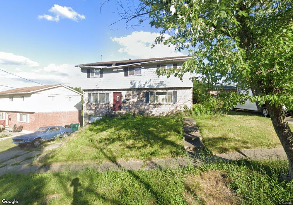
2597 Mustang Dr Cincinnati, OH 45211
Westwood NeighborhoodEstimated Value: $240,662 - $279,000
4
Beds
3
Baths
2,040
Sq Ft
$124/Sq Ft
Est. Value
About This Home
This home is located at 2597 Mustang Dr, Cincinnati, OH 45211 and is currently estimated at $252,166, approximately $123 per square foot. 2597 Mustang Dr is a home located in Hamilton County with nearby schools including Western Hills High School, Gilbert A. Dater High School, and Robert A. Taft Information Technology High School.
Ownership History
Date
Name
Owned For
Owner Type
Purchase Details
Closed on
Sep 3, 2004
Sold by
Brown Albert L
Bought by
Brown Karen
Current Estimated Value
Purchase Details
Closed on
Oct 31, 1997
Sold by
Longhauser Bruce A and Laseke Blanche C
Bought by
Brown Albert L
Home Financials for this Owner
Home Financials are based on the most recent Mortgage that was taken out on this home.
Original Mortgage
$88,954
Outstanding Balance
$14,780
Interest Rate
7.42%
Mortgage Type
FHA
Estimated Equity
$237,386
Create a Home Valuation Report for This Property
The Home Valuation Report is an in-depth analysis detailing your home's value as well as a comparison with similar homes in the area
Home Values in the Area
Average Home Value in this Area
Purchase History
| Date | Buyer | Sale Price | Title Company |
|---|---|---|---|
| Brown Karen | -- | -- | |
| Brown Albert L | $89,000 | Vintage Title Agency Inc |
Source: Public Records
Mortgage History
| Date | Status | Borrower | Loan Amount |
|---|---|---|---|
| Open | Brown Albert L | $88,954 |
Source: Public Records
Tax History Compared to Growth
Tax History
| Year | Tax Paid | Tax Assessment Tax Assessment Total Assessment is a certain percentage of the fair market value that is determined by local assessors to be the total taxable value of land and additions on the property. | Land | Improvement |
|---|---|---|---|---|
| 2024 | $3,562 | $59,416 | $6,762 | $52,654 |
| 2023 | $3,642 | $59,416 | $6,762 | $52,654 |
| 2022 | $2,211 | $32,225 | $5,492 | $26,733 |
| 2021 | $2,123 | $32,225 | $5,492 | $26,733 |
| 2020 | $2,185 | $32,225 | $5,492 | $26,733 |
| 2019 | $2,171 | $29,295 | $4,991 | $24,304 |
| 2018 | $2,174 | $29,295 | $4,991 | $24,304 |
| 2017 | $2,065 | $29,295 | $4,991 | $24,304 |
| 2016 | $2,179 | $30,475 | $5,786 | $24,689 |
| 2015 | $1,965 | $30,475 | $5,786 | $24,689 |
| 2014 | $1,979 | $30,475 | $5,786 | $24,689 |
| 2013 | $2,096 | $31,745 | $6,027 | $25,718 |
Source: Public Records
Map
Nearby Homes
- 3427 Bighorn Ct
- 2508 Mustang Dr
- 2562 Montana Ave
- 2454 Mustang Dr
- 2469 Montana Ave
- 3418 Millrich Ave
- 3162 Sunshine Ave
- 3116 Gobel Ave
- 2424 Westwood Northern Blvd
- 2822 Montana Ave
- 3331 Felicity Dr
- 3413 Fyffe Ave
- 3072 Worthington Ave
- 3345 Meyer Place
- 3046 Bracken Woods Ln
- 3042 Percy Ave
- 3064 Mchenry Ave
- 3073 Bracken Woods Ln
- 3069 Bracken Woods Ln
- 3501 Mcfarlan Rd
- 2589 Mustang Dr
- 3398 Anaconda Dr
- 3394 Anaconda Dr
- 2577 Mustang Dr
- 3390 Anaconda Dr
- 2614 Mustang Dr
- 2618 Mustang Dr
- 3402 Anaconda Dr
- 2584 Mustang Dr
- 3388 Anaconda Dr
- 2569 Mustang Dr
- 3384 Anaconda Dr
- 3399 Anaconda Dr
- 3406 Anaconda Dr
- 2578 Mustang Dr
- 2563 Mustang Dr
- 3393 Anaconda Dr
- 3403 Anaconda Dr
- 3380 Anaconda Dr
- 3391 Anaconda Dr