Estimated Value: $415,000 - $656,000
4
Beds
3
Baths
2,050
Sq Ft
$239/Sq Ft
Est. Value
About This Home
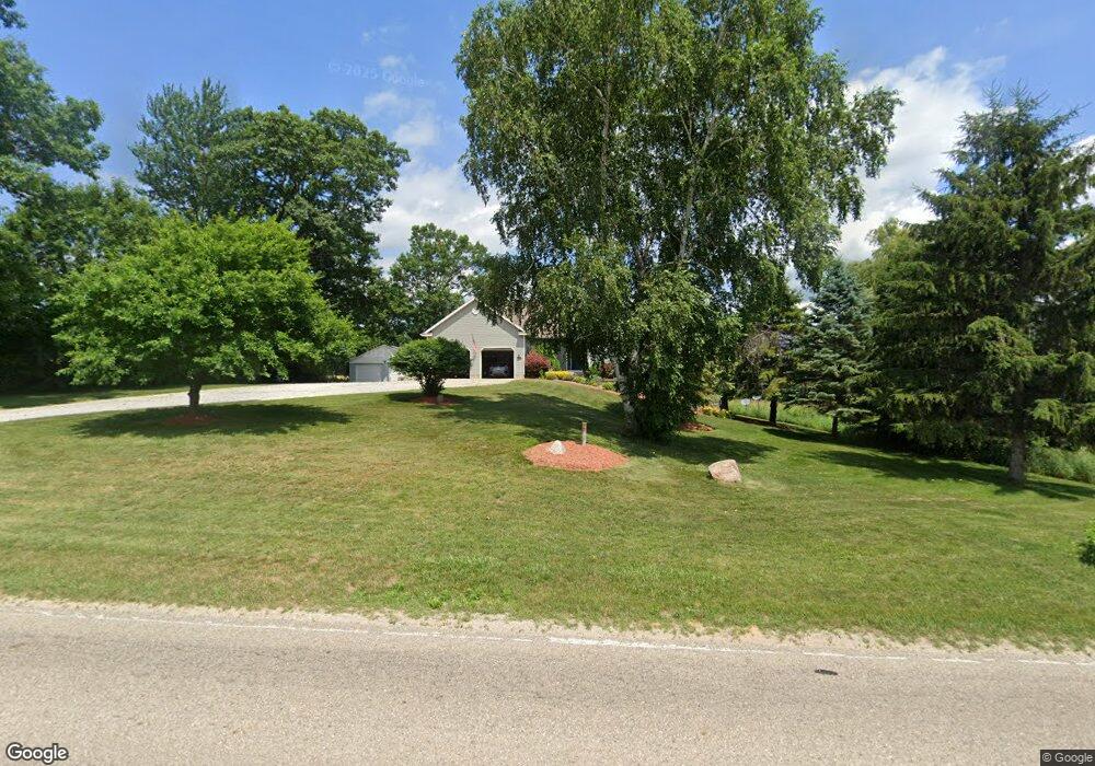
This home is located at 2597 W 112th St, Grant, MI 49327 and is currently estimated at $490,899, approximately $239 per square foot. 2597 W 112th St is a home located in Newaygo County with nearby schools including Grant Elementary School, Grant Primary Center, and Grant Middle School.
Ownership History
Date
Name
Owned For
Owner Type
Purchase Details
Closed on
Feb 9, 2011
Sold by
Hansen Richard E and Hansen Lisa L
Bought by
Gerstle Louis E and Gerstle Andrea P
Current Estimated Value
Purchase Details
Closed on
Feb 25, 2004
Sold by
Hansen Richard and Hansen Lisa L
Bought by
Hansen Richard E and Hansen Lisa L
Home Financials for this Owner
Home Financials are based on the most recent Mortgage that was taken out on this home.
Original Mortgage
$175,000
Interest Rate
5.71%
Mortgage Type
New Conventional
Purchase Details
Closed on
Jul 1, 2003
Sold by
Hansen Ronald L
Bought by
Hansen Richard
Create a Home Valuation Report for This Property
The Home Valuation Report is an in-depth analysis detailing your home's value as well as a comparison with similar homes in the area
Home Values in the Area
Average Home Value in this Area
Purchase History
| Date | Buyer | Sale Price | Title Company |
|---|---|---|---|
| Gerstle Louis E | $215,000 | -- | |
| Hansen Richard E | -- | Metropolitan Title Company | |
| Hansen Richard | -- | -- |
Source: Public Records
Mortgage History
| Date | Status | Borrower | Loan Amount |
|---|---|---|---|
| Previous Owner | Hansen Richard E | $175,000 |
Source: Public Records
Tax History Compared to Growth
Tax History
| Year | Tax Paid | Tax Assessment Tax Assessment Total Assessment is a certain percentage of the fair market value that is determined by local assessors to be the total taxable value of land and additions on the property. | Land | Improvement |
|---|---|---|---|---|
| 2025 | $3,746 | $184,800 | $0 | $0 |
| 2024 | $15 | $176,100 | $0 | $0 |
| 2023 | $1,479 | $172,700 | $0 | $0 |
| 2022 | $3,460 | $169,300 | $0 | $0 |
| 2021 | $3,433 | $164,000 | $0 | $0 |
| 2020 | $3,388 | $141,200 | $0 | $0 |
| 2019 | $3,339 | $134,500 | $0 | $0 |
| 2018 | $3,415 | $127,500 | $0 | $0 |
| 2017 | $3,477 | $118,200 | $0 | $0 |
| 2016 | $3,400 | $120,700 | $0 | $0 |
| 2015 | -- | $129,400 | $0 | $0 |
| 2014 | -- | $112,100 | $0 | $0 |
Source: Public Records
Map
Nearby Homes
- 2308 W 112th St
- 3193 W 112th St
- 2159 W 116th St
- 2119 W 116th St
- 12017 Mcclelland Ave
- 4115 W 108th St
- 3223 W 96th St
- 12745 Austrian Dr
- 2346 W 112th St
- 9263 S Ferris Ave
- 12515 Rosemary Ave
- 4615 W 112th St
- 86 W State Rd
- 122 Lincoln St
- 10201 Mason Dr
- 151 & 153 Clark St
- 185 E Commerce St
- 12536 S Mason Dr
- 998 Thompson Rd
- Lot 19 S Elder Ave
- 2491 W 112th St
- 2431 W 112th St
- 11218 Wisner Ave
- 11209 Wisner Ave
- 12150 S Fitzgerald Ave
- 11285 S Wisner Ave
- 2345 W 112th St
- 0 W 112th St Unit APP 4 3326979
- 0 W 112th St Unit PAR A 3445911
- 0 W 112th St Unit PAR G 3441070
- 0 W 112th St Unit LOT A 3423591
- 0 W 112th St Unit APP 4 3402597
- 0 W 112th St Unit LOT B 3373513
- 0 W 112th St Unit LOT B 3373515
- 0 W 112th St Unit LOT A 3373517
- 0 W 112th St Unit LOT C 3373539
- 0 W 112th St Unit LOT A 3356719
- 0 W 112th St Unit PAR 1 3351597
- 0 W 112th St Unit APP 6 3341849
- 0 W 112th St Unit APP 6 3341846