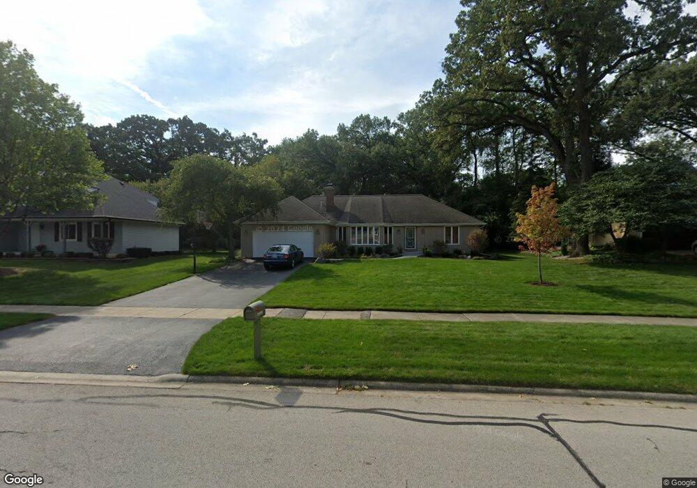
25W701 Red Maple Ln Unit 1 Wheaton, IL 60189
Arrowhead NeighborhoodEstimated Value: $648,303 - $739,000
4
Beds
3
Baths
2,339
Sq Ft
$291/Sq Ft
Est. Value
About This Home
This home is located at 25W701 Red Maple Ln Unit 1, Wheaton, IL 60189 and is currently estimated at $680,076, approximately $290 per square foot. 25W701 Red Maple Ln Unit 1 is a home located in DuPage County with nearby schools including Wiesbrook Elementary School, Hubble Middle School, and Wheaton Warrenville South High School.
Ownership History
Date
Name
Owned For
Owner Type
Purchase Details
Closed on
Jan 24, 2025
Sold by
Andrew Scott D and Andrew Pamela F
Bought by
Andrew Family Trust and Andrew
Current Estimated Value
Purchase Details
Closed on
Jul 14, 2005
Sold by
Andrew Scott D and Andrew Pamela
Bought by
Andrew Scott D and Andrew Pamela F
Home Financials for this Owner
Home Financials are based on the most recent Mortgage that was taken out on this home.
Original Mortgage
$320,000
Interest Rate
5.74%
Mortgage Type
Stand Alone Refi Refinance Of Original Loan
Purchase Details
Closed on
Jun 22, 1998
Sold by
Obrien Susan Elizabeth and Estate Of Richard W Pope
Bought by
North Pamela F and North Andrew Scott
Home Financials for this Owner
Home Financials are based on the most recent Mortgage that was taken out on this home.
Original Mortgage
$185,600
Interest Rate
7.22%
Purchase Details
Closed on
Jan 31, 1995
Sold by
Pope Donna L
Bought by
Pope Richard W
Create a Home Valuation Report for This Property
The Home Valuation Report is an in-depth analysis detailing your home's value as well as a comparison with similar homes in the area
Home Values in the Area
Average Home Value in this Area
Purchase History
| Date | Buyer | Sale Price | Title Company |
|---|---|---|---|
| Andrew Family Trust | -- | None Listed On Document | |
| Andrew Scott D | -- | M G R Title | |
| North Pamela F | $232,000 | -- | |
| Pope Richard W | -- | -- |
Source: Public Records
Mortgage History
| Date | Status | Borrower | Loan Amount |
|---|---|---|---|
| Previous Owner | Andrew Scott D | $320,000 | |
| Previous Owner | North Pamela F | $185,600 | |
| Closed | North Pamela F | $23,200 |
Source: Public Records
Tax History Compared to Growth
Tax History
| Year | Tax Paid | Tax Assessment Tax Assessment Total Assessment is a certain percentage of the fair market value that is determined by local assessors to be the total taxable value of land and additions on the property. | Land | Improvement |
|---|---|---|---|---|
| 2024 | $9,115 | $164,134 | $36,123 | $128,011 |
| 2023 | $8,721 | $151,080 | $33,250 | $117,830 |
| 2022 | $8,469 | $142,780 | $31,420 | $111,360 |
| 2021 | $8,202 | $139,390 | $30,670 | $108,720 |
| 2020 | $8,128 | $138,090 | $30,380 | $107,710 |
| 2019 | $7,918 | $134,450 | $29,580 | $104,870 |
| 2018 | $7,876 | $134,500 | $27,880 | $106,620 |
| 2017 | $7,743 | $129,540 | $26,850 | $102,690 |
| 2016 | $7,642 | $124,370 | $25,780 | $98,590 |
| 2015 | $7,585 | $118,650 | $24,590 | $94,060 |
| 2014 | $7,329 | $112,760 | $29,600 | $83,160 |
| 2013 | $7,111 | $113,100 | $29,690 | $83,410 |
Source: Public Records
Map
Nearby Homes
- 2S501 Seneca Dr
- 2S386 Seneca Dr
- 141 Loretto Ct
- 1601 W Wiesbrook Rd
- 30 Danada Dr
- 24 Winners Cup Cir Unit 3
- 1519 Foothill Dr
- 1255 Josiah Rd
- Lot 1 Foothill Dr
- 1420 Stonebridge Trail Unit 1-3
- 1477 S County Farm Rd Unit 23F
- 1521 S County Farm Rd Unit 1-1
- 1460 Stonebridge Cir Unit G9
- 1028 Lodalia Ct
- 1S728 Shaffner Rd
- 1S710 Shaffner Rd
- 1961 Wexford Cir Unit 116
- 27W041 Walz Way
- 2034 Iron Ridge Ln
- 2130 Iron Ridge Ln
- 25W675 Red Maple Ln
- 25W713 Red Maple Ln
- 25W665 Red Maple Ln
- 25W714 White Birch Ct
- 25W726 White Birch Ct
- 25W731 Red Maple Ln
- 25W700 Red Maple Ln
- 25W676 Red Maple Ln
- 25W660 Summerfield Ct
- 25W720 Red Maple Ln
- 25W651 Red Maple Ln
- 25W664 Red Maple Ln Unit 1
- 25W646 Summerfield Ct
- 25W741 Red Maple Ln
- 25W736 White Birch Ct
- 25W711 White Birch Ct
- 25W652 Red Maple Ln
- 25W644 Summerfield Ct
- 25W641 Red Maple Ln
- 25W730 Red Maple Ln Unit 1