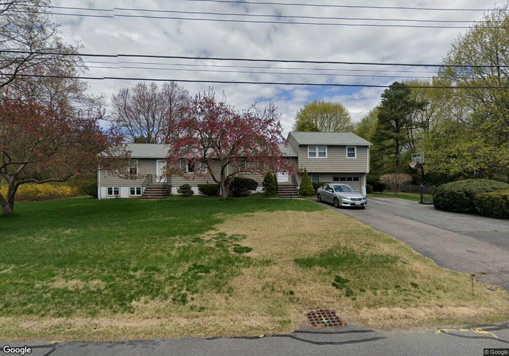
26 Ames Rd Sudbury, MA 01776
Estimated Value: $760,000 - $1,085,000
4
Beds
3
Baths
1,602
Sq Ft
$592/Sq Ft
Est. Value
About This Home
This home is located at 26 Ames Rd, Sudbury, MA 01776 and is currently estimated at $949,165, approximately $592 per square foot. 26 Ames Rd is a home located in Middlesex County with nearby schools including Israel Loring Elementary School, Ephraim Curtis Middle School, and Lincoln-Sudbury Regional High School.
Ownership History
Date
Name
Owned For
Owner Type
Purchase Details
Closed on
Jul 29, 2024
Sold by
Vorderer Christopher P
Bought by
C P Vorderer Ret and Vorderer
Current Estimated Value
Purchase Details
Closed on
Jul 19, 2024
Sold by
Vorderer Jeffrey D
Bought by
Jeffrey D Vorderer Ret and Vorderer
Purchase Details
Closed on
Oct 29, 1993
Sold by
Zichella Mary
Bought by
Vorderer Christopher and Vorderer Jeffrey D
Home Financials for this Owner
Home Financials are based on the most recent Mortgage that was taken out on this home.
Original Mortgage
$172,000
Interest Rate
6.86%
Mortgage Type
Purchase Money Mortgage
Create a Home Valuation Report for This Property
The Home Valuation Report is an in-depth analysis detailing your home's value as well as a comparison with similar homes in the area
Home Values in the Area
Average Home Value in this Area
Purchase History
| Date | Buyer | Sale Price | Title Company |
|---|---|---|---|
| C P Vorderer Ret | -- | None Available | |
| C P Vorderer Ret | -- | None Available | |
| Jeffrey D Vorderer Ret | -- | None Available | |
| Jeffrey D Vorderer Ret | -- | None Available | |
| Vorderer Christopher | $215,000 | -- | |
| Vorderer Christopher | $215,000 | -- |
Source: Public Records
Mortgage History
| Date | Status | Borrower | Loan Amount |
|---|---|---|---|
| Previous Owner | Vorderer Christopher | $172,000 | |
| Previous Owner | Vorderer Christopher | $21,100 |
Source: Public Records
Tax History Compared to Growth
Tax History
| Year | Tax Paid | Tax Assessment Tax Assessment Total Assessment is a certain percentage of the fair market value that is determined by local assessors to be the total taxable value of land and additions on the property. | Land | Improvement |
|---|---|---|---|---|
| 2025 | $12,160 | $830,600 | $441,200 | $389,400 |
| 2024 | $11,760 | $804,900 | $428,400 | $376,500 |
| 2023 | $11,708 | $742,400 | $396,800 | $345,600 |
| 2022 | $10,978 | $608,200 | $364,400 | $243,800 |
| 2021 | $10,592 | $562,500 | $364,400 | $198,100 |
| 2020 | $10,378 | $562,500 | $364,400 | $198,100 |
| 2019 | $10,074 | $562,500 | $364,400 | $198,100 |
| 2018 | $9,980 | $556,600 | $388,400 | $168,200 |
| 2017 | $9,353 | $527,200 | $369,600 | $157,600 |
| 2016 | $9,105 | $511,500 | $355,600 | $155,900 |
| 2015 | $8,576 | $487,300 | $342,000 | $145,300 |
| 2014 | $8,543 | $473,800 | $332,000 | $141,800 |
Source: Public Records
Map
Nearby Homes
- 63 Landham Rd
- 0 Wagonwheel Rd
- 84 Hopestill Brown Rd
- 216 Landham Rd
- 30 Edith Rd
- 8 Clara Rd
- 24 Pinewood Dr
- 14 Francine Rd
- 14 Eisenhower Rd
- 81 Nicholas Rd Unit B
- 71 Nicholas Rd Unit H
- 27 Sloane Dr
- 19 Park Ave
- 163 Water St
- 91 Eaton Rd W
- 29 Derby St
- 82 Joseph Rd
- 8 Elm St Unit 8A
- 19 Nob Hill Dr
- 53 Davidson Rd