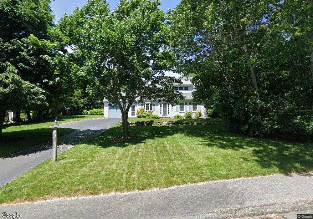
26 Buckingham Way Cotuit, MA 02635
Cotuit NeighborhoodEstimated Value: $667,000 - $869,000
3
Beds
2
Baths
1,478
Sq Ft
$517/Sq Ft
Est. Value
About This Home
This home is located at 26 Buckingham Way, Cotuit, MA 02635 and is currently estimated at $764,711, approximately $517 per square foot. 26 Buckingham Way is a home located in Barnstable County with nearby schools including West Villages Elementary School, Barnstable United Elementary School, and Barnstable Intermediate School.
Ownership History
Date
Name
Owned For
Owner Type
Purchase Details
Closed on
Jul 10, 2008
Sold by
Fayne Francis A and Fayne Joan M
Bought by
Fraone Gianfranco
Current Estimated Value
Home Financials for this Owner
Home Financials are based on the most recent Mortgage that was taken out on this home.
Original Mortgage
$150,000
Outstanding Balance
$97,063
Interest Rate
6.13%
Mortgage Type
Purchase Money Mortgage
Estimated Equity
$667,648
Create a Home Valuation Report for This Property
The Home Valuation Report is an in-depth analysis detailing your home's value as well as a comparison with similar homes in the area
Home Values in the Area
Average Home Value in this Area
Purchase History
We collect this data history from publicly available records. To have your information removed, we recommend requesting removal directly through your county’s website.
| Date | Buyer | Sale Price | Title Company |
|---|---|---|---|
| Fraone Gianfranco | $382,000 | -- |
Source: Public Records
Mortgage History
We collect this data history from publicly available records. To have your information removed, we recommend requesting removal directly through your county’s website.
| Date | Status | Borrower | Loan Amount |
|---|---|---|---|
| Open | Fraone Gianfranco | $150,000 |
Source: Public Records
Tax History
| Year | Tax Paid | Tax Assessment Tax Assessment Total Assessment is a certain percentage of the fair market value that is determined by local assessors to be the total taxable value of land and additions on the property. | Land | Improvement |
|---|---|---|---|---|
| 2025 | $5,134 | $614,900 | $219,100 | $395,800 |
| 2024 | $4,686 | $594,700 | $219,100 | $375,600 |
| 2023 | $4,470 | $534,000 | $199,200 | $334,800 |
| 2022 | $4,348 | $420,500 | $137,000 | $283,500 |
| 2021 | $0 | $385,200 | $139,100 | $246,100 |
| 2020 | $0 | $375,600 | $139,100 | $236,500 |
| 2019 | $4,297 | $361,700 | $147,500 | $214,200 |
| 2018 | $0 | $358,400 | $171,900 | $186,500 |
| 2017 | $0 | $349,700 | $171,900 | $177,800 |
| 2016 | $4,045 | $351,400 | $173,600 | $177,800 |
| 2015 | $3,978 | $345,300 | $169,900 | $175,400 |
Source: Public Records
Map
Nearby Homes
- 7 Oxford Dr
- 107 Abbey Gate Rd
- 239 Oxford Dr
- 10 Abbey Gate Rd
- 535 Main St
- 552 Main St
- 15 Riverview Ave Unit D
- 15 Riverview Ave Unit D
- 75 Trout Brook Rd
- 89 Trout Brook Rd
- 131 Dunrobin Rd
- 30 Pleasant Park Dr
- 181 School St
- 359 Santuit Rd
- 359 Santuit Rd
- 134 School St
- 13 Cedar St
- 1820 Santuit Newtown Rd
- 60 Nickerson Dr
- 70 Simons Rd Unit E
Your Personal Tour Guide
Ask me questions while you tour the home.