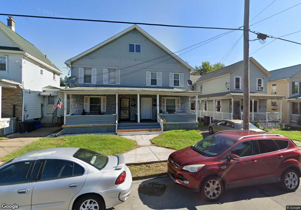
26 Dean St Unit 28 Scranton, PA 18509
Providence NeighborhoodEstimated Value: $224,000 - $248,000
--
Bed
--
Bath
3,000
Sq Ft
$78/Sq Ft
Est. Value
About This Home
This home is located at 26 Dean St Unit 28, Scranton, PA 18509 and is currently estimated at $233,000, approximately $77 per square foot. 26 Dean St Unit 28 is a home located in Lackawanna County with nearby schools including Neil Armstrong Elementary School, Scranton High School, and St. Paul St. Clare School St. Clare Campus.
Ownership History
Date
Name
Owned For
Owner Type
Purchase Details
Closed on
Jan 24, 2014
Sold by
Georginis Lorraine
Bought by
Georginis Richard
Current Estimated Value
Purchase Details
Closed on
Feb 5, 2013
Sold by
Household Finance Consumer Discount Comp
Bought by
Georginis Lorraine
Purchase Details
Closed on
Aug 29, 2012
Sold by
Cruise Otis R and Cruise Daniel
Bought by
Household Finance Consumer Discount Comp
Purchase Details
Closed on
Jul 31, 2008
Sold by
Cruise Otis R
Bought by
Eruise Daniel
Create a Home Valuation Report for This Property
The Home Valuation Report is an in-depth analysis detailing your home's value as well as a comparison with similar homes in the area
Home Values in the Area
Average Home Value in this Area
Purchase History
| Date | Buyer | Sale Price | Title Company |
|---|---|---|---|
| Georginis Richard | -- | None Available | |
| Georginis Lorraine | $23,000 | None Available | |
| Household Finance Consumer Discount Comp | $3,148 | None Available | |
| Eruise Daniel | -- | None Available |
Source: Public Records
Tax History Compared to Growth
Tax History
| Year | Tax Paid | Tax Assessment Tax Assessment Total Assessment is a certain percentage of the fair market value that is determined by local assessors to be the total taxable value of land and additions on the property. | Land | Improvement |
|---|---|---|---|---|
| 2025 | $4,024 | $12,500 | $2,000 | $10,500 |
| 2024 | $3,677 | $12,500 | $2,000 | $10,500 |
| 2023 | $3,677 | $12,500 | $2,000 | $10,500 |
| 2022 | $3,596 | $12,500 | $2,000 | $10,500 |
| 2021 | $3,596 | $12,500 | $2,000 | $10,500 |
| 2020 | $3,529 | $12,500 | $2,000 | $10,500 |
| 2019 | $3,320 | $12,500 | $2,000 | $10,500 |
| 2018 | $3,320 | $12,500 | $2,000 | $10,500 |
| 2017 | $3,261 | $12,500 | $2,000 | $10,500 |
| 2016 | $0 | $12,500 | $2,000 | $10,500 |
| 2015 | $2,447 | $12,500 | $2,000 | $10,500 |
| 2014 | -- | $12,500 | $2,000 | $10,500 |
Source: Public Records
Map
Nearby Homes
- 35 Dean St
- 49-51 E Parker St
- 121 Throop St
- 601 Dean St
- 180 Golden Ave Unit 182
- 2129 Comegys Ave Unit L11
- 2706 N Main Ave
- 193 W Parker St
- 2724 N Main Ave
- 2089 N Main Ave
- 119 Spring St
- 2237 Boulevard Ave
- 2219 Golden Ave
- 2510 Boulevard Ave
- 2105 Belmont Terrace
- 829 Raines St Unit 831
- 831 Raines St
- 2113 Golden Ave
- 2106 Boulevard Ave
- 2040 Margaret Ave Unit 2042
- 28 Dean St
- 24 Dean St
- 30 Dean St
- 20 Dean St
- 2406 N Main Ave
- 2410 N Main Ave
- 2402 N Main Ave
- 2432 N Main Ave
- 2416 N Main Ave Unit Rear
- 2416 N Main Ave
- 29 Dean St
- 31 Dean St
- 2423 Heermans Ave
- 2420 Heermans Ave
- 2425 Heermans Ave Unit 2427
- 2420 Heerman Ave
- 2440 Hermans Ave
- 2409 N Main Ave
- 2430 N Main Ave
- 4 Dean St