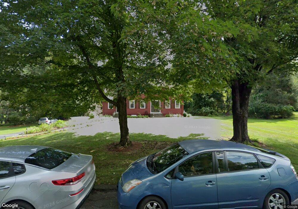
26 Dopping Brook Rd Sherborn, MA 01770
Estimated Value: $1,077,000 - $1,641,000
4
Beds
3
Baths
2,201
Sq Ft
$581/Sq Ft
Est. Value
About This Home
This home is located at 26 Dopping Brook Rd, Sherborn, MA 01770 and is currently estimated at $1,278,079, approximately $580 per square foot. 26 Dopping Brook Rd is a home located in Middlesex County with nearby schools including Pine Hill Elementary School, Dover-Sherborn Regional Middle School, and Dover-Sherborn Regional High School.
Ownership History
Date
Name
Owned For
Owner Type
Purchase Details
Closed on
Jun 19, 2012
Sold by
Weare Gerald W and Weare Natalie Q
Bought by
Weare Rt and Weare Gerald W
Current Estimated Value
Purchase Details
Closed on
Jul 7, 1992
Sold by
Feustel Edward A and Feustel Delycia E
Bought by
Weare Gerald W and Weare Natalie Q
Home Financials for this Owner
Home Financials are based on the most recent Mortgage that was taken out on this home.
Original Mortgage
$64,000
Interest Rate
8.54%
Create a Home Valuation Report for This Property
The Home Valuation Report is an in-depth analysis detailing your home's value as well as a comparison with similar homes in the area
Home Values in the Area
Average Home Value in this Area
Purchase History
| Date | Buyer | Sale Price | Title Company |
|---|---|---|---|
| Weare Rt | -- | -- | |
| Weare Gerald W | $332,000 | -- |
Source: Public Records
Mortgage History
| Date | Status | Borrower | Loan Amount |
|---|---|---|---|
| Previous Owner | Weare Gerald W | $90,000 | |
| Previous Owner | Weare Gerald W | $184,000 | |
| Previous Owner | Weare Gerald W | $64,000 | |
| Previous Owner | Weare Gerald W | $180,000 |
Source: Public Records
Tax History Compared to Growth
Tax History
| Year | Tax Paid | Tax Assessment Tax Assessment Total Assessment is a certain percentage of the fair market value that is determined by local assessors to be the total taxable value of land and additions on the property. | Land | Improvement |
|---|---|---|---|---|
| 2025 | $15,652 | $944,000 | $473,700 | $470,300 |
| 2024 | $14,777 | $871,800 | $465,000 | $406,800 |
| 2023 | $13,333 | $740,300 | $465,000 | $275,300 |
| 2022 | $13,085 | $687,600 | $453,300 | $234,300 |
| 2021 | $13,150 | $669,900 | $453,300 | $216,600 |
| 2020 | $13,036 | $669,900 | $453,300 | $216,600 |
| 2019 | $13,089 | $667,100 | $453,300 | $213,800 |
| 2018 | $12,744 | $660,300 | $453,300 | $207,000 |
| 2017 | $12,890 | $630,000 | $447,500 | $182,500 |
| 2016 | $12,280 | $597,000 | $418,700 | $178,300 |
| 2015 | $11,968 | $589,000 | $407,100 | $181,900 |
| 2014 | $11,614 | $571,000 | $395,600 | $175,400 |
Source: Public Records
Map
Nearby Homes
- 6 Brook St
- 19 Southfield Ln
- 19 Southfield Ln Unit 19
- 20 Greenwood St
- 61 Old Orchard Rd
- 10 Ward Ln
- 59 Russett Hill Rd
- 16 Page Farm Rd
- 13 Wood Rd
- 199 Mohawk Path
- 15 Wildwood Dr
- 90 Maple St
- 2 Surrey Ln
- 3 Danforth Dr
- 14 Fiske Pond Rd
- 15 Fiske Pond Rd
- 20 Nason Hill Rd
- 104 Brooksmont Dr Unit 104
- 1 Fawn Rd
- 4 Green Ln
- 22 Dopping Brook Rd
- 30 Dopping Brook Rd
- 27 Dopping Brook Rd
- 19 Dopping Brook Rd
- 18 Dopping Brook Rd
- 14 Dopping Brook Rd
- 210 Washington St Unit A
- 210 Washington St
- 9 Dopping Brook Rd
- 11 Ames Dr
- 10 Dopping Brook Rd
- 214 Washington St
- 12 Ames Dr
- 3 Dopping Brook Rd
- 212 Washington St
- 255 Western Ave
- 246 Western Ave
- 178 Washington St
- 206 Woodland St
- 206 Woodland St Unit 1