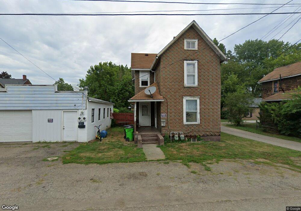
26 E Washington St Alliance, OH 44601
Estimated Value: $66,063 - $76,000
3
Beds
1
Bath
1,968
Sq Ft
$36/Sq Ft
Est. Value
About This Home
This home is located at 26 E Washington St, Alliance, OH 44601 and is currently estimated at $71,021, approximately $36 per square foot. 26 E Washington St is a home with nearby schools including Alliance Early Learning School, Alliance Intermediate School at Northside, and Alliance Middle School.
Ownership History
Date
Name
Owned For
Owner Type
Purchase Details
Closed on
Oct 27, 2023
Sold by
Carnation Rentals Ltd
Bought by
Landin Marsha
Current Estimated Value
Purchase Details
Closed on
Apr 14, 2015
Sold by
Vanwagenen Doug R
Bought by
Carnation Rentals Ltd
Purchase Details
Closed on
Mar 30, 2006
Sold by
Loudin Gerald Wayne and Loudin Gretchen Anni
Bought by
Vanwagenen Doug R
Purchase Details
Closed on
Apr 2, 2003
Sold by
Loudin Gerald W and Loudin Gretchen A
Bought by
Loudin Gerald Wayne and Loudin Gretchen Anni
Purchase Details
Closed on
Aug 29, 1996
Sold by
Hanan Richard E
Bought by
Loudin Gerald W and Loudin Gretchen
Create a Home Valuation Report for This Property
The Home Valuation Report is an in-depth analysis detailing your home's value as well as a comparison with similar homes in the area
Home Values in the Area
Average Home Value in this Area
Purchase History
| Date | Buyer | Sale Price | Title Company |
|---|---|---|---|
| Landin Marsha | -- | Heritage Union Title | |
| Carnation Rentals Ltd | $11,000 | Heritage Union Title Co Ltd | |
| Vanwagenen Doug R | $11,000 | Title Professionals Inc | |
| Loudin Gerald Wayne | -- | -- | |
| Loudin Gerald W | $27,000 | -- |
Source: Public Records
Tax History
| Year | Tax Paid | Tax Assessment Tax Assessment Total Assessment is a certain percentage of the fair market value that is determined by local assessors to be the total taxable value of land and additions on the property. | Land | Improvement |
|---|---|---|---|---|
| 2025 | $414 | $17,930 | $1,230 | $16,700 |
| 2024 | -- | $17,930 | $1,230 | $16,700 |
| 2023 | $386 | $6,940 | $1,230 | $5,710 |
| 2022 | $186 | $6,940 | $1,230 | $5,710 |
| 2021 | $370 | $6,940 | $1,230 | $5,710 |
| 2020 | $362 | $6,300 | $1,120 | $5,180 |
| 2019 | $353 | $6,310 | $1,120 | $5,190 |
| 2018 | $349 | $6,310 | $1,120 | $5,190 |
| 2017 | $304 | $5,320 | $700 | $4,620 |
| 2016 | $306 | $5,320 | $700 | $4,620 |
| 2015 | $308 | $5,320 | $700 | $4,620 |
| 2014 | $358 | $6,060 | $700 | $5,360 |
| 2013 | $178 | $6,060 | $700 | $5,360 |
Source: Public Records
Map
Nearby Homes
- 505 N Union Ave
- 710 N Freedom Ave
- 717 Garfield Ave
- 849 Walnut Ave
- 62 E Market St
- 171 1/2 W Main St
- 163 W Market St
- 361 E Main St
- 264 W Market St
- 33 S Lincoln Ave
- 118 S Mckinley Ave
- 343 W Columbia St
- 427 S Union Ave
- 11344 Walnut Ave NE
- 847 E Patterson St
- V/L S Freedom Ave
- 228 W Oxford St
- 319 W Oxford St
- 233 W Cambridge St
- 479 W High St
- 515 N Union Ave
- 31 E Washington St
- 519 N Union Ave
- 451 N Union Ave
- 40 E Washington St
- 445 N Union Ave
- 525 N Union Ave
- 512 N Park Ave
- 26 Union Ct
- 435 N Union Ave
- 539 N Union Ave
- 506 N Park Ave
- 45 E Wayne St
- 536 N Park Ave
- 35 E Wayne St
- 35 E Wayne St
- 520 N Park Ave
- 25 Union Ct
- 44 E Harrison St
- 553 N Union Ave
Your Personal Tour Guide
Ask me questions while you tour the home.