L
Seller's Agent in 2013
Linda Nugent
Coldwell Banker Classic Real Estate
(217) 254-4000
1 Total Sale
Estimated Value: $290,669 - $410,000
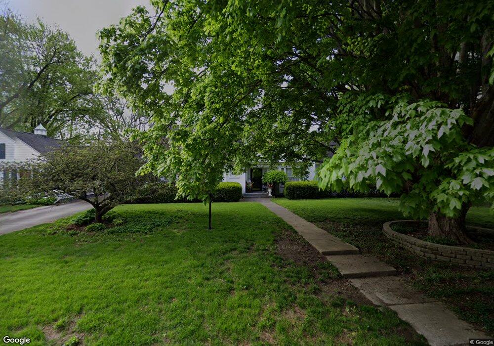
PICTURESQUE 1 1/2 STORY ... Located on neighbor-friendly Elm Ridge, this lovely home w/over 5,000 sq. ft. boasts over numerous features & amenities including large foyer w/marble tile flooring, generously sized living w/gas fireplace, formal dining & screened porch overlooking private back yard w/gazebo, Koi pond/waterfall, perennials (lilies, hydrangeas, hostas) grape arbor & fruit trees. Charming kitchen & breakfast room, library w/built-ins, bedrooms incuding master conveniently located on main level. Upper level has 3 large. bedrooms & home office w/wood flooring; ample closets & more built-ins. Finished basement w/family room w/WB fireplace, Pullman kitchen, wine cellar, more storage. Rear load Carriage garage w/above storage, additional parking. Call for your private viewing while home mortgage interest rates are at an all time low!
Last Agent to Sell the Property
Coldwell Banker Classic Real Estate License #475086263 Listed on: 04/06/2013

Last Buyer's Agent
Deborah Matheny
Century 21 KIMA Properties
| Date | Buyer | Sale Price | Title Company |
|---|---|---|---|
| Snowden Richard M | $210,000 | None Available |
| Date | Status | Borrower | Loan Amount |
|---|---|---|---|
| Open | Snowden Richard M | $168,000 |
| Date | Event | Price | List to Sale | Price per Sq Ft |
|---|---|---|---|---|
| 06/21/2013 06/21/13 | Sold | $210,000 | 0.0% | $50 / Sq Ft |
| 05/13/2013 05/13/13 | Pending | -- | -- | -- |
| 04/06/2013 04/06/13 | For Sale | $210,000 | -- | $50 / Sq Ft |
| Year | Tax Paid | Tax Assessment Tax Assessment Total Assessment is a certain percentage of the fair market value that is determined by local assessors to be the total taxable value of land and additions on the property. | Land | Improvement |
|---|---|---|---|---|
| 2024 | $6,366 | $84,845 | $25,569 | $59,276 |
| 2023 | $6,277 | $76,437 | $23,035 | $53,402 |
| 2022 | $6,108 | $75,174 | $22,654 | $52,520 |
| 2021 | $5,967 | $67,724 | $20,409 | $47,315 |
| 2020 | $5,902 | $70,169 | $13,796 | $56,373 |
| 2019 | $5,778 | $67,724 | $13,315 | $54,409 |
| 2018 | $5,679 | $67,724 | $13,315 | $54,409 |
| 2017 | $5,669 | $67,724 | $13,315 | $54,409 |
| 2016 | $5,547 | $67,724 | $13,315 | $54,409 |
| 2015 | $5,035 | $66,396 | $13,054 | $53,342 |
| 2014 | $5,035 | $66,396 | $13,054 | $53,342 |
| 2013 | $5,035 | $66,396 | $13,054 | $53,342 |
L
Seller's Agent in 2013
Linda Nugent
Coldwell Banker Classic Real Estate
(217) 254-4000
1 Total Sale
D
Buyer's Agent in 2013
Deborah Matheny
Century 21 KIMA Properties
Source: Central Illinois Board of REALTORS®
MLS Number: 4218120
APN: 06-0-02342-000