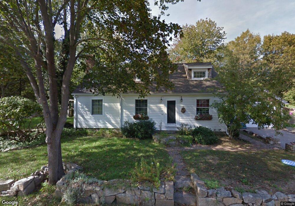
26 Folcutt Rd Kittery Point, ME 03905
Kittery Point NeighborhoodEstimated Value: $739,000 - $960,000
2
Beds
2
Baths
2,393
Sq Ft
$342/Sq Ft
Est. Value
About This Home
This home is located at 26 Folcutt Rd, Kittery Point, ME 03905 and is currently estimated at $819,597, approximately $342 per square foot. 26 Folcutt Rd is a home with nearby schools including Horace Mitchell Primary School, Shapleigh School, and Robert W Traip Academy.
Create a Home Valuation Report for This Property
The Home Valuation Report is an in-depth analysis detailing your home's value as well as a comparison with similar homes in the area
Home Values in the Area
Average Home Value in this Area
Tax History Compared to Growth
Tax History
| Year | Tax Paid | Tax Assessment Tax Assessment Total Assessment is a certain percentage of the fair market value that is determined by local assessors to be the total taxable value of land and additions on the property. | Land | Improvement |
|---|---|---|---|---|
| 2024 | $5,494 | $386,900 | $138,500 | $248,400 |
| 2023 | $5,266 | $386,900 | $138,500 | $248,400 |
| 2022 | $5,062 | $375,500 | $138,500 | $237,000 |
| 2021 | $4,882 | $375,500 | $138,500 | $237,000 |
| 2020 | $4,844 | $375,500 | $138,500 | $237,000 |
| 2019 | $4,639 | $266,600 | $74,500 | $192,100 |
| 2018 | $4,479 | $266,600 | $74,500 | $192,100 |
| 2017 | $4,399 | $266,600 | $74,500 | $192,100 |
| 2016 | $4,279 | $266,600 | $74,500 | $192,100 |
| 2015 | $4,178 | $266,600 | $74,500 | $192,100 |
| 2014 | $4,138 | $266,600 | $74,500 | $192,100 |
| 2013 | $4,058 | $266,600 | $74,500 | $192,100 |
Source: Public Records
Map
Nearby Homes
- 205 Whipple Rd
- 72 Pepperrell Rd
- 42 Tilton Ave
- 12 Gillis Dr Unit 3
- 132 Pepperrell Rd
- 2 Wainwright Ave
- 299 Haley Rd
- 19 Debra Ln
- 17 Elm Ct
- 8 Spruce Point Rd
- 15 Atkinson St
- 24 Seabreeze Ln
- 14 Colonial Ln
- 39 Tenney Hill Rd
- 36 Traip Ave
- 175 Wentworth Rd
- 10-12 Pine St
- 18 Mainmast Cir
- 165 Rogers Rd
- 100 Shepards Cove Rd Unit F204