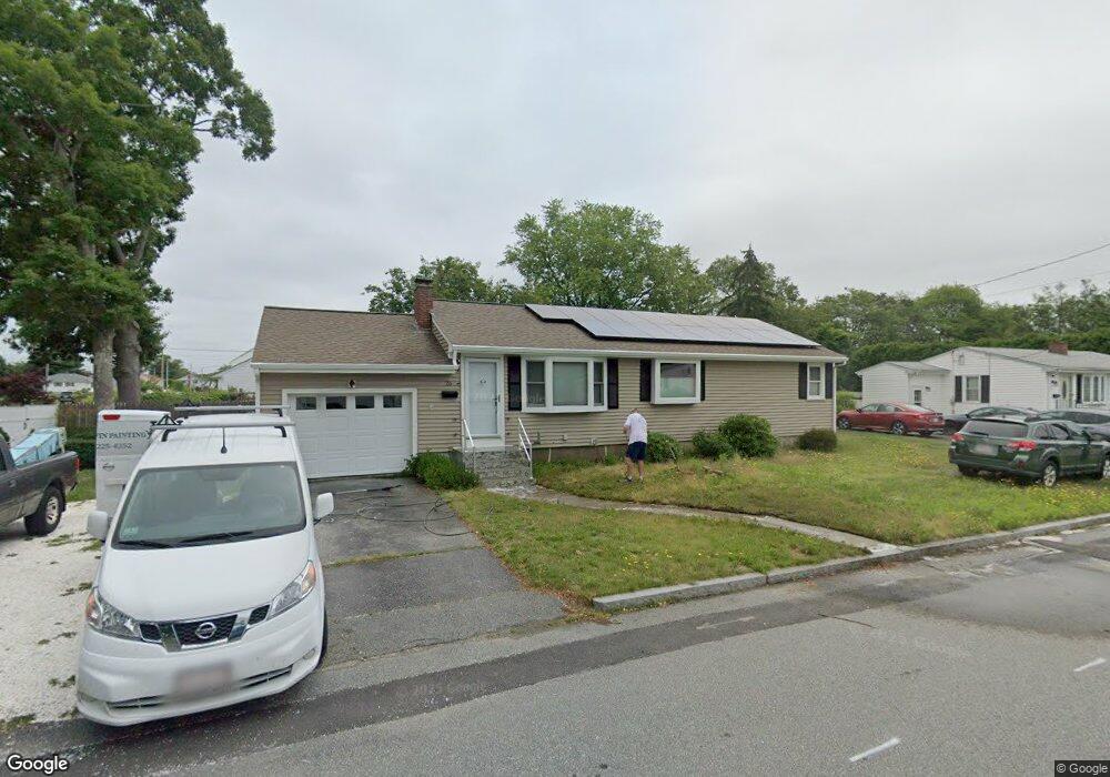
26 Hiram St Fall River, MA 02720
Bank Street NeighborhoodEstimated Value: $378,000 - $436,000
3
Beds
1
Bath
1,056
Sq Ft
$385/Sq Ft
Est. Value
About This Home
This home is located at 26 Hiram St, Fall River, MA 02720 and is currently estimated at $406,884, approximately $385 per square foot. 26 Hiram St is a home located in Bristol County with nearby schools including Spencer Borden Elementary School, Morton Middle School, and B M C Durfee High School.
Ownership History
Date
Name
Owned For
Owner Type
Purchase Details
Closed on
Jun 7, 2021
Sold by
Cook Dwight E
Bought by
Picciandra Michael
Current Estimated Value
Purchase Details
Closed on
Sep 19, 2019
Sold by
Cook Dwight E
Bought by
Cook Dwight E and Picciandra Michael
Home Financials for this Owner
Home Financials are based on the most recent Mortgage that was taken out on this home.
Original Mortgage
$177,000
Interest Rate
3.5%
Mortgage Type
VA
Purchase Details
Closed on
Oct 29, 2007
Sold by
Cook Pauline C
Bought by
Cook Dwight E and Cook Pauline C
Create a Home Valuation Report for This Property
The Home Valuation Report is an in-depth analysis detailing your home's value as well as a comparison with similar homes in the area
Home Values in the Area
Average Home Value in this Area
Purchase History
| Date | Buyer | Sale Price | Title Company |
|---|---|---|---|
| Picciandra Michael | -- | None Available | |
| Cook Dwight E | -- | -- | |
| Cook Dwight E | -- | -- |
Source: Public Records
Mortgage History
| Date | Status | Borrower | Loan Amount |
|---|---|---|---|
| Previous Owner | Cook Dwight E | $177,000 |
Source: Public Records
Tax History Compared to Growth
Tax History
| Year | Tax Paid | Tax Assessment Tax Assessment Total Assessment is a certain percentage of the fair market value that is determined by local assessors to be the total taxable value of land and additions on the property. | Land | Improvement |
|---|---|---|---|---|
| 2025 | $3,849 | $336,200 | $136,900 | $199,300 |
| 2024 | $3,614 | $314,500 | $131,600 | $182,900 |
| 2023 | $3,529 | $287,600 | $118,200 | $169,400 |
| 2022 | $3,115 | $246,800 | $109,400 | $137,400 |
| 2021 | $3,142 | $227,200 | $103,300 | $123,900 |
| 2020 | $3,039 | $210,300 | $99,500 | $110,800 |
| 2019 | $2,958 | $202,900 | $99,500 | $103,400 |
| 2018 | $2,917 | $199,500 | $99,500 | $100,000 |
| 2017 | $2,768 | $197,700 | $99,500 | $98,200 |
| 2016 | $2,627 | $192,700 | $99,500 | $93,200 |
| 2015 | $2,435 | $186,200 | $93,000 | $93,200 |
| 2014 | $2,342 | $186,200 | $93,000 | $93,200 |
Source: Public Records
Map
Nearby Homes
- 200 David St
- 350 Doherty St
- 36 Fordney St
- 168 Windsor St
- 1796 Locust St
- 380 Eddy St
- 302 Oak Grove Ave
- 235 Chavenson St
- 243 Oak Grove Ave
- 1268 President Ave
- 108 Garden St
- 270 Garden St
- 344 Beattie St Unit 5
- 49 Farnham St
- 342 Stetson St
- 218 Plain St
- 37 Shawmut St
- 992 Pine St
- 14 Downing St
- 545 Robeson St
- 46 Hiram St
- 785 N Eastern Ave
- 84 Crestwood St
- 729 N Eastern Ave
- 62 Hiram St
- 74 Crestwood St
- 63 Hiram St
- 807 N Eastern Ave
- 807 N Eastern Ave Unit 1
- 130 Celia St
- 713 N Eastern Ave
- 79 Hiram St
- 55 Crestwood St
- 786 N Eastern Ave
- 48 Crestwood St
- 436 Freelove St
- 135 Celia St
- 744 N Eastern Ave
- 695 N Eastern Ave
- 460 Freelove St