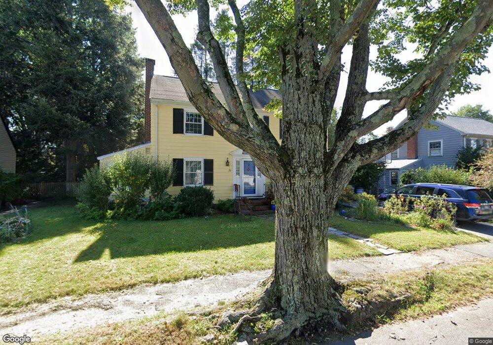
26 Livermore Rd Belmont, MA 02478
Cushing Square NeighborhoodEstimated Value: $1,272,000 - $1,589,211
4
Beds
2
Baths
1,617
Sq Ft
$891/Sq Ft
Est. Value
About This Home
This home is located at 26 Livermore Rd, Belmont, MA 02478 and is currently estimated at $1,440,803, approximately $891 per square foot. 26 Livermore Rd is a home located in Middlesex County with nearby schools including Mary Lee Burbank Elementary School, Winthrop L Chenery Middle School, and Belmont High School.
Ownership History
Date
Name
Owned For
Owner Type
Purchase Details
Closed on
Jun 16, 2020
Sold by
Titus David E and Titus Susan R
Bought by
26 Livermore Road Nt
Current Estimated Value
Purchase Details
Closed on
Oct 29, 1998
Sold by
Est Factor Joseph and Mcdermott M Virginia
Bought by
Titus David E and Titus Susan R
Home Financials for this Owner
Home Financials are based on the most recent Mortgage that was taken out on this home.
Original Mortgage
$270,000
Interest Rate
6.68%
Mortgage Type
Purchase Money Mortgage
Create a Home Valuation Report for This Property
The Home Valuation Report is an in-depth analysis detailing your home's value as well as a comparison with similar homes in the area
Home Values in the Area
Average Home Value in this Area
Purchase History
| Date | Buyer | Sale Price | Title Company |
|---|---|---|---|
| 26 Livermore Road Nt | -- | None Available | |
| Titus David E | $339,000 | -- |
Source: Public Records
Mortgage History
| Date | Status | Borrower | Loan Amount |
|---|---|---|---|
| Previous Owner | Titus David E | $130,300 | |
| Previous Owner | Titus David E | $270,000 |
Source: Public Records
Tax History Compared to Growth
Tax History
| Year | Tax Paid | Tax Assessment Tax Assessment Total Assessment is a certain percentage of the fair market value that is determined by local assessors to be the total taxable value of land and additions on the property. | Land | Improvement |
|---|---|---|---|---|
| 2025 | $15,456 | $1,357,000 | $797,000 | $560,000 |
| 2024 | $15,333 | $1,452,000 | $994,000 | $458,000 |
| 2023 | $14,432 | $1,284,000 | $867,000 | $417,000 |
| 2022 | $13,930 | $1,205,000 | $815,000 | $390,000 |
| 2021 | $14,298 | $1,239,000 | $850,000 | $389,000 |
| 2020 | $13,409 | $1,219,000 | $832,000 | $387,000 |
| 2019 | $11,180 | $958,000 | $619,000 | $339,000 |
| 2018 | $10,874 | $895,000 | $562,000 | $333,000 |
| 2017 | $10,723 | $845,000 | $516,000 | $329,000 |
| 2016 | $10,588 | $843,000 | $516,000 | $327,000 |
| 2015 | $9,636 | $747,000 | $429,000 | $318,000 |
Source: Public Records
Map
Nearby Homes
- 105 Watson Rd
- 248 School St
- 73 Foster Rd Unit 2
- 48 Concord Ave
- 4 Merrill Ave
- 30 Unity Ave Unit 30
- 15 Sunset Rd
- 276 Belmont St Unit 1
- 48 Hamilton Rd
- 46 Hamilton Rd
- 161 Cushing St
- 10 Marlboro St Unit 1
- 163 Belmont St
- 95 Griswold St Unit 95
- 93 Griswold St Unit 93
- 133 Hillside Rd
- 30 Payson Rd
- 73 Trowbridge St Unit 73A
- 73 Trowbridge St Unit 73B
- 55 S Normandy Ave