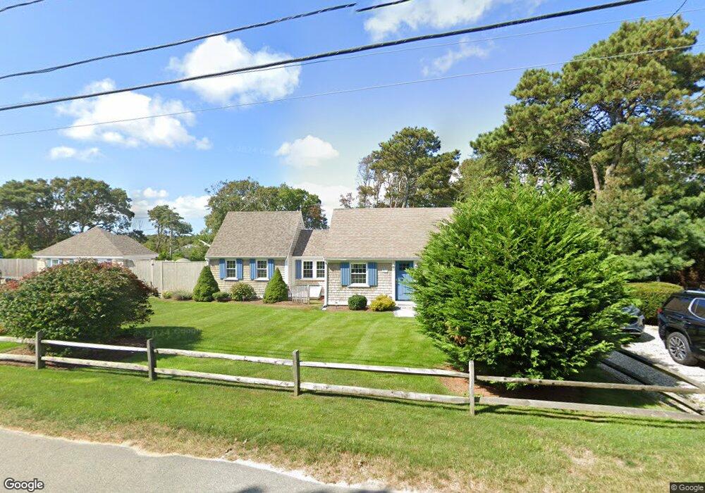
26 Lower County Rd West Dennis, MA 2670
West Dennis NeighborhoodEstimated Value: $800,000 - $833,000
5
Beds
3
Baths
1,573
Sq Ft
$519/Sq Ft
Est. Value
About This Home
This home is located at 26 Lower County Rd, West Dennis, MA 2670 and is currently estimated at $815,715, approximately $518 per square foot. 26 Lower County Rd is a home located in Barnstable County with nearby schools including Dennis-Yarmouth Regional High School and St. Pius X. School.
Ownership History
Date
Name
Owned For
Owner Type
Purchase Details
Closed on
Sep 21, 2018
Sold by
Perrin Thomas E and Perrin David F
Bought by
Whalen Ryan and Whalen John P
Current Estimated Value
Home Financials for this Owner
Home Financials are based on the most recent Mortgage that was taken out on this home.
Original Mortgage
$350,533
Outstanding Balance
$302,513
Interest Rate
4.5%
Mortgage Type
FHA
Estimated Equity
$513,202
Purchase Details
Closed on
Jan 27, 2010
Sold by
Perrin Rt and Perrin
Bought by
Perrin Thomas E and Perrin David F
Purchase Details
Closed on
Jan 6, 1989
Sold by
Sheehan Garrett F
Bought by
Plante Craig E
Home Financials for this Owner
Home Financials are based on the most recent Mortgage that was taken out on this home.
Original Mortgage
$50,700
Interest Rate
10.32%
Mortgage Type
Purchase Money Mortgage
Create a Home Valuation Report for This Property
The Home Valuation Report is an in-depth analysis detailing your home's value as well as a comparison with similar homes in the area
Home Values in the Area
Average Home Value in this Area
Purchase History
| Date | Buyer | Sale Price | Title Company |
|---|---|---|---|
| Whalen Ryan | $357,000 | -- | |
| Perrin Thomas E | -- | -- | |
| Plante Craig E | $67,500 | -- | |
| Plante Craig E | $67,500 | -- |
Source: Public Records
Mortgage History
| Date | Status | Borrower | Loan Amount |
|---|---|---|---|
| Open | Whalen Ryan | $350,533 | |
| Previous Owner | Plante Craig E | $50,700 |
Source: Public Records
Tax History
| Year | Tax Paid | Tax Assessment Tax Assessment Total Assessment is a certain percentage of the fair market value that is determined by local assessors to be the total taxable value of land and additions on the property. | Land | Improvement |
|---|---|---|---|---|
| 2025 | $3,010 | $695,200 | $254,700 | $440,500 |
| 2024 | $2,912 | $663,400 | $244,900 | $418,500 |
| 2023 | $2,698 | $577,800 | $222,600 | $355,200 |
| 2022 | $2,588 | $462,100 | $200,600 | $261,500 |
| 2021 | $2,385 | $395,600 | $186,100 | $209,500 |
| 2020 | $2,089 | $342,400 | $162,800 | $179,600 |
| 2019 | $1,985 | $321,700 | $159,600 | $162,100 |
| 2018 | $1,947 | $307,100 | $152,000 | $155,100 |
| 2017 | $1,839 | $299,000 | $141,100 | $157,900 |
| 2016 | $1,841 | $281,900 | $152,000 | $129,900 |
| 2015 | $1,804 | $281,900 | $152,000 | $129,900 |
| 2014 | $1,626 | $256,000 | $130,300 | $125,700 |
Source: Public Records
Map
Nearby Homes
- 111 School St Unit 5
- 23 Doric Ave
- 467 Main St
- 8 Buckley Rd
- 38 Lower County Rd
- 15 Woodside Park Rd
- 45 Seth Ln
- 308 Old Main St
- 7 Pinefield Ln
- 112 Old Wharf Rd Unit E4
- 102 Lawrence Rd
- 3 Pinefield Ln
- 183 Captain Chase Rd
- 154 Old Wharf Rd Unit 14
- 194 Main St
- 194 Main St
- 230 Old Wharf Rd Unit 272
- 230 Old Wharf Rd Unit 265
- 230 Old Wharf Rd Unit 291
- 217 Old Wharf Rd Unit 64
- 22 Lower County Rd
- 30 Lower County Rd
- 34 Lower County Rd
- 5 Lower County Rd
- 210 School St
- 111111 Main St (Motel)
- 197 School St
- 191 School St
- 200 School St
- 38-E Lower County Rd
- 38 Lower County Rd
- 38-F Lower County Rd
- 34 S Main St
- 13 Eaton Ln
- 35 S Main St
- 204 School St
- 37 S Main St
- 25 Lower County Rd
- 1 Scotts Ocean View Dr Unit 2
- 1 Scotts Ocean View Dr
Your Personal Tour Guide
Ask me questions while you tour the home.