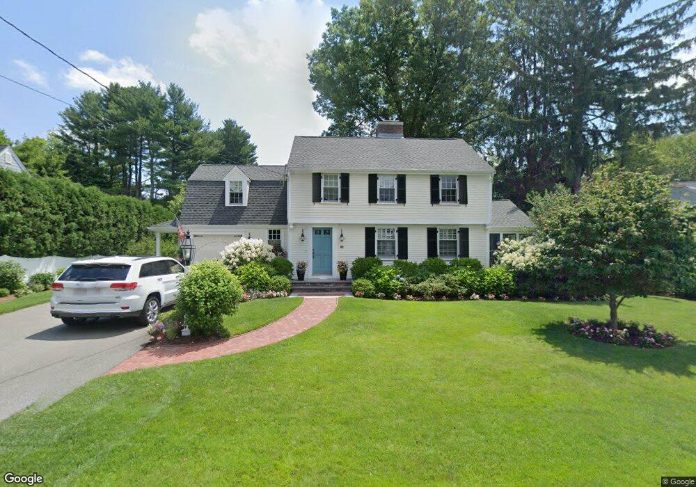
26 Meadowbrook Rd Needham, MA 02492
Estimated Value: $1,520,000 - $1,964,000
4
Beds
4
Baths
1,902
Sq Ft
$967/Sq Ft
Est. Value
About This Home
This home is located at 26 Meadowbrook Rd, Needham, MA 02492 and is currently estimated at $1,839,216, approximately $966 per square foot. 26 Meadowbrook Rd is a home located in Norfolk County with nearby schools including High Rock Middle School, Sunita L. Williams Elementary School, and Pollard Middle School.
Ownership History
Date
Name
Owned For
Owner Type
Purchase Details
Closed on
May 31, 1996
Sold by
Tobin David S and Tobin Sandra
Bought by
Goldman Gerry M and Goldman Elizabeth M
Current Estimated Value
Home Financials for this Owner
Home Financials are based on the most recent Mortgage that was taken out on this home.
Original Mortgage
$335,200
Interest Rate
7.91%
Mortgage Type
Purchase Money Mortgage
Purchase Details
Closed on
Nov 30, 1987
Sold by
Strong William A
Bought by
Tobin David S
Create a Home Valuation Report for This Property
The Home Valuation Report is an in-depth analysis detailing your home's value as well as a comparison with similar homes in the area
Home Values in the Area
Average Home Value in this Area
Purchase History
| Date | Buyer | Sale Price | Title Company |
|---|---|---|---|
| Goldman Gerry M | $419,000 | -- | |
| Goldman Gerry M | $419,000 | -- | |
| Tobin David S | $370,000 | -- |
Source: Public Records
Mortgage History
| Date | Status | Borrower | Loan Amount |
|---|---|---|---|
| Open | Tobin David S | $330,700 | |
| Closed | Tobin David S | $332,800 | |
| Closed | Tobin David S | $335,200 |
Source: Public Records
Tax History Compared to Growth
Tax History
| Year | Tax Paid | Tax Assessment Tax Assessment Total Assessment is a certain percentage of the fair market value that is determined by local assessors to be the total taxable value of land and additions on the property. | Land | Improvement |
|---|---|---|---|---|
| 2025 | $17,333 | $1,635,200 | $744,700 | $890,500 |
| 2024 | $16,377 | $1,308,100 | $542,900 | $765,200 |
| 2023 | $16,240 | $1,245,400 | $542,900 | $702,500 |
| 2022 | $15,872 | $1,187,100 | $513,100 | $674,000 |
| 2021 | $15,468 | $1,187,100 | $513,100 | $674,000 |
| 2020 | $15,358 | $1,229,600 | $513,100 | $716,500 |
| 2019 | $14,478 | $1,168,500 | $468,000 | $700,500 |
| 2018 | $13,882 | $1,168,500 | $468,000 | $700,500 |
| 2017 | $12,838 | $1,079,700 | $468,000 | $611,700 |
| 2016 | $12,527 | $1,085,500 | $468,000 | $617,500 |
| 2015 | $12,255 | $1,085,500 | $468,000 | $617,500 |
| 2014 | $11,829 | $1,016,200 | $427,000 | $589,200 |
Source: Public Records
Map
Nearby Homes
- 34 Pershing Rd
- 445 Hillside Ave
- 29 Tolman St
- 3 Crescent Rd
- 71 School St
- 556 Webster St
- 154 Warren St
- 403 Hunnewell St Unit 403
- 379 Hunnewell St Unit 379
- 400 Hunnewell St Unit 103
- 35 Andrea Cir
- 132 Hillside Ave
- 233 Warren St
- 40 Otis St Unit L
- 42 Otis St Unit R
- 7 Avery St
- 77 High St
- 24 Deerfield Rd
- 12 Hill St
- 287 High Rock St
- 18 Meadowbrook Rd
- 34 Meadowbrook Rd
- 27 Meadowbrook Rd
- 17 Meadowbrook Rd
- 151 Nehoiden St
- 145 Nehoiden St
- 35 Meadowbrook Rd
- 161 Nehoiden St
- 11 Meadowbrook Rd
- 48 Meadowbrook Rd
- 25 Blacksmith Dr
- 167 Nehoiden St
- 45 Meadowbrook Rd
- 17 Blacksmith Dr
- 30 Meredith Cir
- 24 Meredith Cir
- 32 Meredith Cir
- 3 Meadowbrook Rd
- 33 Blacksmith Dr
- 154 Nehoiden St