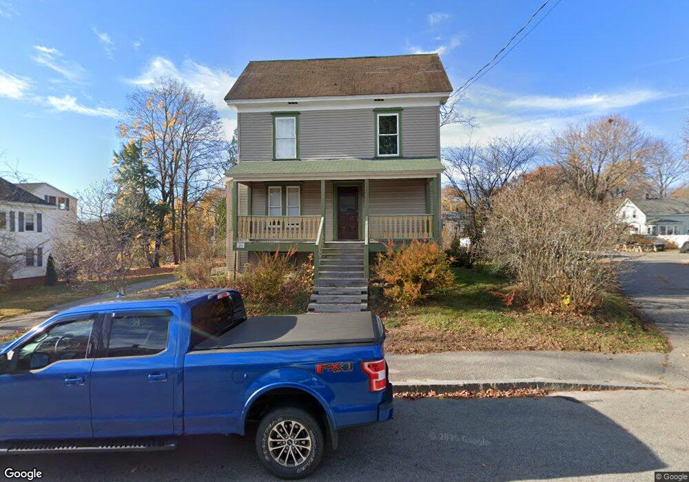
26 Myrtle St Westbrook, ME 04092
Estimated Value: $431,000 - $468,000
4
Beds
2
Baths
1,642
Sq Ft
$272/Sq Ft
Est. Value
About This Home
This home is located at 26 Myrtle St, Westbrook, ME 04092 and is currently estimated at $446,508, approximately $271 per square foot. 26 Myrtle St is a home located in Cumberland County with nearby schools including Westbrook High School, Breakwater School, and The Little Dolphin School Foundation.
Ownership History
Date
Name
Owned For
Owner Type
Purchase Details
Closed on
Oct 9, 2012
Sold by
Us Bank Na
Bought by
Department Of Housing & Urban Dev
Current Estimated Value
Purchase Details
Closed on
Jun 6, 2012
Sold by
Us Bank Home Mtg
Bought by
Department Of Housing & Urban Dev
Purchase Details
Closed on
Aug 9, 2011
Sold by
Us Bank Home Mortgage and Whitzell Lynne
Bought by
Us Bank Home Mortgage
Create a Home Valuation Report for This Property
The Home Valuation Report is an in-depth analysis detailing your home's value as well as a comparison with similar homes in the area
Home Values in the Area
Average Home Value in this Area
Purchase History
| Date | Buyer | Sale Price | Title Company |
|---|---|---|---|
| Department Of Housing & Urban Dev | -- | -- | |
| Us Bank Na | -- | -- | |
| Department Of Housing & Urban Dev | -- | -- | |
| Us Bank Home Mortgage | -- | -- |
Source: Public Records
Tax History Compared to Growth
Tax History
| Year | Tax Paid | Tax Assessment Tax Assessment Total Assessment is a certain percentage of the fair market value that is determined by local assessors to be the total taxable value of land and additions on the property. | Land | Improvement |
|---|---|---|---|---|
| 2023 | $4,142 | $248,300 | $85,500 | $162,800 |
| 2022 | $3,761 | $207,800 | $71,200 | $136,600 |
| 2021 | $3,705 | $207,800 | $71,200 | $136,600 |
| 2020 | $0 | $208,500 | $71,200 | $137,300 |
| 2019 | $0 | $208,500 | $71,200 | $137,300 |
| 2018 | $3,591 | $180,000 | $61,900 | $118,100 |
| 2017 | $3,398 | $180,000 | $61,900 | $118,100 |
| 2016 | $3,312 | $180,000 | $61,900 | $118,100 |
| 2015 | $3,233 | $180,000 | $61,900 | $118,100 |
| 2014 | $3,096 | $180,000 | $61,900 | $118,100 |
| 2013 | $3,096 | $180,000 | $61,900 | $118,100 |
Source: Public Records
Map
Nearby Homes
- 110 Myrtle St
- 18 Cole St
- 154 Myrtle St
- 21 Clover Ln Unit 201
- 21 Clover Ln Unit 103
- 21 Clover Ln Unit 402
- 21 Clover Ln Unit 406
- 21 Clover Ln Unit 309
- 21 Clover Ln Unit 109
- 21 Clover Ln Unit 306
- 21 Clover Ln Unit 107
- 42 Lowell St
- 48 Nasson Ave
- 97 Stroudwater St
- 17 Mechanic St
- 159 Lincoln St Unit 15
- 40 Oakland Ave
- 3 Collins Place Unit 5
- 68 Seavey St
- 17 Graham Rd Unit 3