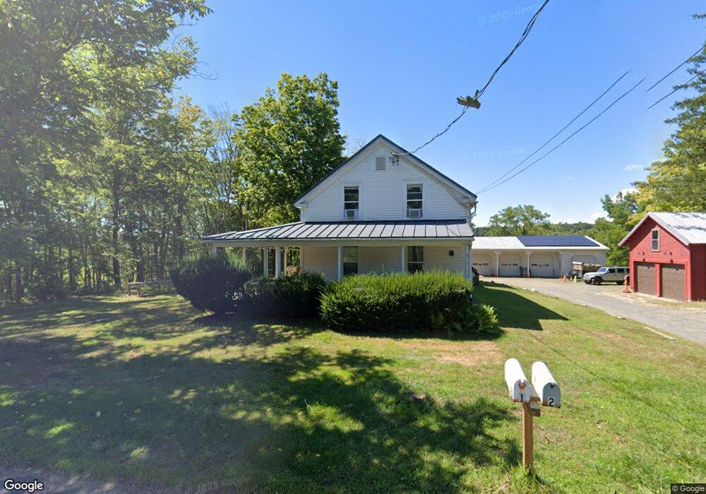
26 N Maple St Hadley, MA 01035
Estimated Value: $538,000 - $806,000
5
Beds
2
Baths
2,660
Sq Ft
$250/Sq Ft
Est. Value
About This Home
This home is located at 26 N Maple St, Hadley, MA 01035 and is currently estimated at $665,348, approximately $250 per square foot. 26 N Maple St is a home located in Hampshire County with nearby schools including Hadley Elementary School, Hopkins Academy, and Pioneer Valley Chinese Immersion Charter School.
Ownership History
Date
Name
Owned For
Owner Type
Purchase Details
Closed on
Mar 31, 2016
Sold by
Summerlin Co Llc
Bought by
Sthilaire Alan P and Sthilaire Carrera-Sthilaire C
Current Estimated Value
Home Financials for this Owner
Home Financials are based on the most recent Mortgage that was taken out on this home.
Original Mortgage
$260,000
Outstanding Balance
$206,351
Interest Rate
3.65%
Mortgage Type
New Conventional
Estimated Equity
$458,997
Create a Home Valuation Report for This Property
The Home Valuation Report is an in-depth analysis detailing your home's value as well as a comparison with similar homes in the area
Home Values in the Area
Average Home Value in this Area
Purchase History
| Date | Buyer | Sale Price | Title Company |
|---|---|---|---|
| Sthilaire Alan P | $325,000 | -- |
Source: Public Records
Mortgage History
| Date | Status | Borrower | Loan Amount |
|---|---|---|---|
| Open | Sthilaire Alan P | $260,000 |
Source: Public Records
Tax History
| Year | Tax Paid | Tax Assessment Tax Assessment Total Assessment is a certain percentage of the fair market value that is determined by local assessors to be the total taxable value of land and additions on the property. | Land | Improvement |
|---|---|---|---|---|
| 2025 | $6,931 | $596,000 | $136,100 | $459,900 |
| 2024 | $6,400 | $561,900 | $136,100 | $425,800 |
| 2023 | $6,249 | $541,500 | $136,100 | $405,400 |
| 2022 | $5,323 | $437,000 | $136,100 | $300,900 |
| 2021 | $5,027 | $418,900 | $136,100 | $282,800 |
| 2020 | $3,801 | $297,400 | $136,100 | $161,300 |
| 2019 | $3,597 | $291,000 | $136,100 | $154,900 |
| 2018 | $3,518 | $291,000 | $136,100 | $154,900 |
| 2017 | $3,415 | $295,200 | $136,100 | $159,100 |
| 2016 | $3,239 | $290,500 | $136,100 | $154,400 |
| 2015 | $3,155 | $290,500 | $136,100 | $154,400 |
| 2014 | $3,091 | $290,500 | $136,100 | $154,400 |
Source: Public Records
Map
Nearby Homes
- 30 Greenleaves Dr
- 27 Greenleaves Dr Unit 726
- 26 Greenleaves Dr Unit 635
- 24 Greenleaves Dr Unit 418
- 63 Amity Place Unit 63
- 75 Amity Place Unit 75
- 170 E Hadley Rd Unit 87
- 0 Main St
- Lot 3 Roosevelt St
- 141 Tracy Cir
- 48 Gray St
- 58 Main St Unit 4
- 58 Main St Unit 3
- 60 Red Gate Ln
- 0 Red Gate Ln Unit 73348273
- 89 Potwine Ln
- 11 West St
- 39 Valley Ln
- 83 Bay Rd
- 0 N Branch Rd
Your Personal Tour Guide
Ask me questions while you tour the home.