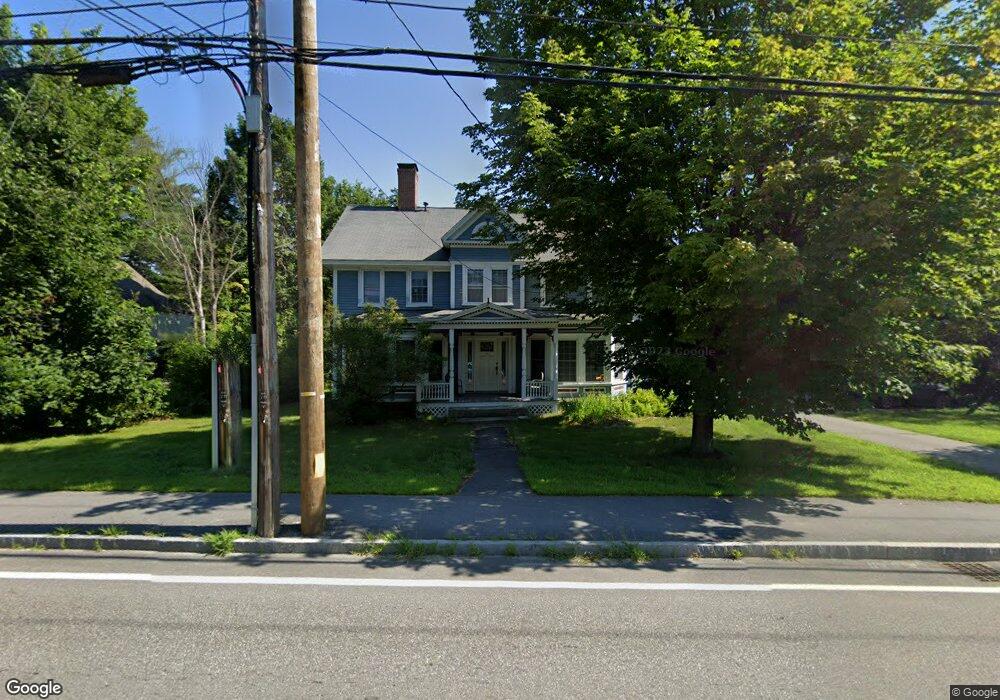
26 N Mast St Goffstown, NH 03045
Estimated Value: $570,000 - $630,000
4
Beds
2
Baths
2,772
Sq Ft
$216/Sq Ft
Est. Value
About This Home
This home is located at 26 N Mast St, Goffstown, NH 03045 and is currently estimated at $598,388, approximately $215 per square foot. 26 N Mast St is a home with nearby schools including Mountain View Middle School and Goffstown High School.
Create a Home Valuation Report for This Property
The Home Valuation Report is an in-depth analysis detailing your home's value as well as a comparison with similar homes in the area
Home Values in the Area
Average Home Value in this Area
Tax History Compared to Growth
Tax History
| Year | Tax Paid | Tax Assessment Tax Assessment Total Assessment is a certain percentage of the fair market value that is determined by local assessors to be the total taxable value of land and additions on the property. | Land | Improvement |
|---|---|---|---|---|
| 2024 | $9,237 | $451,900 | $193,400 | $258,500 |
| 2023 | $8,523 | $451,900 | $193,400 | $258,500 |
| 2022 | $7,980 | $303,300 | $128,500 | $174,800 |
| 2021 | $7,528 | $303,300 | $128,500 | $174,800 |
| 2020 | $7,528 | $303,300 | $128,500 | $174,800 |
| 2019 | $7,455 | $303,300 | $128,500 | $174,800 |
| 2018 | $5,641 | $303,300 | $128,500 | $174,800 |
| 2017 | $7,124 | $259,800 | $105,400 | $154,400 |
| 2016 | $6,867 | $259,800 | $105,400 | $154,400 |
| 2015 | $6,992 | $248,300 | $96,700 | $151,600 |
| 2014 | $6,704 | $248,300 | $96,700 | $151,600 |
Source: Public Records
Map
Nearby Homes
- 25 Pleasant St
- 12 S Mast St
- 39 S Mast St
- 99 Elm St
- 16 Palmer Rd
- 137 Elm St
- 120 S Mast St
- 232 N Mast St
- 152 S Mast St
- 88 Saunders Rd
- 22 Winter Hill Rd
- 2 Larch St Unit 1
- 12 Maplewood Ave
- 21A Apple Tree Dr
- 45 Range Rd
- 22 Fairway Dr
- 111 Bog Brook Rd
- 0 Fairway Dr Unit 11
- 914 Back Mountain Rd
- 602 Black Brook Rd