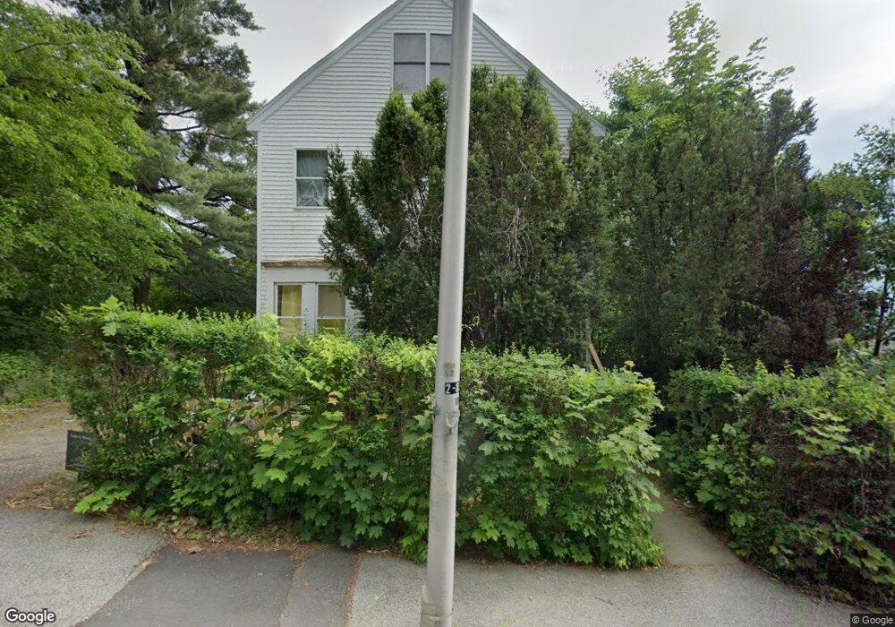
26 Perkins St Worcester, MA 01605
Bell Hill NeighborhoodEstimated Value: $496,000 - $549,276
4
Beds
2
Baths
3,064
Sq Ft
$172/Sq Ft
Est. Value
About This Home
This home is located at 26 Perkins St, Worcester, MA 01605 and is currently estimated at $526,819, approximately $171 per square foot. 26 Perkins St is a home located in Worcester County with nearby schools including Jacob Hiatt Magnet School, Chandler Magnet, and Burncoat Middle School.
Ownership History
Date
Name
Owned For
Owner Type
Purchase Details
Closed on
Aug 6, 1993
Sold by
Takesian Walter and Takesian Paul K
Bought by
Ledoux John F and Ledoux Allison
Current Estimated Value
Purchase Details
Closed on
Feb 6, 1987
Sold by
Takesian C S
Bought by
Takesian W A
Create a Home Valuation Report for This Property
The Home Valuation Report is an in-depth analysis detailing your home's value as well as a comparison with similar homes in the area
Home Values in the Area
Average Home Value in this Area
Purchase History
| Date | Buyer | Sale Price | Title Company |
|---|---|---|---|
| Ledoux John F | $87,000 | -- | |
| Takesian W A | $80,000 | -- |
Source: Public Records
Mortgage History
| Date | Status | Borrower | Loan Amount |
|---|---|---|---|
| Open | Takesian W A | $237,962 | |
| Closed | Takesian W A | $239,112 | |
| Closed | Takesian W A | $15,000 |
Source: Public Records
Tax History Compared to Growth
Tax History
| Year | Tax Paid | Tax Assessment Tax Assessment Total Assessment is a certain percentage of the fair market value that is determined by local assessors to be the total taxable value of land and additions on the property. | Land | Improvement |
|---|---|---|---|---|
| 2025 | $6,098 | $462,300 | $99,300 | $363,000 |
| 2024 | $5,776 | $420,100 | $99,300 | $320,800 |
| 2023 | $5,593 | $390,000 | $86,400 | $303,600 |
| 2022 | $5,202 | $342,000 | $69,100 | $272,900 |
| 2021 | $5,302 | $325,700 | $55,300 | $270,400 |
| 2020 | $4,984 | $293,200 | $54,800 | $238,400 |
| 2019 | $4,774 | $265,200 | $48,200 | $217,000 |
| 2018 | $4,731 | $250,200 | $48,200 | $202,000 |
| 2017 | $4,655 | $242,200 | $48,200 | $194,000 |
| 2016 | $4,769 | $231,400 | $35,600 | $195,800 |
| 2015 | $4,644 | $231,400 | $35,600 | $195,800 |
| 2014 | $4,522 | $231,400 | $35,600 | $195,800 |
Source: Public Records
Map
Nearby Homes
- 44 Westminster St
- 41 Westminster St
- 139 Lincoln St
- 55 Channing St
- 26 Orne St
- 12 Windsor St
- 10 Windsor St Unit C
- 82 Green Hill Pkwy
- 78 Green Hill Pkwy
- 74 Green Hill Pkwy
- 126 Lincoln St
- 24 Catharine St
- 40 Hooper St
- 73 Paine St
- 119 Rodney St
- 19 Mckinley Rd
- 67 Everard St
- 145 Eastern Ave
- 23 Ashton St
- 17 Vinson St
- 32 Westminster St
- 30 Perkins St
- 22 Perkins St
- 30 Westminster St
- 17 Forestdale Rd
- 15 Forestdale Rd
- 15 Forestdale Rd Unit 2
- 27 Perkins St
- 19 Forestdale Rd
- 31 Perkins St
- 32 Perkins St
- 25 Perkins St
- 9 Forestdale Rd Unit 2
- 9 Forestdale Rd Unit 3
- 9 Forestdale Rd Unit 1
- 25 Windsor St
- 34 Perkins St
- 21 Windsor St
- 35 Westminster St
- 27 Windsor St