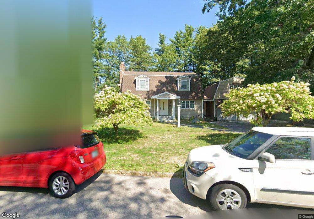
26 Pollard Rd Nashua, NH 03062
Southwest Nashua NeighborhoodEstimated Value: $593,000 - $635,000
3
Beds
3
Baths
2,120
Sq Ft
$292/Sq Ft
Est. Value
About This Home
This home is located at 26 Pollard Rd, Nashua, NH 03062 and is currently estimated at $619,075, approximately $292 per square foot. 26 Pollard Rd is a home located in Hillsborough County with nearby schools including New Searles School, Fairgrounds Middle School, and Nashua High School South.
Ownership History
Date
Name
Owned For
Owner Type
Purchase Details
Closed on
Aug 30, 2000
Sold by
Roeder Myriam M
Bought by
Pinto Cleber D
Current Estimated Value
Home Financials for this Owner
Home Financials are based on the most recent Mortgage that was taken out on this home.
Original Mortgage
$150,307
Interest Rate
8.16%
Mortgage Type
Purchase Money Mortgage
Create a Home Valuation Report for This Property
The Home Valuation Report is an in-depth analysis detailing your home's value as well as a comparison with similar homes in the area
Home Values in the Area
Average Home Value in this Area
Purchase History
| Date | Buyer | Sale Price | Title Company |
|---|---|---|---|
| Pinto Cleber D | $182,000 | -- |
Source: Public Records
Mortgage History
| Date | Status | Borrower | Loan Amount |
|---|---|---|---|
| Open | Pinto Cleber D | $322,000 | |
| Closed | Pinto Cleber D | $290,340 | |
| Closed | Pinto Cleber D | $150,307 |
Source: Public Records
Tax History Compared to Growth
Tax History
| Year | Tax Paid | Tax Assessment Tax Assessment Total Assessment is a certain percentage of the fair market value that is determined by local assessors to be the total taxable value of land and additions on the property. | Land | Improvement |
|---|---|---|---|---|
| 2024 | $8,421 | $529,600 | $164,900 | $364,700 |
| 2023 | $8,240 | $452,000 | $131,900 | $320,100 |
| 2022 | $8,168 | $452,000 | $131,900 | $320,100 |
| 2021 | $7,096 | $305,600 | $88,000 | $217,600 |
| 2020 | $6,910 | $305,600 | $88,000 | $217,600 |
| 2019 | $6,650 | $305,600 | $88,000 | $217,600 |
| 2018 | $6,482 | $305,600 | $88,000 | $217,600 |
| 2017 | $6,865 | $266,200 | $70,300 | $195,900 |
| 2016 | $6,674 | $266,200 | $70,300 | $195,900 |
| 2015 | $6,530 | $266,200 | $70,300 | $195,900 |
| 2014 | $6,402 | $266,200 | $70,300 | $195,900 |
Source: Public Records
Map
Nearby Homes
- 2 Wakefield Dr
- 23 Glen Dr
- 4 Henry David Dr Unit 203
- 11 Bordeaux St
- 30 Gingras Dr
- 22 Kern Dr
- 247 Main Dunstable Rd
- 5 Wilderness Dr
- 9 Michelle Dr
- 30 Gendron St
- 57 Wethersfield Rd
- 97 Linwood St
- 8 Althea Ln Unit U26
- 15 Westray Dr
- 41 New Dunstable Rd Unit 371
- 375 Main Dunstable Rd
- 63 Dexter St
- 22 New Dunstable Rd Unit 132133
- 47 Dogwood Dr Unit U202
- 5 Appaloosa Place
- 28 Pollard Rd
- 24 Pollard Rd
- 21 Pollard Rd
- 19 Pollard Rd
- 35 Nottingham Dr
- 22 Pollard Rd
- 76 Northeastern Blvd Unit 31B
- 76 Northeastern Blvd Unit 33B
- 76 Northeastern Blvd Unit 29B
- 76 Northeastern Blvd Unit 37B
- 76 Northeastern Blvd Unit 37-38
- 76 Northeastern Blvd
- 76 Northeastern Blvd Unit 36A/B
- 76 Northeastern Blvd Unit 39-40
- 76 Northeastern Blvd Unit 34
- 76 Northeastern Blvd Unit 32
- 33 Nottingham Dr
- 76 NE Blvd #33b
- 37 Nottingham Dr
- 20 Pollard Rd