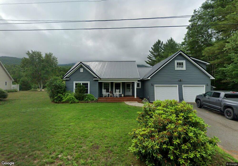
26 Profile Dr North Woodstock, NH 03262
Estimated Value: $549,000 - $1,094,000
3
Beds
4
Baths
2,247
Sq Ft
$351/Sq Ft
Est. Value
About This Home
This home is located at 26 Profile Dr, North Woodstock, NH 03262 and is currently estimated at $789,023, approximately $351 per square foot. 26 Profile Dr is a home with nearby schools including Lin-Wood Public Elementary School.
Ownership History
Date
Name
Owned For
Owner Type
Purchase Details
Closed on
Oct 22, 2001
Sold by
Cmb Constr Co Inc
Bought by
Hyland Michael J and Hyland Pamela M
Current Estimated Value
Home Financials for this Owner
Home Financials are based on the most recent Mortgage that was taken out on this home.
Original Mortgage
$47,600
Interest Rate
6.92%
Mortgage Type
Purchase Money Mortgage
Create a Home Valuation Report for This Property
The Home Valuation Report is an in-depth analysis detailing your home's value as well as a comparison with similar homes in the area
Home Values in the Area
Average Home Value in this Area
Purchase History
| Date | Buyer | Sale Price | Title Company |
|---|---|---|---|
| Hyland Michael J | $59,500 | -- |
Source: Public Records
Mortgage History
| Date | Status | Borrower | Loan Amount |
|---|---|---|---|
| Open | Hyland Michael J | $265,206 | |
| Closed | Hyland Michael J | $264,000 | |
| Closed | Hyland Michael J | $47,600 |
Source: Public Records
Tax History Compared to Growth
Tax History
| Year | Tax Paid | Tax Assessment Tax Assessment Total Assessment is a certain percentage of the fair market value that is determined by local assessors to be the total taxable value of land and additions on the property. | Land | Improvement |
|---|---|---|---|---|
| 2024 | $7,905 | $389,010 | $147,600 | $241,410 |
| 2023 | $7,562 | $389,010 | $147,600 | $241,410 |
| 2022 | $7,150 | $389,010 | $147,600 | $241,410 |
| 2021 | $7,391 | $389,010 | $147,600 | $241,410 |
| 2020 | $7,761 | $389,010 | $147,600 | $241,410 |
| 2019 | $4,076 | $309,450 | $123,100 | $186,350 |
| 2018 | $271 | $309,450 | $123,100 | $186,350 |
| 2016 | $209 | $309,450 | $123,100 | $186,350 |
| 2015 | $5,858 | $309,450 | $123,100 | $186,350 |
| 2014 | $5,919 | $313,350 | $123,100 | $190,250 |
| 2012 | $5,902 | $330,110 | $137,200 | $192,910 |
Source: Public Records
Map
Nearby Homes
- 56 Kancamagus Hwy
- 206-011 Lost River Rd
- 25 Main St
- 11 Cascade Dr Unit 288
- 164 Deer Park Dr Unit 160D
- 164 Deer Park Dr Unit 161D
- 164 Deer Park Dr Unit 168D
- 156 Deer Park Dr Unit 135 A
- 17 Ridge Dr Unit A-14
- 23 Oakes St
- 65 Riverfront Dr Unit 217
- 45 Riverfront Dr Unit 242
- 16 Riverfront Dr Unit 293
- 16 Riverfront Dr Unit 292
- 14 Monroe Dr Unit 92
- 6 Monroe Dr Unit 111
- 9 Moose Ln
- 34 Franklin St
- 252-254 Lost River Rd
- 78 Main St Unit 3A
- Lot 9 Profile Dr
- Lot 8 Profile Dr
- Lots 8 & 9 Profile Dr
- 45 Profile Dr
- 36 Profile Dr
- 51 Profile Dr
- 0 Profile Dr
- 0 Profile Dr Unit 4036447
- 0 Profile Dr Unit 4129296
- 2 Profile Dr Unit 3
- 2 Profile Dr
- 3 Profile Dr
- 38 Profile Dr
- 5 Profile Dr
- 25 Profile Dr
- 48 Profile Dr
- 4D Riverside Estates
- 8 Depot St
- 6 Depot St
- 229 Riverfront Dr Unit 229