Estimated Value: $304,242 - $347,000
3
Beds
2
Baths
1,853
Sq Ft
$179/Sq Ft
Est. Value
About This Home
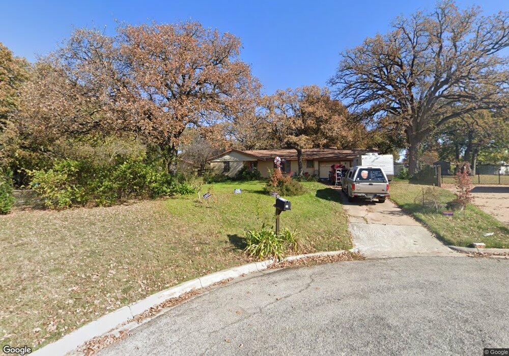
This home is located at 26 Shadowbrook Ln, Hurst, TX 76053 and is currently estimated at $332,061, approximately $179 per square foot. 26 Shadowbrook Ln is a home located in Tarrant County with nearby schools including West Hurst Elementary School, Hurst J High School, and L.D. Bell High School.
Ownership History
Date
Name
Owned For
Owner Type
Purchase Details
Closed on
Nov 16, 2018
Sold by
Wilkerson Patricia Ann
Bought by
Wilkerson Patricia Ann and Estate Of Elizabeth Ann Parvin
Current Estimated Value
Purchase Details
Closed on
Mar 14, 2018
Sold by
Wilkerson Patricia Ann
Bought by
Wilkerson Patricia Ann and Parvin Michael Wayne
Purchase Details
Closed on
Dec 21, 2007
Sold by
Hackney Marcia
Bought by
Parvin Luther D and Parvin Elizabeth Ann
Purchase Details
Closed on
Dec 17, 2007
Sold by
Hackney Richard L
Bought by
Hackney Marcia
Create a Home Valuation Report for This Property
The Home Valuation Report is an in-depth analysis detailing your home's value as well as a comparison with similar homes in the area
Home Values in the Area
Average Home Value in this Area
Purchase History
| Date | Buyer | Sale Price | Title Company |
|---|---|---|---|
| Wilkerson Patricia Ann | -- | None Available | |
| Wilkerson Patricia Ann | -- | None Available | |
| Wilkeron Patricia Ann | -- | None Available | |
| Wilkerson Patricia Ann | -- | None Available | |
| Wilkerson Patricia Ann | -- | None Available | |
| Parvin Luther D | -- | None Available | |
| Hackney Marcia | -- | Richard M Kilgore Title Svcs |
Source: Public Records
Tax History
| Year | Tax Paid | Tax Assessment Tax Assessment Total Assessment is a certain percentage of the fair market value that is determined by local assessors to be the total taxable value of land and additions on the property. | Land | Improvement |
|---|---|---|---|---|
| 2025 | $7,061 | $345,727 | $60,000 | $285,727 |
| 2024 | $7,162 | $345,727 | $60,000 | $285,727 |
| 2023 | $7,162 | $357,466 | $30,000 | $327,466 |
| 2022 | $6,932 | $301,061 | $30,000 | $271,061 |
| 2021 | $6,568 | $272,330 | $30,000 | $242,330 |
| 2020 | $5,370 | $223,221 | $30,000 | $193,221 |
| 2019 | $5,331 | $217,833 | $30,000 | $187,833 |
| 2018 | $4,930 | $201,419 | $18,000 | $183,419 |
| 2017 | $4,880 | $192,852 | $18,000 | $174,852 |
| 2016 | $4,411 | $174,318 | $18,000 | $156,318 |
| 2015 | $3,247 | $123,800 | $18,000 | $105,800 |
| 2014 | $3,247 | $123,800 | $18,000 | $105,800 |
Source: Public Records
Map
Nearby Homes
- 528 Buena Vista Dr
- 512 Shadowbrook Ln
- 231 Elm St
- 709 Hurstview Dr
- 701 Harrison Ln
- 608 W Redbud Dr
- 609 Norwood Dr
- 209 W Cedar St
- 552 Norwood Dr
- 408 Harrison Ln
- 47 Donald Ct
- 756 Briarwood Ln
- 712 Pine St
- 416 Simmons Dr
- 758 Briarwood Ln
- 153 Sheri Ln
- 408 Simmons Dr
- 424 Holder Dr
- 1016 Keith Dr
- 813 Chase Cir
- 22 Shadowbrook Ln
- 545 Buena Vista Dr
- 34 Shadowbrook Ln
- 541 Buena Vista Dr
- 601 Buena Vista Dr
- 18 Shadowbrook Ln
- 537 Buena Vista Dr
- 38 Shadowbrook Ln
- 553 Buena Vista Dr
- 14 Shadowbrook Ln
- 605 Buena Vista Dr
- 533 Buena Vista Dr
- 42 Shadowbrook Ln
- 609 Buena Vista Dr
- 544 Buena Vista Dr
- 540 Buena Vista Dr
- 10 Shadowbrook Ln
- 548 Buena Vista Dr
- 536 Buena Vista Dr
- 529 Buena Vista Dr
Your Personal Tour Guide
Ask me questions while you tour the home.