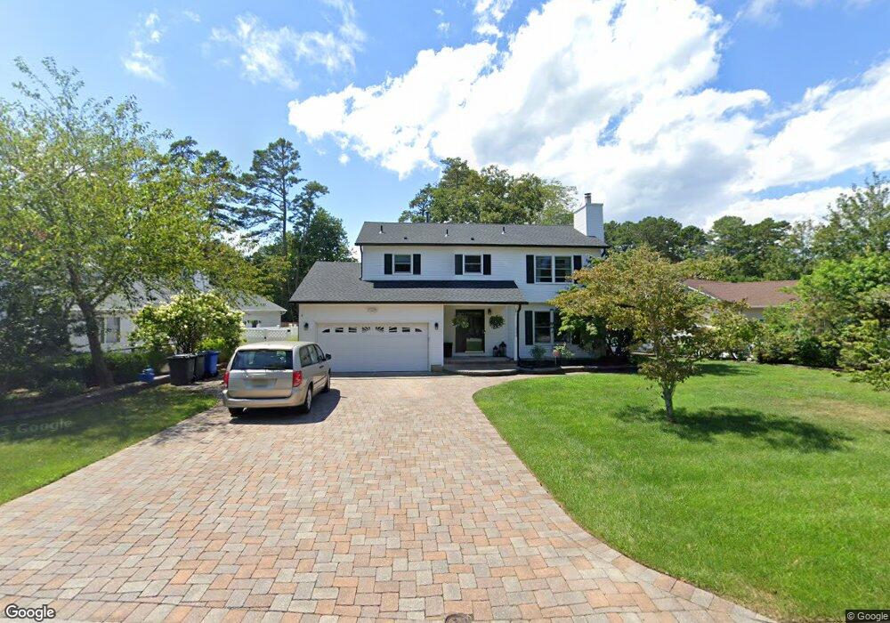
26 Shoveler Ln Manahawkin, NJ 08050
Stafford NeighborhoodEstimated Value: $596,000 - $639,000
4
Beds
3
Baths
2,073
Sq Ft
$297/Sq Ft
Est. Value
About This Home
This home is located at 26 Shoveler Ln, Manahawkin, NJ 08050 and is currently estimated at $616,286, approximately $297 per square foot. 26 Shoveler Ln is a home located in Ocean County with nearby schools including Oxycocus Elementary School, Ocean Acres Elementary School, and McKinley Avenue Elementary School.
Ownership History
Date
Name
Owned For
Owner Type
Purchase Details
Closed on
Sep 30, 2009
Sold by
Southstar Iv Llc
Bought by
Silva Catherine and Silva Justin
Current Estimated Value
Home Financials for this Owner
Home Financials are based on the most recent Mortgage that was taken out on this home.
Original Mortgage
$270,019
Interest Rate
5%
Mortgage Type
FHA
Purchase Details
Closed on
Jun 29, 2009
Sold by
Schmid David O and Schmid Sharon M
Bought by
Southstar Iv Llc
Create a Home Valuation Report for This Property
The Home Valuation Report is an in-depth analysis detailing your home's value as well as a comparison with similar homes in the area
Home Values in the Area
Average Home Value in this Area
Purchase History
| Date | Buyer | Sale Price | Title Company |
|---|---|---|---|
| Silva Catherine | $275,000 | First American Title Ins Co | |
| Southstar Iv Llc | -- | None Available |
Source: Public Records
Mortgage History
| Date | Status | Borrower | Loan Amount |
|---|---|---|---|
| Previous Owner | Silva Catherine | $270,019 |
Source: Public Records
Tax History Compared to Growth
Tax History
| Year | Tax Paid | Tax Assessment Tax Assessment Total Assessment is a certain percentage of the fair market value that is determined by local assessors to be the total taxable value of land and additions on the property. | Land | Improvement |
|---|---|---|---|---|
| 2025 | $6,672 | $268,700 | $107,600 | $161,100 |
| 2024 | $6,607 | $268,700 | $107,600 | $161,100 |
| 2023 | $6,325 | $268,700 | $107,600 | $161,100 |
| 2022 | $6,325 | $268,700 | $107,600 | $161,100 |
| 2021 | $6,239 | $268,700 | $107,600 | $161,100 |
| 2020 | $6,247 | $268,700 | $107,600 | $161,100 |
| 2019 | $6,159 | $268,700 | $107,600 | $161,100 |
| 2018 | $6,121 | $268,700 | $107,600 | $161,100 |
| 2017 | $5,991 | $254,600 | $107,600 | $147,000 |
| 2016 | $5,930 | $254,600 | $107,600 | $147,000 |
| 2015 | $5,721 | $254,600 | $107,600 | $147,000 |
| 2014 | $5,683 | $249,800 | $107,600 | $142,200 |
Source: Public Records
Map
Nearby Homes
- 223 Hilliard Blvd
- 557 Mermaid Dr
- 76 Beach Ave
- 26 Littleworth Rd
- 151 Littleworth Rd
- 25 N Union St
- 155 Littleworth Rd
- 159 Littleworth Rd
- 128 Rowan Ct
- 384 Hilliard Blvd
- 303 S Lakeshore Dr
- 5 Pine Cone Ln
- 18 Maple Tree Ct
- 84 Jennings Rd
- 527 Mill Creek Rd
- 30 Fort Lee Dr
- 36 Fort Lee Dr
- 5 Popper St
- 40 Pine Grove Ave
- 75 Perry Ln