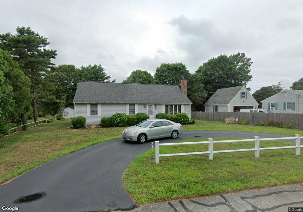
26 Wing Rd Pocasset, MA 02559
Pocasset NeighborhoodEstimated Value: $631,000 - $761,000
2
Beds
2
Baths
1,400
Sq Ft
$489/Sq Ft
Est. Value
About This Home
This home is located at 26 Wing Rd, Pocasset, MA 02559 and is currently estimated at $684,264, approximately $488 per square foot. 26 Wing Rd is a home located in Barnstable County with nearby schools including Bourne High School and Cadence Academy Preschool - Bourne.
Ownership History
Date
Name
Owned For
Owner Type
Purchase Details
Closed on
Aug 12, 2004
Sold by
Fulton T T and Fulton Obryant
Bought by
Palanzi Louise
Current Estimated Value
Purchase Details
Closed on
Feb 20, 2001
Sold by
Mortali Frederick C and Mortali Alice M
Bought by
Fulton T and Obryant J A
Home Financials for this Owner
Home Financials are based on the most recent Mortgage that was taken out on this home.
Original Mortgage
$120,000
Interest Rate
7.08%
Mortgage Type
Purchase Money Mortgage
Purchase Details
Closed on
Jul 9, 1997
Sold by
Mortali Frederick C and Mortali Alice M
Bought by
Fulton T
Create a Home Valuation Report for This Property
The Home Valuation Report is an in-depth analysis detailing your home's value as well as a comparison with similar homes in the area
Home Values in the Area
Average Home Value in this Area
Purchase History
| Date | Buyer | Sale Price | Title Company |
|---|---|---|---|
| Palanzi Louise | $10,000 | -- | |
| Palanzi Louise | $10,000 | -- | |
| Fulton T | $44,000 | -- | |
| Fulton T T | $44,000 | -- | |
| Fulton T | $44,000 | -- | |
| Fulton T | $44,000 | -- |
Source: Public Records
Mortgage History
| Date | Status | Borrower | Loan Amount |
|---|---|---|---|
| Previous Owner | Fulton T | $120,000 |
Source: Public Records
Tax History Compared to Growth
Tax History
| Year | Tax Paid | Tax Assessment Tax Assessment Total Assessment is a certain percentage of the fair market value that is determined by local assessors to be the total taxable value of land and additions on the property. | Land | Improvement |
|---|---|---|---|---|
| 2025 | $3,825 | $489,700 | $211,400 | $278,300 |
| 2024 | $3,765 | $469,500 | $201,300 | $268,200 |
| 2023 | $3,593 | $407,800 | $170,400 | $237,400 |
| 2022 | $3,792 | $375,800 | $185,100 | $190,700 |
| 2021 | $3,706 | $344,100 | $168,400 | $175,700 |
| 2020 | $3,609 | $336,000 | $166,800 | $169,200 |
| 2019 | $3,432 | $326,500 | $166,800 | $159,700 |
| 2018 | $3,214 | $304,900 | $158,900 | $146,000 |
| 2017 | $2,990 | $290,300 | $145,800 | $144,500 |
| 2016 | $2,913 | $286,700 | $145,800 | $140,900 |
| 2015 | $3,122 | $310,000 | $169,100 | $140,900 |
Source: Public Records
Map
Nearby Homes
- 171 Bellavista Dr
- 254 Barlows Landing Rd
- 34 Kenwood Rd
- 45 Kenwood Rd
- 940 County Rd
- 22 Nairn Rd
- 709 County Rd
- 70 Wings Neck Rd
- 174 Barlows Landing Rd
- 14 Navajo Rd
- 7 4th Ave
- 24 Richmond Rd
- 940 County Rd
- 15 1st St
- 48 Red Brook Harbor Rd
- 3 Red Brook Pond Dr
- 39 Bennets Neck Dr
- 89 Harbor Dr
- 7 Portside Dr
- 515 County Rd