Estimated Value: $613,000 - $655,297
5
Beds
2
Baths
2,216
Sq Ft
$286/Sq Ft
Est. Value
About This Home
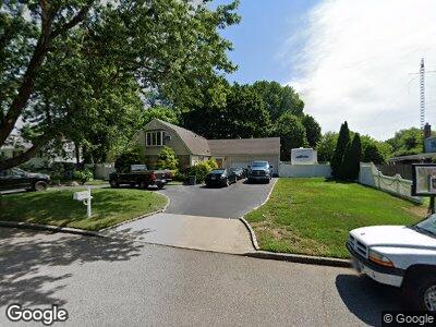
This home is located at 26 Yale St, Port Jefferson Station, NY 11776 and is currently estimated at $634,149, approximately $286 per square foot. 26 Yale St is a home located in Suffolk County with nearby schools including John F Kennedy Middle School and Comsewogue High School.
Ownership History
Date
Name
Owned For
Owner Type
Purchase Details
Closed on
Jan 23, 2010
Sold by
Gentile Gladys and Demuth Michael
Bought by
Deutsche Bank National Trust Company
Current Estimated Value
Purchase Details
Closed on
Aug 7, 2006
Sold by
Maloney Robert F
Bought by
Demuth Michael
Purchase Details
Closed on
Nov 16, 1998
Sold by
Louka Louis and Louka Helen
Bought by
Maloney Robert F and Maloney Patricia J
Home Financials for this Owner
Home Financials are based on the most recent Mortgage that was taken out on this home.
Original Mortgage
$180,500
Interest Rate
6.68%
Create a Home Valuation Report for This Property
The Home Valuation Report is an in-depth analysis detailing your home's value as well as a comparison with similar homes in the area
Home Values in the Area
Average Home Value in this Area
Purchase History
| Date | Buyer | Sale Price | Title Company |
|---|---|---|---|
| Deutsche Bank National Trust Company | $1,000 | -- | |
| Demuth Michael | $450,000 | Jason L Abelove | |
| Maloney Robert F | $190,000 | Safe Harbor Title Agency |
Source: Public Records
Mortgage History
| Date | Status | Borrower | Loan Amount |
|---|---|---|---|
| Previous Owner | Maloney Robert F | $98,501 | |
| Previous Owner | Maloney Robert F | $57,000 | |
| Previous Owner | Maloney Robert F | $180,500 |
Source: Public Records
Tax History Compared to Growth
Tax History
| Year | Tax Paid | Tax Assessment Tax Assessment Total Assessment is a certain percentage of the fair market value that is determined by local assessors to be the total taxable value of land and additions on the property. | Land | Improvement |
|---|---|---|---|---|
| 2023 | $11,590 | $2,715 | $300 | $2,415 |
| 2022 | $10,450 | $2,715 | $300 | $2,415 |
| 2021 | $10,450 | $2,715 | $300 | $2,415 |
| 2020 | $10,658 | $2,715 | $300 | $2,415 |
| 2019 | $10,658 | $0 | $0 | $0 |
| 2018 | $10,203 | $2,715 | $300 | $2,415 |
| 2017 | $10,203 | $2,715 | $300 | $2,415 |
| 2016 | $10,411 | $2,800 | $300 | $2,500 |
| 2015 | -- | $2,800 | $300 | $2,500 |
| 2014 | -- | $2,925 | $300 | $2,625 |
Source: Public Records
Map
Nearby Homes