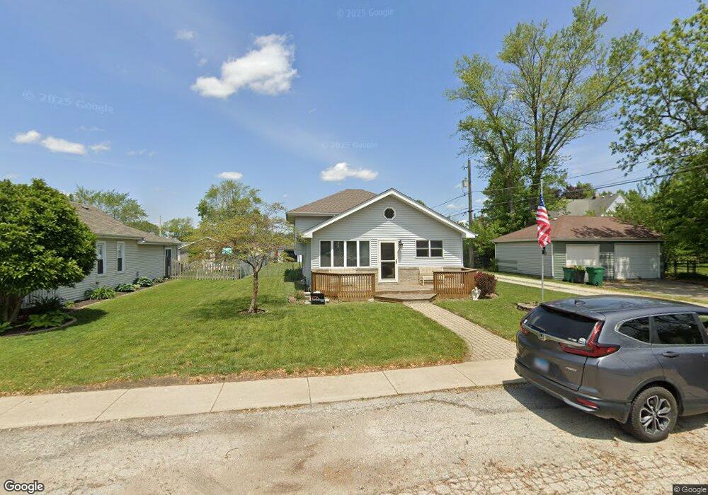
260 1st St Manhattan, IL 60442
Estimated Value: $277,000 - $367,966
3
Beds
2
Baths
1,669
Sq Ft
$199/Sq Ft
Est. Value
About This Home
This home is located at 260 1st St, Manhattan, IL 60442 and is currently estimated at $331,742, approximately $198 per square foot. 260 1st St is a home with nearby schools including Wilson Creek Elementary School, Anna McDonald Elementary School, and Manhattan Junior High School.
Ownership History
Date
Name
Owned For
Owner Type
Purchase Details
Closed on
Dec 8, 2010
Sold by
Lamaster Cheryl L
Bought by
Lamaster Clifford W
Current Estimated Value
Purchase Details
Closed on
Jan 4, 1994
Sold by
Pearson Michael S and Pearson Debra A
Bought by
Lamaster Clifford W and Lamaster Cheryl L
Home Financials for this Owner
Home Financials are based on the most recent Mortgage that was taken out on this home.
Original Mortgage
$55,929
Interest Rate
7.26%
Mortgage Type
FHA
Create a Home Valuation Report for This Property
The Home Valuation Report is an in-depth analysis detailing your home's value as well as a comparison with similar homes in the area
Home Values in the Area
Average Home Value in this Area
Purchase History
| Date | Buyer | Sale Price | Title Company |
|---|---|---|---|
| Lamaster Clifford W | -- | None Available | |
| Lamaster Clifford W | $56,000 | Chicago Title Insurance Co |
Source: Public Records
Mortgage History
| Date | Status | Borrower | Loan Amount |
|---|---|---|---|
| Closed | Lamaster Clifford W | $55,929 |
Source: Public Records
Tax History
| Year | Tax Paid | Tax Assessment Tax Assessment Total Assessment is a certain percentage of the fair market value that is determined by local assessors to be the total taxable value of land and additions on the property. | Land | Improvement |
|---|---|---|---|---|
| 2024 | $9,732 | $105,850 | $23,350 | $82,500 |
| 2023 | $9,732 | $94,700 | $20,200 | $74,500 |
| 2022 | $8,876 | $86,600 | $16,350 | $70,250 |
| 2021 | $7,807 | $81,800 | $16,350 | $65,450 |
| 2020 | $7,497 | $78,600 | $16,350 | $62,250 |
| 2019 | $7,292 | $76,800 | $15,150 | $61,650 |
| 2018 | $6,840 | $72,650 | $15,150 | $57,500 |
| 2017 | $6,565 | $69,650 | $15,150 | $54,500 |
| 2016 | $6,257 | $66,350 | $15,150 | $51,200 |
| 2015 | -- | $63,550 | $14,550 | $49,000 |
| 2014 | -- | $62,200 | $14,550 | $47,650 |
| 2013 | -- | $64,700 | $14,550 | $50,150 |
Source: Public Records
Map
Nearby Homes
- 00 S State St
- 435 S State St
- 100 Lee St
- 25463 Colligan St
- 15120 W Oxford Ln
- 25910 S Manchester Ln
- 25920 S Manchester Ln
- 25346 Bann St
- 304 Brynn Dr
- 25426 Barrow Rd
- 25116 Colligan St
- 25047 Clare Cir
- 25109 Colligan St
- 26017 Locksley Dr
- 25029 Clare Cir
- 14931 W Yorkshire St
- 15001 W Yorkshire St
- 14941 W Yorkshire St
- 15040 W Winchester Ln
- 26213 S Castle Blvd
Your Personal Tour Guide
Ask me questions while you tour the home.