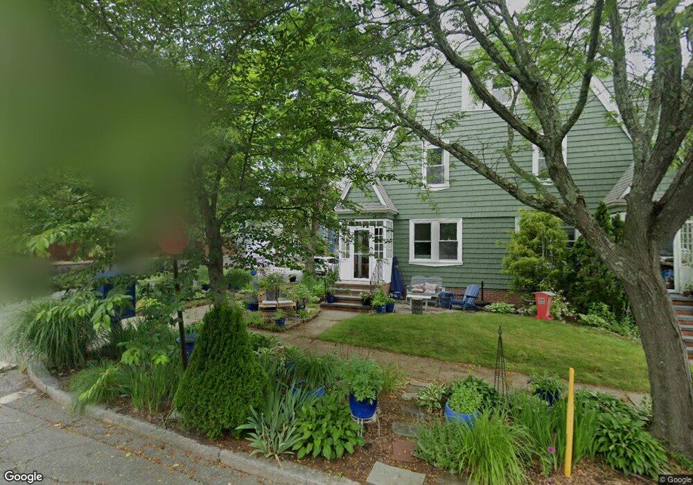
260 4th St Unit 1 Providence, RI 02906
Blackstone NeighborhoodEstimated Value: $796,896 - $824,000
3
Beds
2
Baths
1,520
Sq Ft
$533/Sq Ft
Est. Value
About This Home
This home is located at 260 4th St Unit 1, Providence, RI 02906 and is currently estimated at $810,448, approximately $533 per square foot. 260 4th St Unit 1 is a home located in Providence County with nearby schools including Jewish Community Day School Of Rhode Island, Montessori Childrens House, and Lincoln School.
Ownership History
Date
Name
Owned For
Owner Type
Purchase Details
Closed on
Jan 31, 2003
Sold by
Mcnamara Judith and Armistead Covington C
Bought by
Jacobson Steven M and Katzman Andrea R
Current Estimated Value
Home Financials for this Owner
Home Financials are based on the most recent Mortgage that was taken out on this home.
Original Mortgage
$260,000
Interest Rate
6.09%
Create a Home Valuation Report for This Property
The Home Valuation Report is an in-depth analysis detailing your home's value as well as a comparison with similar homes in the area
Home Values in the Area
Average Home Value in this Area
Purchase History
| Date | Buyer | Sale Price | Title Company |
|---|---|---|---|
| Jacobson Steven M | $325,000 | -- |
Source: Public Records
Mortgage History
| Date | Status | Borrower | Loan Amount |
|---|---|---|---|
| Open | Jacobson Steven M | $234,500 | |
| Closed | Jacobson Steven M | $260,000 |
Source: Public Records
Tax History
| Year | Tax Paid | Tax Assessment Tax Assessment Total Assessment is a certain percentage of the fair market value that is determined by local assessors to be the total taxable value of land and additions on the property. | Land | Improvement |
|---|---|---|---|---|
| 2025 | $16,334 | $1,118,800 | $0 | $1,118,800 |
| 2024 | $13,750 | $749,300 | $0 | $749,300 |
| 2023 | $13,750 | $749,300 | $0 | $749,300 |
| 2022 | $13,338 | $749,300 | $0 | $749,300 |
| 2021 | $6,443 | $437,200 | $0 | $437,200 |
| 2020 | $6,443 | $437,200 | $0 | $437,200 |
| 2019 | $6,444 | $437,200 | $0 | $437,200 |
| 2018 | $12,445 | $389,400 | $0 | $389,400 |
| 2017 | $12,445 | $389,400 | $0 | $389,400 |
| 2016 | $12,445 | $389,400 | $0 | $389,400 |
| 2015 | $12,207 | $368,800 | $0 | $368,800 |
| 2014 | $12,447 | $368,800 | $0 | $368,800 |
| 2013 | $12,447 | $368,800 | $0 | $368,800 |
Source: Public Records
Map
Nearby Homes
Your Personal Tour Guide
Ask me questions while you tour the home.