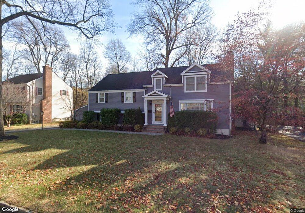
260 Ashland Rd Summit, NJ 07901
Estimated Value: $1,104,000 - $1,581,000
--
Bed
--
Bath
2,429
Sq Ft
$583/Sq Ft
Est. Value
About This Home
This home is located at 260 Ashland Rd, Summit, NJ 07901 and is currently estimated at $1,415,383, approximately $582 per square foot. 260 Ashland Rd is a home located in Union County with nearby schools including L C Johnson Summit Middle School, Summit Sr High School, and Oak Knoll School of the Holy Child.
Ownership History
Date
Name
Owned For
Owner Type
Purchase Details
Closed on
Nov 1, 2022
Sold by
Nahas Basile A and Nahas Katherine K
Bought by
Nahas Basile A
Current Estimated Value
Purchase Details
Closed on
Mar 27, 2013
Sold by
Silveira Paul J Da and Sutton Barbara Ann
Bought by
Nahas Basile A and Nahas Katherine K
Purchase Details
Closed on
May 1, 2008
Sold by
Tam David and Tam Elaine
Bought by
Da Silveira Paul J and Sutton Barbara Ann
Home Financials for this Owner
Home Financials are based on the most recent Mortgage that was taken out on this home.
Original Mortgage
$724,500
Interest Rate
5.93%
Mortgage Type
Purchase Money Mortgage
Purchase Details
Closed on
May 29, 1998
Sold by
Juhase Thomas F and Juhase Kelly
Bought by
Tam David and Eng Elaine
Home Financials for this Owner
Home Financials are based on the most recent Mortgage that was taken out on this home.
Original Mortgage
$330,300
Interest Rate
6.92%
Purchase Details
Closed on
Dec 18, 1996
Sold by
Mcdaniel Robert and Mcdaniel Susan
Bought by
Juhase Thomas F
Home Financials for this Owner
Home Financials are based on the most recent Mortgage that was taken out on this home.
Original Mortgage
$243,550
Interest Rate
7.16%
Create a Home Valuation Report for This Property
The Home Valuation Report is an in-depth analysis detailing your home's value as well as a comparison with similar homes in the area
Home Values in the Area
Average Home Value in this Area
Purchase History
| Date | Buyer | Sale Price | Title Company |
|---|---|---|---|
| Nahas Basile A | -- | -- | |
| Nahas Basile A | -- | None Listed On Document | |
| Nahas Basile A | $575,000 | None Available | |
| Da Silveira Paul J | $805,000 | None Available | |
| Tam David | $367,000 | -- | |
| Juhase Thomas F | $348,000 | -- |
Source: Public Records
Mortgage History
| Date | Status | Borrower | Loan Amount |
|---|---|---|---|
| Previous Owner | Da Silveira Paul J | $724,500 | |
| Previous Owner | Tam David | $330,300 | |
| Previous Owner | Juhase Thomas F | $243,550 |
Source: Public Records
Tax History Compared to Growth
Tax History
| Year | Tax Paid | Tax Assessment Tax Assessment Total Assessment is a certain percentage of the fair market value that is determined by local assessors to be the total taxable value of land and additions on the property. | Land | Improvement |
|---|---|---|---|---|
| 2025 | $17,524 | $402,300 | $188,500 | $213,800 |
| 2024 | $17,408 | $402,300 | $188,500 | $213,800 |
| 2023 | $17,408 | $402,300 | $188,500 | $213,800 |
| 2022 | $17,367 | $402,300 | $188,500 | $213,800 |
| 2021 | $17,560 | $402,300 | $188,500 | $213,800 |
| 2020 | $17,540 | $402,300 | $188,500 | $213,800 |
| 2019 | $17,560 | $402,300 | $188,500 | $213,800 |
| 2018 | $17,448 | $402,300 | $188,500 | $213,800 |
| 2017 | $16,347 | $374,500 | $188,500 | $186,000 |
| 2016 | $16,107 | $374,500 | $188,500 | $186,000 |
| 2015 | $15,793 | $374,500 | $188,500 | $186,000 |
| 2014 | $15,384 | $358,200 | $188,500 | $169,700 |
Source: Public Records
Map
Nearby Homes
- 4 Midland Terrace
- 110 Division Ave
- 29 Druid Hill Rd
- 100 Larned Rd
- 171 Grant Ave
- 140 Countryside Dr
- 709 Springfield Ave Unit 4
- 709 Springfield Ave Unit 3
- 25 Division Ave
- 183 Countryside Dr
- 54 Badgley Dr
- 97 the Fellsway
- 67 Tulip St
- 34 Ashland Rd
- 10 Rowan Rd
- 115 Maple St
- 62 Beekman Rd
- 62 Mountain Ave
- 24 Primrose Dr
- 34 Grant Ave