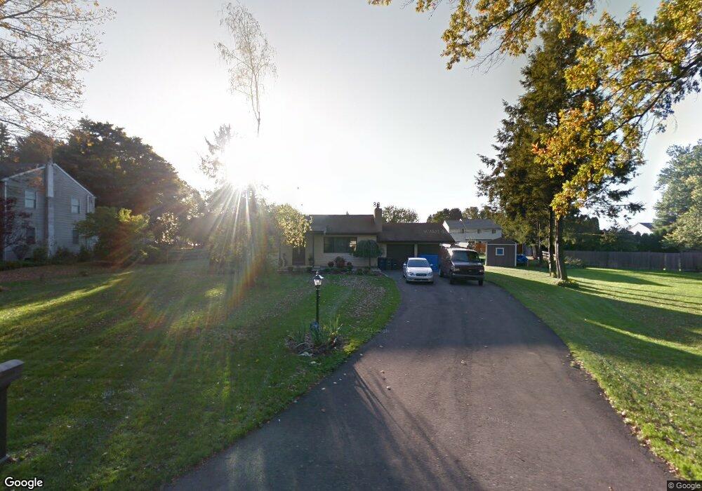
260 Doris Ave Southampton, PA 18966
Estimated Value: $476,000 - $660,000
3
Beds
2
Baths
1,868
Sq Ft
$317/Sq Ft
Est. Value
About This Home
This home is located at 260 Doris Ave, Southampton, PA 18966 and is currently estimated at $592,197, approximately $317 per square foot. 260 Doris Ave is a home located in Bucks County with nearby schools including Rolling Hills Elementary School, Richboro Middle School, and Council Rock High School - South.
Ownership History
Date
Name
Owned For
Owner Type
Purchase Details
Closed on
Dec 29, 2020
Sold by
Belyavsky Dmitry and Perevertaylova Nandezada
Bought by
Belyavsky Dmitry and Belyavsky Nadya
Current Estimated Value
Home Financials for this Owner
Home Financials are based on the most recent Mortgage that was taken out on this home.
Original Mortgage
$160,000
Outstanding Balance
$116,962
Interest Rate
2.7%
Mortgage Type
New Conventional
Estimated Equity
$475,235
Purchase Details
Closed on
Jun 28, 2011
Sold by
Federal Home Loan Mortgage Corporation
Bought by
Beliavskii Dmitrii and Perevertaylova Nadezda
Home Financials for this Owner
Home Financials are based on the most recent Mortgage that was taken out on this home.
Original Mortgage
$180,000
Interest Rate
4.51%
Mortgage Type
New Conventional
Purchase Details
Closed on
Sep 15, 2010
Sold by
Garlick Thomas
Bought by
Federal Home Loan Mortgage Corp
Create a Home Valuation Report for This Property
The Home Valuation Report is an in-depth analysis detailing your home's value as well as a comparison with similar homes in the area
Home Values in the Area
Average Home Value in this Area
Purchase History
| Date | Buyer | Sale Price | Title Company |
|---|---|---|---|
| Belyavsky Dmitry | -- | Global Abstract & Stlmts Svc | |
| Beliavskii Dmitrii | $255,000 | None Available | |
| Federal Home Loan Mortgage Corp | $947 | None Available |
Source: Public Records
Mortgage History
| Date | Status | Borrower | Loan Amount |
|---|---|---|---|
| Open | Belyavsky Dmitry | $160,000 | |
| Closed | Beliavskii Dmitrii | $180,000 |
Source: Public Records
Tax History Compared to Growth
Tax History
| Year | Tax Paid | Tax Assessment Tax Assessment Total Assessment is a certain percentage of the fair market value that is determined by local assessors to be the total taxable value of land and additions on the property. | Land | Improvement |
|---|---|---|---|---|
| 2025 | $5,701 | $29,600 | $6,600 | $23,000 |
| 2024 | $5,701 | $29,600 | $6,600 | $23,000 |
| 2023 | $5,373 | $29,600 | $6,600 | $23,000 |
| 2022 | $5,324 | $29,600 | $6,600 | $23,000 |
| 2021 | $5,156 | $29,600 | $6,600 | $23,000 |
| 2020 | $5,040 | $29,600 | $6,600 | $23,000 |
| 2019 | $4,824 | $29,600 | $6,600 | $23,000 |
| 2018 | $4,738 | $29,600 | $6,600 | $23,000 |
| 2017 | $4,555 | $29,600 | $6,600 | $23,000 |
| 2016 | $4,555 | $29,600 | $6,600 | $23,000 |
| 2015 | -- | $29,600 | $6,600 | $23,000 |
| 2014 | -- | $29,600 | $6,600 | $23,000 |
Source: Public Records
Map
Nearby Homes
- 2010 Barry Ct Unit 743B
- 4016 Barry Ct Unit 736B
- 151 Knox Ct
- 105 Hopkins Ct Unit 744A
- 1206 Barry Ct Unit 717A
- 6 Springwood Place
- 327 Hale Dr Unit 801A
- 302 Independence Dr
- 139 Heather Valley Rd
- 21019 Bennett Place Unit 7
- 7 Bennett Place
- 19 Seton Hill Ct
- 102 Keenan Ln
- 24010 Beacon Hill Dr
- 2604 Beacon Hill Dr Unit 2
- 80 Hershey Ct
- 281 E Village Rd
- 157 Sunbury Ct Unit 79
- 9017 Heritage Place Unit 9
- 13 S Lancaster Ln
- 252 Doris Ave
- 268 Doris Ave
- 132 Independence Dr
- 128 Independence Dr
- 136 Independence Dr
- 244 Doris Ave
- 267 Doris Ave
- 243 Doris Ave
- 140 Independence Dr
- 276 Doris Ave
- 287 Doris Ave
- 124 Independence Dr
- 236 Doris Ave
- 284 Doris Ave
- 271 Hudson Ct
- 144 Independence Dr
- 270 Clinton Ct
- 272 Hudson Ct
- 120 Independence Dr
- 288 Hudson Ct