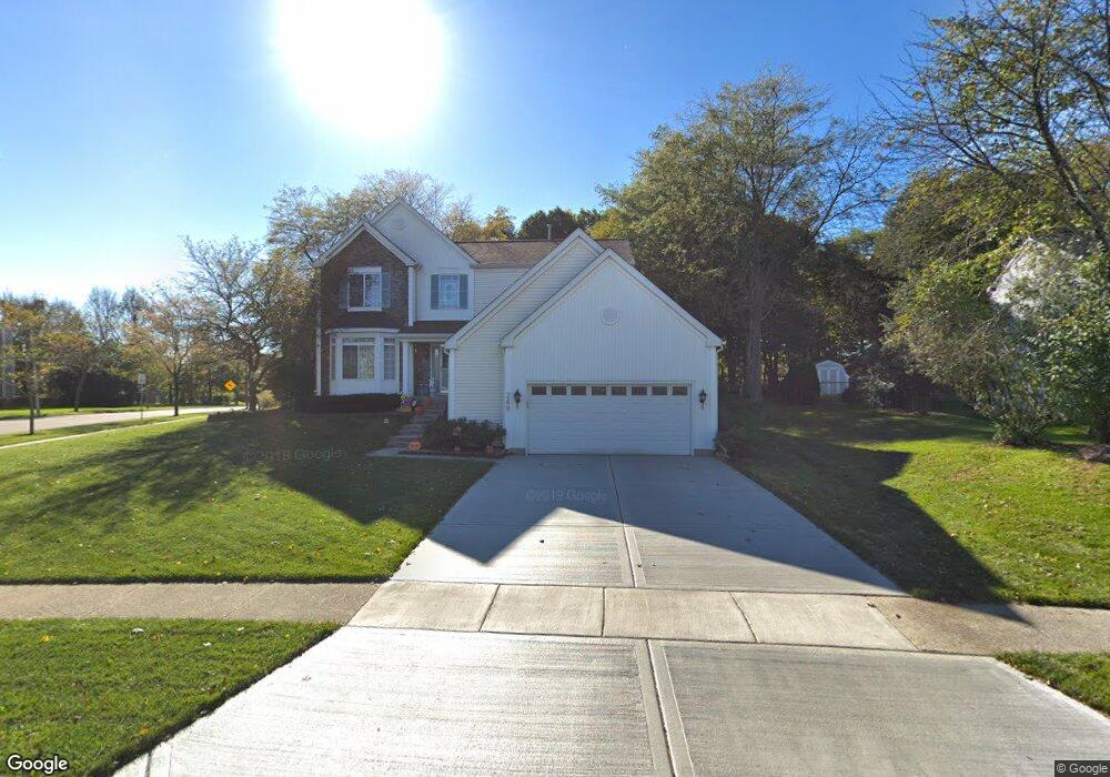
260 Lake Dr S Algonquin, IL 60102
Estimated Value: $423,819 - $481,000
4
Beds
3
Baths
2,302
Sq Ft
$197/Sq Ft
Est. Value
About This Home
This home is located at 260 Lake Dr S, Algonquin, IL 60102 and is currently estimated at $452,705, approximately $196 per square foot. 260 Lake Dr S is a home located in McHenry County with nearby schools including Westfield Community School, United Junior High School, and Harry D Jacobs High School.
Ownership History
Date
Name
Owned For
Owner Type
Purchase Details
Closed on
Aug 31, 1995
Sold by
Pulte Home Corp
Bought by
Hetherington Robert A and Hetherington Linda K
Current Estimated Value
Home Financials for this Owner
Home Financials are based on the most recent Mortgage that was taken out on this home.
Original Mortgage
$153,050
Interest Rate
7.76%
Create a Home Valuation Report for This Property
The Home Valuation Report is an in-depth analysis detailing your home's value as well as a comparison with similar homes in the area
Home Values in the Area
Average Home Value in this Area
Purchase History
| Date | Buyer | Sale Price | Title Company |
|---|---|---|---|
| Hetherington Robert A | $219,000 | Intercounty Title |
Source: Public Records
Mortgage History
| Date | Status | Borrower | Loan Amount |
|---|---|---|---|
| Closed | Hetherington Robert A | $153,050 |
Source: Public Records
Tax History Compared to Growth
Tax History
| Year | Tax Paid | Tax Assessment Tax Assessment Total Assessment is a certain percentage of the fair market value that is determined by local assessors to be the total taxable value of land and additions on the property. | Land | Improvement |
|---|---|---|---|---|
| 2024 | $9,636 | $131,186 | $27,803 | $103,383 |
| 2023 | $9,152 | $117,329 | $24,866 | $92,463 |
| 2022 | $8,540 | $105,579 | $29,652 | $75,927 |
| 2021 | $8,195 | $98,359 | $27,624 | $70,735 |
| 2020 | $7,981 | $94,877 | $26,646 | $68,231 |
| 2019 | $7,787 | $90,808 | $25,503 | $65,305 |
| 2018 | $7,424 | $83,887 | $23,559 | $60,328 |
| 2017 | $7,272 | $79,027 | $22,194 | $56,833 |
| 2016 | $7,163 | $74,120 | $20,816 | $53,304 |
| 2013 | -- | $67,067 | $19,420 | $47,647 |
Source: Public Records
Map
Nearby Homes
- 305 Buckingham Dr
- 135 Arquilla Dr
- 1 Wander Way
- Lots 10 & 11 Ramble Rd
- 661 Majestic Dr
- 700 Fairfield Ln
- 113 Pheasant Trail
- 2248 Dawson Ln Unit 272
- 266 Grandview Ct
- 741 Regal Ln
- 2235 Dawson Ln
- 101 Oakleaf Rd
- 1820 Crofton Dr
- 16 Brian Ct
- LOT 3 Blackhawk Dr
- 1235 Fairmont Ct
- 541 Blackhawk Dr
- 909 Roger St
- 212 Village Creek Dr
- 807 Menominee Dr