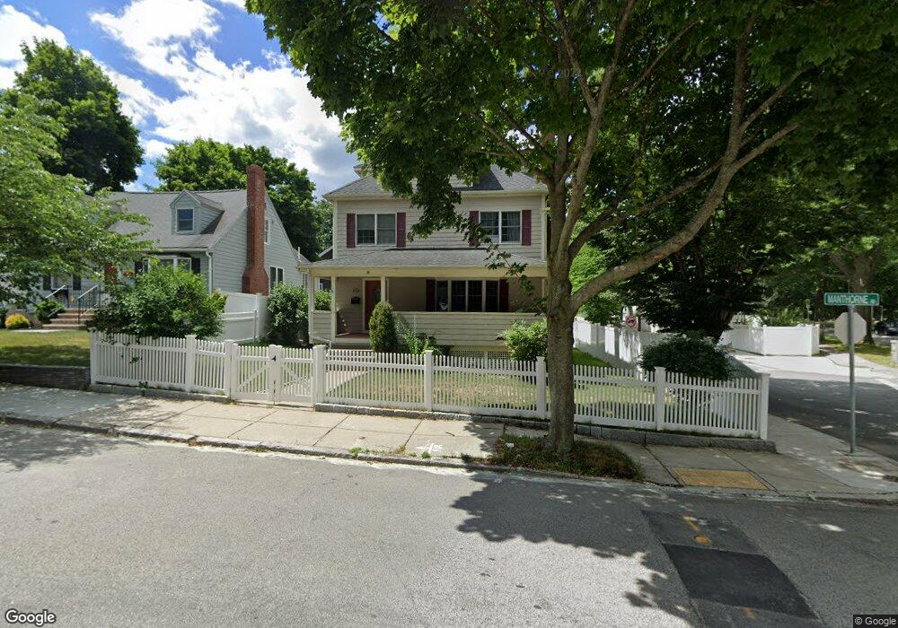
260 Manthorne Rd West Roxbury, MA 02132
West Roxbury NeighborhoodEstimated Value: $1,164,000 - $1,335,000
4
Beds
4
Baths
3,380
Sq Ft
$376/Sq Ft
Est. Value
About This Home
This home is located at 260 Manthorne Rd, West Roxbury, MA 02132 and is currently estimated at $1,269,658, approximately $375 per square foot. 260 Manthorne Rd is a home located in Suffolk County with nearby schools including Holy Name Parish School, St Theresa School, and Dexter School.
Ownership History
Date
Name
Owned For
Owner Type
Purchase Details
Closed on
Jan 9, 2019
Sold by
Ni Rain Y and Ni May J
Bought by
Rain and Rain Yi
Current Estimated Value
Purchase Details
Closed on
Feb 26, 2007
Sold by
Dateo Julie M and Dateo Robert W
Bought by
Ni May J and Ni Rain Y
Home Financials for this Owner
Home Financials are based on the most recent Mortgage that was taken out on this home.
Original Mortgage
$182,000
Interest Rate
6.23%
Mortgage Type
Purchase Money Mortgage
Create a Home Valuation Report for This Property
The Home Valuation Report is an in-depth analysis detailing your home's value as well as a comparison with similar homes in the area
Home Values in the Area
Average Home Value in this Area
Purchase History
| Date | Buyer | Sale Price | Title Company |
|---|---|---|---|
| Rain | -- | None Available | |
| Ni May J | $582,000 | -- |
Source: Public Records
Mortgage History
| Date | Status | Borrower | Loan Amount |
|---|---|---|---|
| Previous Owner | Ni May J | $182,000 |
Source: Public Records
Tax History Compared to Growth
Tax History
| Year | Tax Paid | Tax Assessment Tax Assessment Total Assessment is a certain percentage of the fair market value that is determined by local assessors to be the total taxable value of land and additions on the property. | Land | Improvement |
|---|---|---|---|---|
| 2025 | $13,169 | $1,137,200 | $219,400 | $917,800 |
| 2024 | $13,152 | $1,206,600 | $235,800 | $970,800 |
| 2023 | $12,222 | $1,138,000 | $222,400 | $915,600 |
| 2022 | $11,255 | $1,034,500 | $202,200 | $832,300 |
| 2021 | $10,497 | $983,800 | $194,400 | $789,400 |
| 2020 | $8,893 | $842,100 | $175,300 | $666,800 |
| 2019 | $8,293 | $786,800 | $145,700 | $641,100 |
| 2018 | $7,930 | $756,700 | $145,700 | $611,000 |
| 2017 | $7,932 | $749,000 | $145,700 | $603,300 |
| 2016 | $7,700 | $700,000 | $145,700 | $554,300 |
| 2015 | $8,045 | $664,300 | $156,600 | $507,700 |
| 2014 | $7,884 | $626,700 | $156,600 | $470,100 |
Source: Public Records
Map
Nearby Homes
- 168 Maple St
- 701 Vfw Pkwy
- 19 Pomfret St
- 37 Pomfret St
- 10 Burwell Rd
- 55 Redlands Rd
- 76 Vermont St
- 173 South St
- 1789 Centre St Unit 202
- 72 Wallis Rd
- 37 Hastings St Unit 103
- 143 South St
- 170 Payson Rd
- 50-56 Broadlawn Park Unit 221
- 23 Westgate Rd Unit 6
- 21 Westgate Rd Unit 6
- 42 Bryon Rd Unit 6
- 865 Lagrange St Unit 5
- 110 Park St Unit 3
- 139 Newfield St
- 256 Manthorne Rd
- 91 Garnet Rd
- 252 Manthorne Rd
- 87 Garnet Rd
- 83 Garnet Rd
- 560 Vfw Pkwy
- 248 Manthorne Rd
- 79 Garnet Rd
- 564 Vfw Pkwy
- 244 Manthorne Rd
- 530 Vfw Pkwy
- 530 Vfw Pkwy Unit 205
- 530 Vfw Pkwy Unit 105
- 530 Vfw Pkwy Unit 104
- 530 Vfw Pkwy Unit 204
- 530 Vfw Pkwy Unit 201
- 540 Vfw Pkwy Unit 6
- 540 Vfw Pkwy Unit 1
- 530 Vfw Pkwy Unit 207
- 530 Vfw Pkwy Unit 102