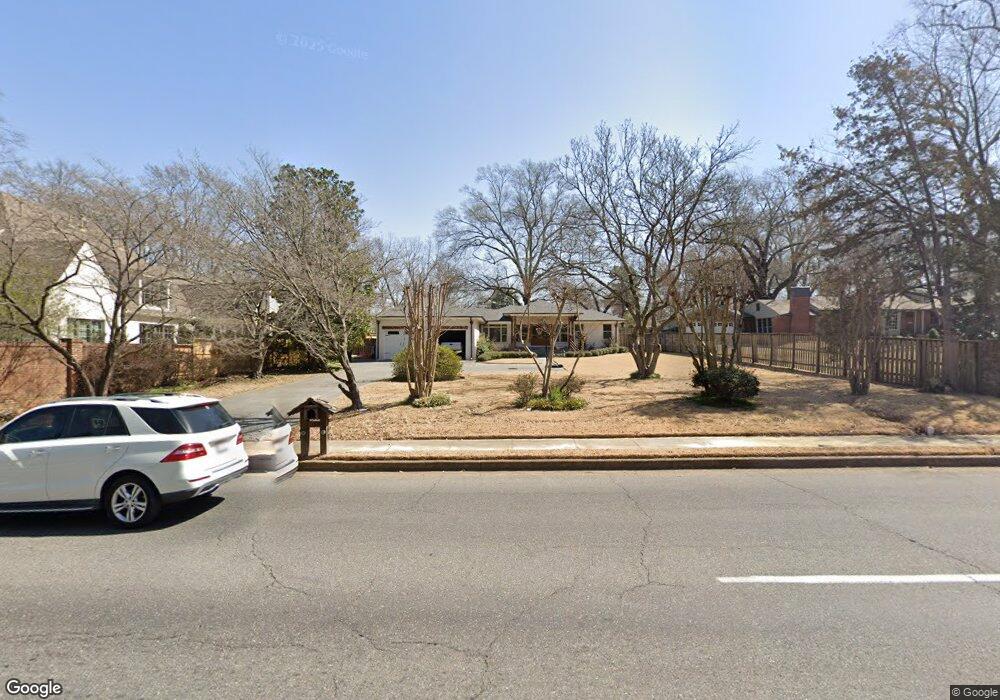
260 S Mendenhall Rd Memphis, TN 38117
Audubon Park NeighborhoodEstimated Value: $561,000 - $751,770
5
Beds
3
Baths
3,931
Sq Ft
$168/Sq Ft
Est. Value
About This Home
This home is located at 260 S Mendenhall Rd, Memphis, TN 38117 and is currently estimated at $661,443, approximately $168 per square foot. 260 S Mendenhall Rd is a home located in Shelby County with nearby schools including White Station Elementary School, White Station High, and White Station Middle.
Ownership History
Date
Name
Owned For
Owner Type
Purchase Details
Closed on
May 5, 2025
Sold by
Balkunas Kenneth G and Balkunas Heather R
Bought by
Ken Balkunas Companies Llc
Current Estimated Value
Purchase Details
Closed on
Sep 7, 2018
Sold by
Balkunas Heather R
Bought by
Balkunas Kenneth G
Purchase Details
Closed on
Aug 18, 2015
Sold by
Moore Frank
Bought by
Balkunas Heather R
Home Financials for this Owner
Home Financials are based on the most recent Mortgage that was taken out on this home.
Original Mortgage
$157,500
Interest Rate
4.09%
Mortgage Type
New Conventional
Purchase Details
Closed on
Aug 25, 2014
Sold by
Moore Frank
Bought by
Moore Frank and The Frank Benjamin Moore Living Trust
Create a Home Valuation Report for This Property
The Home Valuation Report is an in-depth analysis detailing your home's value as well as a comparison with similar homes in the area
Home Values in the Area
Average Home Value in this Area
Purchase History
| Date | Buyer | Sale Price | Title Company |
|---|---|---|---|
| Ken Balkunas Companies Llc | -- | None Listed On Document | |
| Balkunas Kenneth G | -- | None Available | |
| Balkunas Heather R | $225,000 | Attorney | |
| Moore Frank | -- | None Available |
Source: Public Records
Mortgage History
| Date | Status | Borrower | Loan Amount |
|---|---|---|---|
| Previous Owner | Balkunas Heather R | $157,500 |
Source: Public Records
Tax History Compared to Growth
Tax History
| Year | Tax Paid | Tax Assessment Tax Assessment Total Assessment is a certain percentage of the fair market value that is determined by local assessors to be the total taxable value of land and additions on the property. | Land | Improvement |
|---|---|---|---|---|
| 2025 | -- | $180,725 | $48,975 | $131,750 |
| 2024 | -- | $135,775 | $35,800 | $99,975 |
| 2023 | $8,271 | $135,775 | $35,800 | $99,975 |
| 2022 | $8,271 | $135,775 | $35,800 | $99,975 |
| 2021 | $8,368 | $135,775 | $35,800 | $99,975 |
| 2020 | $8,673 | $119,700 | $35,800 | $83,900 |
| 2019 | $3,826 | $119,700 | $35,800 | $83,900 |
| 2018 | $3,826 | $119,700 | $35,800 | $83,900 |
| 2017 | $2,117 | $64,725 | $35,800 | $28,925 |
| 2016 | $2,548 | $58,300 | $0 | $0 |
| 2014 | $2,548 | $58,300 | $0 | $0 |
Source: Public Records
Map
Nearby Homes
- 5094 Cole Rd
- 5055 Greenway Rd
- 5071 Anchor Cove
- 267 Barry Rd
- 264 Barry Rd
- 380 Greenway Place
- 4926 Greenway Ave
- 5157 S Angela Rd
- 4859 Gwynne Rd
- 4916 Greenway Ave
- 4903 Greenway Ave
- 65 Laverne Ln
- 50 Grove Creek Place
- 4948 Fairfield Cir
- 435 Fairfield Cir
- 476 W Racquet Club Place
- 478 W Racquet Club Place
- 5280 Cole Rd
- 5068 Walnut Grove Rd
- 5188 Gwynne Rd
- 5037 Shady Hall Ct
- 270 S Mendenhall Rd
- 5047 Shady Hall Ct
- 288 S Mendenhall Rd
- 265 Greenway Rd
- 5041 Shady Grove Rd
- 5047 Shady Grove Rd
- 253 Greenway Rd
- 5035 Shady Grove Rd
- 277 Greenway Rd
- 5055 Shady Grove Rd
- 257 S Mendenhall Rd
- 269 S Mendenhall Rd
- 289 Greenway Rd
- 245 S Mendenhall Rd
- 281 S Mendenhall Rd
- 5032 Cole Rd
- 5040 Cole Rd
- 5050 Cole Rd
- 5025 Shady Grove Rd