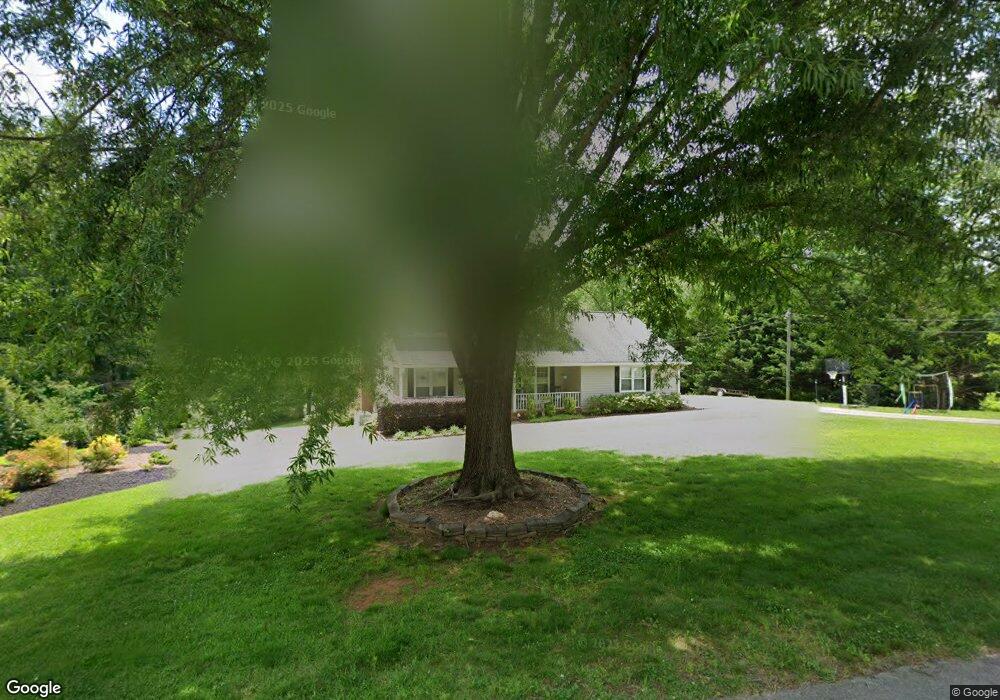
260 Wesley Cir Toccoa, GA 30577
Estimated Value: $320,000 - $481,000
4
Beds
3
Baths
2,152
Sq Ft
$175/Sq Ft
Est. Value
About This Home
This home is located at 260 Wesley Cir, Toccoa, GA 30577 and is currently estimated at $376,726, approximately $175 per square foot. 260 Wesley Cir is a home located in Stephens County with nearby schools including Stephens County High School.
Ownership History
Date
Name
Owned For
Owner Type
Purchase Details
Closed on
Dec 31, 2017
Sold by
Healy Timothy P
Bought by
King Derrick W
Current Estimated Value
Purchase Details
Closed on
Apr 24, 2008
Sold by
Not Provided
Bought by
King Derrick W and Whiten Meghan E
Home Financials for this Owner
Home Financials are based on the most recent Mortgage that was taken out on this home.
Original Mortgage
$143,863
Interest Rate
5.82%
Mortgage Type
FHA
Purchase Details
Closed on
Feb 5, 2008
Sold by
Not Provided
Bought by
King Derrick W and Whiten Meghan E
Home Financials for this Owner
Home Financials are based on the most recent Mortgage that was taken out on this home.
Original Mortgage
$143,863
Interest Rate
5.82%
Mortgage Type
FHA
Purchase Details
Closed on
Feb 25, 2003
Bought by
<Buyer Info Not Present>
Purchase Details
Closed on
Feb 14, 2000
Bought by
<Buyer Info Not Present>
Purchase Details
Closed on
Jan 1, 1998
Bought by
<Buyer Info Not Present>
Purchase Details
Closed on
Sep 1, 1989
Bought by
<Buyer Info Not Present>
Create a Home Valuation Report for This Property
The Home Valuation Report is an in-depth analysis detailing your home's value as well as a comparison with similar homes in the area
Home Values in the Area
Average Home Value in this Area
Purchase History
| Date | Buyer | Sale Price | Title Company |
|---|---|---|---|
| King Derrick W | -- | -- | |
| King Derrick W | $145,000 | -- | |
| King Derrick W | $145,000 | -- | |
| King Derrick W | $145,000 | -- | |
| King Derrick W | -- | -- | |
| <Buyer Info Not Present> | $156,100 | -- | |
| <Buyer Info Not Present> | $112,500 | -- | |
| <Buyer Info Not Present> | $93,000 | -- | |
| <Buyer Info Not Present> | $112,000 | -- |
Source: Public Records
Mortgage History
| Date | Status | Borrower | Loan Amount |
|---|---|---|---|
| Previous Owner | King Derrick W | $143,863 | |
| Previous Owner | King Derrick W | $143,863 |
Source: Public Records
Tax History Compared to Growth
Tax History
| Year | Tax Paid | Tax Assessment Tax Assessment Total Assessment is a certain percentage of the fair market value that is determined by local assessors to be the total taxable value of land and additions on the property. | Land | Improvement |
|---|---|---|---|---|
| 2024 | $2,453 | $70,518 | $5,283 | $65,235 |
| 2023 | $2,267 | $65,785 | $5,283 | $60,502 |
| 2022 | $1,800 | $62,460 | $5,283 | $57,177 |
| 2021 | $1,754 | $58,083 | $5,283 | $52,800 |
| 2020 | $1,767 | $57,948 | $5,283 | $52,665 |
| 2019 | $1,774 | $57,948 | $5,283 | $52,665 |
| 2018 | $1,762 | $57,579 | $5,283 | $52,296 |
| 2017 | $1,776 | $57,125 | $4,829 | $52,296 |
| 2016 | $1,748 | $57,124 | $4,828 | $52,296 |
| 2015 | $1,757 | $54,908 | $4,828 | $50,080 |
| 2014 | $1,786 | $54,909 | $4,829 | $50,080 |
| 2013 | -- | $55,481 | $5,401 | $50,080 |
Source: Public Records
Map
Nearby Homes
- 668 Brookdale Rd
- 0 E Currahee St Unit 10544607
- 297 Ayers Creek Dr
- 327 Ayers Creek Dr
- 405 Ayers Creek Dr
- 110 Valley Rd
- 919 Deer Chase Rd
- 151 Rock Creek Rd
- 139 Myrtle St
- 0 Brookhaven Cir Unit 10616964
- 148 Moreland Dr
- 3013 Hwy 17 A
- 54 Stonewood Forest Rd
- 0 Moreland Dr Unit 10565201
- 3089 Georgia 17 Alternate
- 1222 E Tugalo St
- 249 Hillcrest Dr
- 535 Deer Chase
- 593 Cross Creek Dr
- 5.10 ACRES Hwy 123
- 401 Wesley Cir
- 314 Wesley Cir
- 289 Wesley Cir
- 218 Wesley Cir
- 313 Wesley Cir Unit 16&17
- 313 Wesley Cir
- 239 Wesley Cir
- 275 Wesley Cir
- 267 Wesley Cir
- 215 Wesley Cir
- 198 Wesley Cir
- 207 Wesley Cir
- 424 Wesley Cir
- 0 Wesley Cir Unit 8700600
- 43 Wesley Cir
- 0 Wesley Cir Unit 8953637
- 0 Wesley Cir Unit 9049414
- 0 Wesley Cir Unit Lot 3 8818408
- 0 Wesley Cir Unit 3263196
- 0 Wesley Cir Unit 7026617