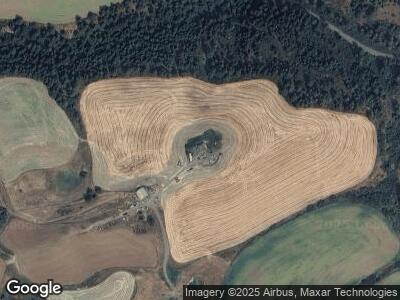
2600 Genesee Juliaetta Rd Genesee, ID 83832
Estimated Value: $481,000 - $693,544
--
Bed
--
Bath
--
Sq Ft
20
Acres
About This Home
This home is located at 2600 Genesee Juliaetta Rd, Genesee, ID 83832 and is currently estimated at $587,136. 2600 Genesee Juliaetta Rd is a home located in Latah County with nearby schools including Genesee School.
Ownership History
Date
Name
Owned For
Owner Type
Purchase Details
Closed on
Aug 20, 2009
Sold by
Stout Darrell L and Stout Kimberly M
Bought by
Stout Kimberly M and Stout Darrell L
Current Estimated Value
Home Financials for this Owner
Home Financials are based on the most recent Mortgage that was taken out on this home.
Original Mortgage
$269,000
Interest Rate
5.19%
Mortgage Type
New Conventional
Create a Home Valuation Report for This Property
The Home Valuation Report is an in-depth analysis detailing your home's value as well as a comparison with similar homes in the area
Home Values in the Area
Average Home Value in this Area
Purchase History
| Date | Buyer | Sale Price | Title Company |
|---|---|---|---|
| Stout Kimberly M | -- | -- |
Source: Public Records
Mortgage History
| Date | Status | Borrower | Loan Amount |
|---|---|---|---|
| Closed | Stout Darrell L | $50,000 | |
| Closed | Stout Darrel L | $330,000 | |
| Closed | Stout Darrell L | $55,000 | |
| Closed | Stout Darrell L | $334,006 | |
| Closed | Stout Darrell L | $0 | |
| Closed | Stout Darrell L | $311,000 | |
| Closed | Stout Darrell L | $62,000 | |
| Closed | Stout Darrell L | $0 | |
| Closed | Stout Darrell L | $68,000 | |
| Closed | Stout Darrell L | $62,000 | |
| Closed | Stout Darrell L | $62,000 | |
| Closed | Stout Darrell L | $0 | |
| Closed | Stout Kimberly M | $269,000 | |
| Closed | Stout Darrell L | $60,000 | |
| Closed | Stout Darrell L | $260,000 |
Source: Public Records
Tax History Compared to Growth
Tax History
| Year | Tax Paid | Tax Assessment Tax Assessment Total Assessment is a certain percentage of the fair market value that is determined by local assessors to be the total taxable value of land and additions on the property. | Land | Improvement |
|---|---|---|---|---|
| 2024 | $3,725 | $499,425 | $103,620 | $395,805 |
| 2023 | $3,122 | $448,377 | $92,744 | $355,633 |
| 2022 | $5,303 | $558,310 | $91,613 | $466,697 |
| 2021 | $5,306 | $395,541 | $58,813 | $336,728 |
| 2020 | $3,344 | $343,553 | $58,813 | $284,740 |
| 2019 | $5,050 | $440,528 | $58,813 | $381,715 |
| 2018 | $4,755 | $404,356 | $57,426 | $346,930 |
| 2017 | $3,805 | $377,436 | $57,265 | $320,171 |
| 2016 | $3,960 | $0 | $0 | $0 |
| 2014 | $3,645 | $369,347 | $55,203 | $314,144 |
Source: Public Records
Map
Nearby Homes
- 1100 Miller Rd
- 2037 S Grade Rd
- 305 3rd St
- 182 Main St
- 206 Water St
- 000 Old Hwy 95
- TBD Parkins Rd
- TBD Pebble Ln
- TBD McGary Grade Rd
- 18090 220 Rd S
- 526 Maple Ct
- 511 Maple Ct
- 331 E Walnut St Unit D
- 331 E Walnut St Unit A
- 331 E Walnut Ave Unit G
- 155 W Persimmon St
- 306 W Hazel Ave
- 652 W Walnut St
- 732 W Walnut Ave
- 1001 Katnook Ln
