Estimated Value: $945,000 - $8,764,000
4
Beds
2
Baths
1,472
Sq Ft
$4,541/Sq Ft
Est. Value
About This Home
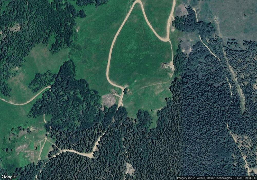
This home is located at 2600 Little Annie Rd, Aspen, CO 81612 and is currently estimated at $6,684,393, approximately $4,541 per square foot. 2600 Little Annie Rd is a home located in Pitkin County with nearby schools including Aspen Elementary School, Aspen Middle School, and Aspen High School.
Ownership History
Date
Name
Owned For
Owner Type
Purchase Details
Closed on
Apr 17, 2025
Sold by
Ba Colorado Lp
Bought by
2750 Little Annie Llc
Current Estimated Value
Purchase Details
Closed on
Mar 15, 2022
Sold by
Daniel Bunta
Bought by
Ba Colorado Lp
Purchase Details
Closed on
May 30, 2006
Sold by
Castle Creek Investors Inc
Bought by
Bunta Daniel and Manning Mary
Home Financials for this Owner
Home Financials are based on the most recent Mortgage that was taken out on this home.
Original Mortgage
$530,000
Interest Rate
6.5%
Mortgage Type
Purchase Money Mortgage
Create a Home Valuation Report for This Property
The Home Valuation Report is an in-depth analysis detailing your home's value as well as a comparison with similar homes in the area
Home Values in the Area
Average Home Value in this Area
Purchase History
| Date | Buyer | Sale Price | Title Company |
|---|---|---|---|
| 2750 Little Annie Llc | $8,300,000 | None Listed On Document | |
| Ba Colorado Lp | $7,900,000 | Land Title | |
| Bunta Daniel | $600,000 | None Available |
Source: Public Records
Mortgage History
| Date | Status | Borrower | Loan Amount |
|---|---|---|---|
| Previous Owner | Bunta Daniel | $530,000 |
Source: Public Records
Tax History Compared to Growth
Tax History
| Year | Tax Paid | Tax Assessment Tax Assessment Total Assessment is a certain percentage of the fair market value that is determined by local assessors to be the total taxable value of land and additions on the property. | Land | Improvement |
|---|---|---|---|---|
| 2024 | $13,577 | $517,150 | $232,840 | $284,310 |
| 2023 | $13,577 | $524,860 | $236,310 | $288,550 |
| 2022 | $2,433 | $83,890 | $52,130 | $31,760 |
| 2021 | $2,420 | $86,310 | $53,630 | $32,680 |
| 2020 | $2,324 | $82,770 | $42,900 | $39,870 |
| 2019 | $2,324 | $82,770 | $42,900 | $39,870 |
| 2018 | $2,206 | $83,350 | $43,200 | $40,150 |
| 2017 | $1,790 | $70,960 | $43,200 | $27,760 |
| 2016 | $1,671 | $64,990 | $39,800 | $25,190 |
| 2015 | $1,127 | $44,120 | $39,800 | $4,320 |
| 2014 | $946 | $36,220 | $31,840 | $4,380 |
Source: Public Records
Map
Nearby Homes
- 88 Lower Hurricane Rd
- 143 Conundrum Creek Rd
- 6770 Castle Creek Rd
- 285 Conundrum
- 255 Conundrum Creek Rd
- 10 Little Highlands Way
- 2601 Midnight Mine Rd
- 800 S Hayden Rd
- 42703 Hwy 82 Unit B
- 9 & 17 Ullr Way
- 195 N Hayden Rd
- 44481 Highway 82
- 335 Hall Dr
- 161 Stillwater Ln
- 9555 Castle Creek Rd
- 1271 S Ute Ave
- 9676 Castle Creek Rd
- 1011 Ute Ave
- 10 Ute Place
- 901 S Ute Ave
- 2600 Little Annie Rd
- 70 Eaglemont Dr
- 2750 Little Annie Rd
- 0150 Hurricane Rd
- 2600 Little Annie Rd
- 2520 Little Annie Rd
- 3100 Little Annie Rd
- TBD Little Annie Rd
- 500 Eaglemont Dr
- 00-Tbd Upper Hurricane Rd
- 0100 Upper Hurricane Rd
- 1221 Richmond Hill Rd
- 600 Eaglemont Dr
- 4084 Midnight Mine Rd
- 2500 Little Annie Rd
- 2222 McLain Flats Rd
- 3590 Midnight Mine Rd
- 150 Lower Hurricane Rd
- 4100 Midnight Mine Rd
- 4150 Midnight Mine Rd
