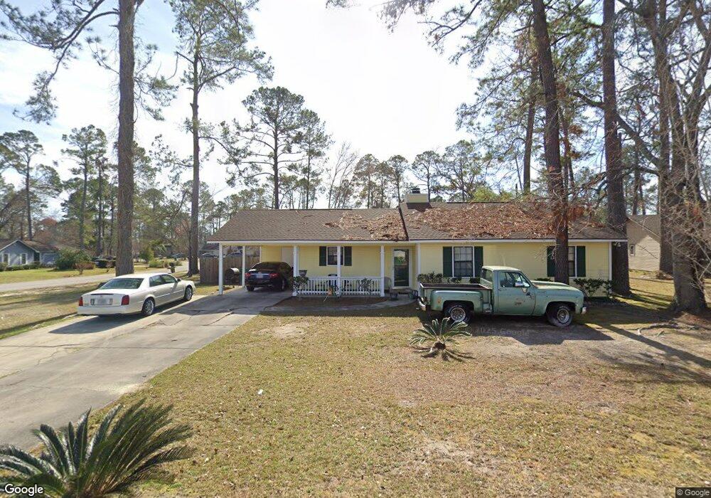
2600 Lowndes Dr Valdosta, GA 31602
Estimated Value: $155,342 - $179,000
3
Beds
2
Baths
1,236
Sq Ft
$138/Sq Ft
Est. Value
About This Home
This home is located at 2600 Lowndes Dr, Valdosta, GA 31602 and is currently estimated at $170,086, approximately $137 per square foot. 2600 Lowndes Dr is a home located in Lowndes County with nearby schools including W.G. Nunn Elementary School, Newbern Middle School, and Valdosta High School.
Ownership History
Date
Name
Owned For
Owner Type
Purchase Details
Closed on
Feb 16, 2005
Sold by
Dyal Wayne J
Bought by
Horton Naomi D
Current Estimated Value
Home Financials for this Owner
Home Financials are based on the most recent Mortgage that was taken out on this home.
Original Mortgage
$85,000
Outstanding Balance
$43,034
Interest Rate
5.69%
Mortgage Type
New Conventional
Estimated Equity
$127,052
Purchase Details
Closed on
Nov 12, 1999
Sold by
Marshall Kenneth L
Bought by
Dyal Wayne J and Dyal Tracy
Purchase Details
Closed on
Mar 31, 1994
Bought by
Marshall Kenneth L
Purchase Details
Closed on
Apr 1, 1992
Bought by
Sinele Lane D
Purchase Details
Closed on
Dec 13, 1984
Bought by
Powell John G and Powell Cindy
Purchase Details
Closed on
Oct 9, 1984
Bought by
Rowan Richard N
Create a Home Valuation Report for This Property
The Home Valuation Report is an in-depth analysis detailing your home's value as well as a comparison with similar homes in the area
Home Values in the Area
Average Home Value in this Area
Purchase History
| Date | Buyer | Sale Price | Title Company |
|---|---|---|---|
| Horton Naomi D | $85,000 | -- | |
| Dyal Wayne J | $72,900 | -- | |
| Marshall Kenneth L | $63,500 | -- | |
| Sinele Lane D | $59,600 | -- | |
| Powell John G | $55,000 | -- | |
| Rowan Richard N | $9,800 | -- |
Source: Public Records
Mortgage History
| Date | Status | Borrower | Loan Amount |
|---|---|---|---|
| Open | Horton Naomi D | $85,000 |
Source: Public Records
Tax History Compared to Growth
Tax History
| Year | Tax Paid | Tax Assessment Tax Assessment Total Assessment is a certain percentage of the fair market value that is determined by local assessors to be the total taxable value of land and additions on the property. | Land | Improvement |
|---|---|---|---|---|
| 2024 | $1,281 | $51,859 | $5,000 | $46,859 |
| 2023 | $1,281 | $51,859 | $5,000 | $46,859 |
| 2022 | $779 | $29,050 | $5,000 | $24,050 |
| 2021 | $801 | $29,050 | $5,000 | $24,050 |
| 2020 | $819 | $29,050 | $5,000 | $24,050 |
| 2019 | $818 | $29,050 | $5,000 | $24,050 |
| 2018 | $923 | $31,674 | $5,000 | $26,674 |
| 2017 | $930 | $31,674 | $5,000 | $26,674 |
| 2016 | $928 | $31,674 | $5,000 | $26,674 |
| 2015 | $858 | $31,849 | $5,000 | $26,849 |
| 2014 | $873 | $31,849 | $5,000 | $26,849 |
Source: Public Records
Map
Nearby Homes
- 2400 Lowndes Dr
- 2320 Barack Obama Blvd
- 2713 Pineview Dr Unit A&B
- 2311 Lowndes Dr
- 2310 Barack Obama Blvd
- 1642 Lexington Cir
- 1724 Eli Place
- 1507 Leone Ave
- 1739 Eli Place
- 1703 Leone Ave
- 1763 Eli Place
- 1703 Largo Cir
- 2414 Deborah Dr
- 1647 Fresno St
- 1761 Hyssop Crossing
- 1852 Chestnut Dr
- 1 Pomona Cir
- 2435 Muscogee Dr
- 2202 Deborah Dr
- 2517 Deborah Dr
- 2318 Glynn Cir
- 2602 Lowndes Dr
- 2601 Lowndes Dr
- 2316 Glynn Cir
- 2502 Lowndes Dr
- 2603 Lowndes Dr
- 2507 Lowndes Dr
- 2315 Glynn Cir
- 2604 Lowndes Dr
- 2505 Lowndes Dr
- 2314 Glynn Cir
- 2605 Lowndes Dr
- 2607 Banks Cir
- 2605 Banks Cir
- 2313 Glynn Cir
- 2609 Banks Cir
- 2606 Lowndes Dr
- 2320 Chattooga Dr
- 2503 Lowndes Dr
- 2322 Chattooga Dr