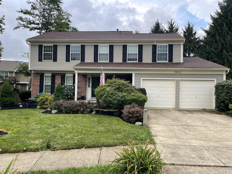

2600 Pennbrook Ct Hilliard, OH 43026
Cross Creek NeighborhoodEstimated payment $3,180/month
Highlights
- Deck
- Heated Sun or Florida Room
- Cul-De-Sac
- Traditional Architecture
- No HOA
- 2 Car Attached Garage
About This Home
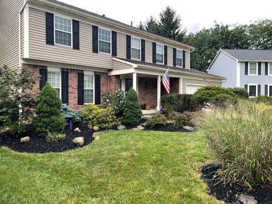
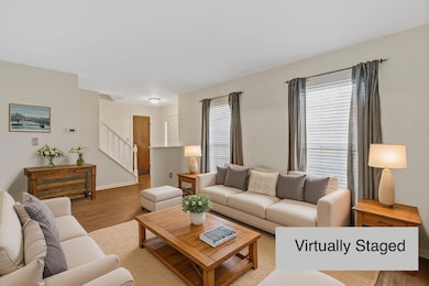
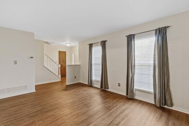
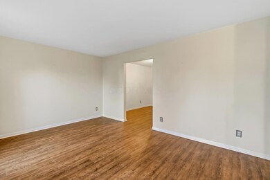
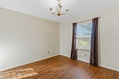
Nestled on a quiet cul-de-sac in the highly desirable Brookfield Village is one of the largest homes in Brookfield Village listed at one of the lowest price per sq ft homes. This home offers over 2,200 square feet of living space, plus a 4 season room and approximately 500 additional square feet in the partially finished lower level. Step inside to find an updated kitchen featuring granite countertops, a custom tile backsplash, and modern appliances—perfect for everyday living and entertaining alike. The open floor plan connects the kitchen to the living room, eat-in space, dining room, and spacious family room, creating an inviting flow throughout the main level. This home features 4 bedrooms and 2.5 baths, including generous closet space and new carpet in all bedrooms. The main level and lower level laundry areas add convenience and flexibility for busy households. The four-season room, complete with a cozy gas stove, can heat much of the home when the adjoining doors are open—perfect for year-round comfort and enjoyment. Step outside to enjoy a deck, new landscaping, and a rain barrel to support eco-friendly gardening. The attached two-car garage and full basement with epoxy floors (partially finished with a recreation room) offer plenty of storage and bonus living space. This home truly has it all—space, comfort, and charm in a fantastic setting. Enjoy the community park, close proximity to shopping, and dining. Don't miss your chance to make this Brookfield Village gem your new home! New battery back up sump pump. Sold As Is!
Listing Agent
Howard Hanna Real Estate Serv License #406627 Listed on: 11/13/2025
Home Details
Home Type
- Single Family
Est. Annual Taxes
- $9,886
Year Built
- Built in 1987
Lot Details
- 8,276 Sq Ft Lot
- Cul-De-Sac
Parking
- 2 Car Attached Garage
Home Design
- Traditional Architecture
- Brick Exterior Construction
- Block Foundation
- Vinyl Siding
Interior Spaces
- 2,706 Sq Ft Home
- 2-Story Property
- Insulated Windows
- Family Room
- Dining Room
- Heated Sun or Florida Room
- Laundry on lower level
Kitchen
- Eat-In Kitchen
- Gas Range
- Microwave
- Dishwasher
Flooring
- Carpet
- Laminate
Bedrooms and Bathrooms
- 4 Bedrooms
Basement
- Basement Fills Entire Space Under The House
- Recreation or Family Area in Basement
Additional Features
- Deck
- Forced Air Heating and Cooling System
Listing and Financial Details
- Assessor Parcel Number 050-003682
Community Details
Overview
- No Home Owners Association
Recreation
- Park
Map
Home Values in the Area
Average Home Value in this Area
Tax History
| Year | Tax Paid | Tax Assessment Tax Assessment Total Assessment is a certain percentage of the fair market value that is determined by local assessors to be the total taxable value of land and additions on the property. | Land | Improvement |
|---|---|---|---|---|
| 2025 | $9,915 | $145,050 | $40,430 | $104,620 |
| 2024 | $9,915 | $145,050 | $40,430 | $104,620 |
| 2023 | $7,911 | $145,050 | $40,430 | $104,620 |
| 2022 | $7,054 | $102,940 | $15,750 | $87,190 |
| 2021 | $7,050 | $102,940 | $15,750 | $87,190 |
| 2020 | $7,032 | $102,940 | $15,750 | $87,190 |
| 2019 | $6,577 | $81,940 | $12,600 | $69,340 |
| 2018 | $6,241 | $81,940 | $12,600 | $69,340 |
| 2017 | $6,337 | $81,940 | $12,600 | $69,340 |
| 2016 | $6,120 | $70,850 | $13,690 | $57,160 |
| 2015 | $5,780 | $70,850 | $13,690 | $57,160 |
| 2014 | $5,790 | $70,850 | $13,690 | $57,160 |
| 2013 | $2,797 | $67,445 | $13,020 | $54,425 |
Property History
| Date | Event | Price | List to Sale | Price per Sq Ft |
|---|---|---|---|---|
| 02/17/2026 02/17/26 | Price Changed | $440,900 | -0.9% | $163 / Sq Ft |
| 01/30/2026 01/30/26 | Price Changed | $444,900 | -1.1% | $164 / Sq Ft |
| 11/13/2025 11/13/25 | For Sale | $450,000 | -- | $166 / Sq Ft |
Purchase History
| Date | Type | Sale Price | Title Company |
|---|---|---|---|
| Warranty Deed | -- | None Available | |
| Interfamily Deed Transfer | -- | None Available | |
| Survivorship Deed | $229,000 | Talon Group | |
| Deed | -- | -- | |
| Deed | $104,700 | -- |
Mortgage History
| Date | Status | Loan Amount | Loan Type |
|---|---|---|---|
| Previous Owner | $183,200 | Purchase Money Mortgage |
Source: Columbus and Central Ohio Regional MLS
MLS Number: 225042888
APN: 050-003682
Disclaimer: Certain information contained herein is derived from information provided by parties other than Homes.com. All information provided is deemed reliable, but is not guaranteed to be accurate and should be independently verified.
![]() IDX information is provided exclusively for personal, non-commercial use, and may not be used for any purpose other than to identify prospective properties consumers may be interested in purchasing.
IDX information is provided exclusively for personal, non-commercial use, and may not be used for any purpose other than to identify prospective properties consumers may be interested in purchasing.
Information is deemed reliable but not guaranteed.
- 2571 Rustling Oak Blvd
- 5570 Oldwynne Rd
- 5521 Mirage Dr
- 2592 Cowall Dr
- 2968 Brookmont Ct
- 2967 Brookmont Ct
- 5483 Thorney Dr
- 5358 Beringer Dr
- 5708 Saucony Dr
- 5931 Heritage Farms Dr
- 0 Hilliard Rome Rd Unit 225040295
- 3045 Bohlen Dr
- 2477 Crystal Springs Dr
- 2458 Crystal Springs Dr Unit 2458
- 2772 Quailview Ln
- 5176 Skytrail Dr
- 5288 Hyde Park Dr
- 5380 Carjan Way
- 5503 Nike Dr
- 5138 Roberts Rd
- 2767 Hickory Mill Dr
- 2640 Lakebridge Ln
- 5535 Cabot Cove Dr
- 2332 Asics Rd
- 5300 Catalina Circle Dr
- 5763 Coldcreek Dr
- 5823 Coldcreek Dr
- 2131 Ripple Rd
- 5016 Scalton Place
- 5800 Brinkwater Blvd
- 1980 Dry Wash Rd
- 5073 Singleton Dr
- 2485 Hilliard Park Blvd
- 1999 Jasper Ln
- 5350 Jasmine Ln
- 5216 Frisco Dr
- 5702 Mango Ln
- 6373 Meadows Way
- 2075 Arway Dr
- 2581 Walcutt Rd

Ask me questions while you tour the home.