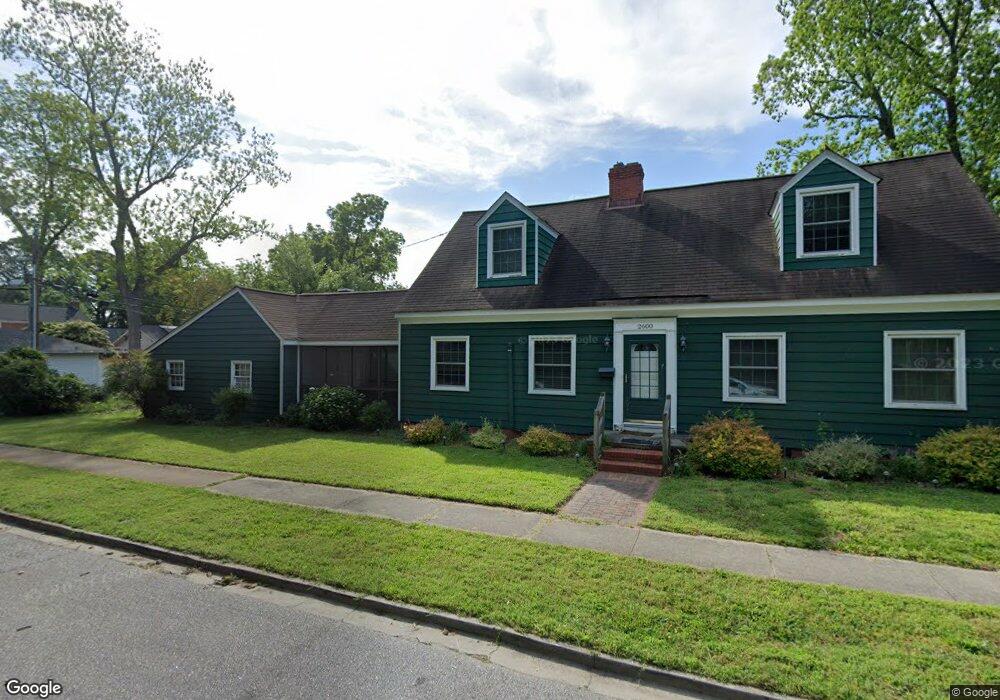
2600 Secota Dr Hampton, VA 23661
Wythe NeighborhoodEstimated Value: $297,000 - $375,000
5
Beds
2
Baths
2,055
Sq Ft
$166/Sq Ft
Est. Value
About This Home
This home is located at 2600 Secota Dr, Hampton, VA 23661 and is currently estimated at $340,119, approximately $165 per square foot. 2600 Secota Dr is a home located in Hampton City with nearby schools including Hunter B. Andrews PK-8 School, C. Alton Lindsay Middle School, and Hampton High School.
Ownership History
Date
Name
Owned For
Owner Type
Purchase Details
Closed on
May 24, 2010
Sold by
Walton Rosemary R
Bought by
Morales David N
Current Estimated Value
Home Financials for this Owner
Home Financials are based on the most recent Mortgage that was taken out on this home.
Original Mortgage
$188,000
Outstanding Balance
$126,379
Interest Rate
5.11%
Mortgage Type
New Conventional
Estimated Equity
$213,740
Create a Home Valuation Report for This Property
The Home Valuation Report is an in-depth analysis detailing your home's value as well as a comparison with similar homes in the area
Home Values in the Area
Average Home Value in this Area
Purchase History
| Date | Buyer | Sale Price | Title Company |
|---|---|---|---|
| Morales David N | $235,000 | -- |
Source: Public Records
Mortgage History
| Date | Status | Borrower | Loan Amount |
|---|---|---|---|
| Open | Morales David N | $188,000 |
Source: Public Records
Tax History
| Year | Tax Paid | Tax Assessment Tax Assessment Total Assessment is a certain percentage of the fair market value that is determined by local assessors to be the total taxable value of land and additions on the property. | Land | Improvement |
|---|---|---|---|---|
| 2025 | $3,734 | $323,500 | $78,200 | $245,300 |
| 2024 | $3,483 | $302,900 | $78,200 | $224,700 |
| 2023 | $3,286 | $283,300 | $73,600 | $209,700 |
| 2022 | $3,251 | $275,500 | $69,000 | $206,500 |
| 2021 | $3,090 | $238,700 | $57,500 | $181,200 |
| 2020 | $2,879 | $232,200 | $55,200 | $177,000 |
| 2019 | $2,854 | $230,200 | $55,200 | $175,000 |
| 2018 | $2,606 | $205,200 | $55,200 | $150,000 |
| 2017 | $2,638 | $0 | $0 | $0 |
| 2016 | $2,638 | $205,200 | $0 | $0 |
| 2015 | $2,574 | $0 | $0 | $0 |
| 2014 | $2,564 | $200,000 | $45,100 | $154,900 |
Source: Public Records
Map
Nearby Homes
- 135 Pochin Place
- 140 Powhatan Pkwy
- 2915 Chesapeake Ave
- 238 Pochin Place
- 254 Pocahontas Place
- 222 Wythe Pkwy
- 2416 Victoria Blvd
- 138 Hampton Roads Ave
- 216 Manteo Ave
- 1913 Bay Ave
- 512 Pocahontas Place
- 115 Piedmont Ave
- 114 Clifton St
- 607 Pocahontas Place
- 614 Rolfe St
- 1705 Shell Rd
- 218 Alleghany Rd
- 1714 Victoria Blvd
- 403 Darnaby Ave
- 620 Celey St
- 122 Powhatan Pkwy
- 128 Powhatan Pkwy
- 120 Powhatan Pkwy
- 127 Pochin Place
- 125 Pochin Place
- 130 Powhatan Pkwy
- 123 Pochin Place
- 129 Pochin Place
- 121 Pochin Place
- 132 Powhatan Pkwy
- 125 Powhatan Pkwy
- 123 Powhatan Pkwy
- 116 Powhatan Pkwy
- 119 Pochin Place
- 121 Powhatan Pkwy
- 131 Pochin Place
- 134 Powhatan Pkwy
- 119 Powhatan Pkwy
- 131 Powhatan Pkwy
- 114 Powhatan Pkwy
Your Personal Tour Guide
Ask me questions while you tour the home.