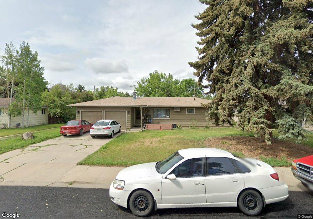
2602 Cedar Dr Loveland, CO 80538
Estimated Value: $398,731 - $417,000
3
Beds
2
Baths
1,152
Sq Ft
$354/Sq Ft
Est. Value
About This Home
This home is located at 2602 Cedar Dr, Loveland, CO 80538 and is currently estimated at $407,933, approximately $354 per square foot. 2602 Cedar Dr is a home located in Larimer County with nearby schools including Lincoln Elementary School, Lucile Erwin Middle School, and Loveland High School.
Ownership History
Date
Name
Owned For
Owner Type
Purchase Details
Closed on
Feb 22, 2002
Sold by
Vance Catherine L
Bought by
Vance William L and Vance Catherine L
Current Estimated Value
Home Financials for this Owner
Home Financials are based on the most recent Mortgage that was taken out on this home.
Original Mortgage
$124,000
Outstanding Balance
$51,236
Interest Rate
7.05%
Estimated Equity
$356,697
Purchase Details
Closed on
Mar 15, 1999
Sold by
Ward Shirley A
Bought by
Vance Catherine L
Purchase Details
Closed on
Mar 3, 1999
Sold by
Ward Shirley A and Bledsoe Lisa K
Bought by
Ward Shirley A
Purchase Details
Closed on
Aug 26, 1998
Sold by
Ward Shirley A
Bought by
Ward Shirley A and Bledsoe Lisa K
Create a Home Valuation Report for This Property
The Home Valuation Report is an in-depth analysis detailing your home's value as well as a comparison with similar homes in the area
Home Values in the Area
Average Home Value in this Area
Purchase History
| Date | Buyer | Sale Price | Title Company |
|---|---|---|---|
| Vance William L | -- | Security Title | |
| Vance Catherine L | $124,000 | -- | |
| Ward Shirley A | -- | -- | |
| Ward Shirley A | -- | -- |
Source: Public Records
Mortgage History
| Date | Status | Borrower | Loan Amount |
|---|---|---|---|
| Open | Vance William L | $124,000 |
Source: Public Records
Tax History Compared to Growth
Tax History
| Year | Tax Paid | Tax Assessment Tax Assessment Total Assessment is a certain percentage of the fair market value that is determined by local assessors to be the total taxable value of land and additions on the property. | Land | Improvement |
|---|---|---|---|---|
| 2025 | $1,913 | $27,651 | $2,680 | $24,971 |
| 2024 | $1,845 | $27,651 | $2,680 | $24,971 |
| 2022 | $1,657 | $20,822 | $2,780 | $18,042 |
| 2021 | $1,702 | $21,421 | $2,860 | $18,561 |
| 2020 | $1,596 | $20,070 | $2,860 | $17,210 |
| 2019 | $1,569 | $20,070 | $2,860 | $17,210 |
| 2018 | $1,288 | $15,646 | $2,880 | $12,766 |
| 2017 | $1,109 | $15,646 | $2,880 | $12,766 |
| 2016 | $1,065 | $14,527 | $3,184 | $11,343 |
| 2015 | $1,057 | $14,520 | $3,180 | $11,340 |
| 2014 | $838 | $11,140 | $3,180 | $7,960 |
Source: Public Records
Map
Nearby Homes
- 2609 Cedar Dr
- 2437 Mountain View Dr
- 2311 N Garfield Ave
- 367 Limber Place
- 3244 Hawthorn Dr
- 502 Honey Locust Dr
- 3110 N Franklin Ave
- 706 W 29th St
- 3321 Butternut Dr
- 3210 N Colorado Ave
- 1700 N Garfield Ave
- 3312 N Colorado Ave
- 3638 Butternut Dr Unit 7A
- 1612 N Cleveland Ave
- 6429 Union Creek Dr
- 6465 Union Creek Dr
- 957 Logan Ct
- 2562 Tupelo Dr
- 1534 Jackson Ave
- 3402 White Ash Ct