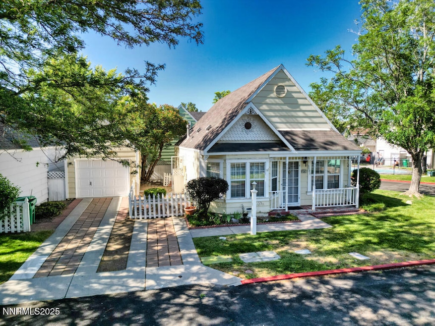
2602 Fanto Ct Unit 17 Sparks, NV 89431
Oddie Boulevard NeighborhoodEstimated payment $2,370/month
Highlights
- Private Pool
- Corner Lot
- Cul-De-Sac
- Loft
- High Ceiling
- Refrigerated Cooling System
About This Home
Cute 3 bedroom cottage, plus loft area with built in desk. This cottage is on a corner. Needs tender loving care. Seller is offering an allowance so that Buyer(s) can choose their own paint carpet and paint color. Summers are a delight, the association pool is across the street. The HOA covers exterior maintenance of the home, maintains the roof and does the front yard maintenance.
Home Details
Home Type
- Single Family
Est. Annual Taxes
- $1,405
Year Built
- Built in 1992
Lot Details
- 2,222 Sq Ft Lot
- Cul-De-Sac
- Partially Fenced Property
- Landscaped
- Corner Lot
- Level Lot
- Property is zoned MF-3/PUD
HOA Fees
- $515 Monthly HOA Fees
Parking
- 1 Car Garage
- Parking Available
- Common or Shared Parking
- Additional Parking
Home Design
- Slab Foundation
- Pitched Roof
- Shingle Roof
- Composition Roof
- Wood Siding
- Stick Built Home
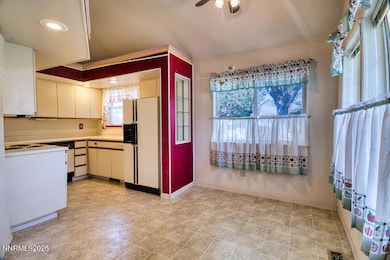
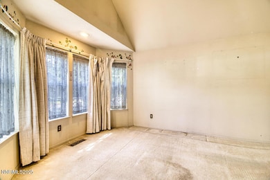
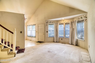
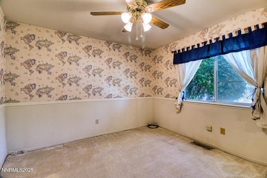
Interior Spaces
- 1,213 Sq Ft Home
- 2-Story Property
- High Ceiling
- Ceiling Fan
- Window Treatments
- Combination Kitchen and Dining Room
- Loft
- Carpet
Kitchen
- Built-In Oven
- Electric Cooktop
- Dishwasher
- Disposal
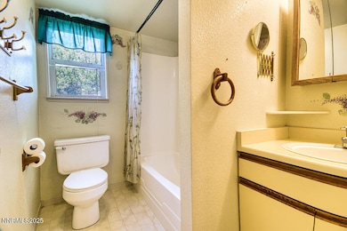
Bedrooms and Bathrooms
- 3 Bedrooms
- 2 Full Bathrooms
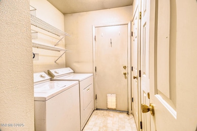
Laundry
- Laundry Room
- Dryer
- Washer
Outdoor Features
- Private Pool
- Patio
Schools
- Mathews Elementary School
- Traner Middle School
- Hug High School
Utilities
- Refrigerated Cooling System
- Central Air
- Heating System Uses Natural Gas
- Gas Water Heater
- Internet Available
- Phone Available
Listing and Financial Details
- Assessor Parcel Number 02637050
Community Details
Overview
- Association fees include ground maintenance, maintenance structure
- $250 HOA Transfer Fee
- Reno Management Company Association, Phone Number (775) 336-1655
- Sparks Community
- Falconcrest 1 Phase 2 Subdivision
- On-Site Maintenance
- Maintained Community
- The community has rules related to covenants, conditions, and restrictions
Amenities
- Common Area
Recreation
- Community Pool
Map
Home Values in the Area
Average Home Value in this Area
Tax History
| Year | Tax Paid | Tax Assessment Tax Assessment Total Assessment is a certain percentage of the fair market value that is determined by local assessors to be the total taxable value of land and additions on the property. | Land | Improvement |
|---|---|---|---|---|
| 2025 | $1,405 | $61,490 | $26,600 | $34,890 |
| 2024 | $1,405 | $60,775 | $25,340 | $35,435 |
| 2023 | $1,364 | $59,038 | $25,340 | $33,698 |
| 2022 | $1,325 | $50,447 | $22,381 | $28,066 |
| 2021 | $1,286 | $44,452 | $16,207 | $28,245 |
| 2020 | $1,247 | $45,050 | $16,538 | $28,512 |
| 2019 | $1,211 | $44,172 | $16,517 | $27,655 |
| 2018 | $1,176 | $38,126 | $10,934 | $27,192 |
| 2017 | $1,045 | $37,454 | $10,087 | $27,367 |
| 2016 | $1,018 | $35,879 | $7,546 | $28,333 |
| 2015 | $1,018 | $35,534 | $7,354 | $28,180 |
| 2014 | $947 | $31,910 | $5,852 | $26,058 |
| 2013 | -- | $27,811 | $4,274 | $23,537 |
Property History
| Date | Event | Price | List to Sale | Price per Sq Ft |
|---|---|---|---|---|
| 09/06/2025 09/06/25 | Price Changed | $330,000 | -4.3% | $272 / Sq Ft |
| 06/23/2025 06/23/25 | For Sale | $345,000 | -- | $284 / Sq Ft |
Purchase History
| Date | Type | Sale Price | Title Company |
|---|---|---|---|
| Bargain Sale Deed | -- | None Listed On Document | |
| Bargain Sale Deed | $140,000 | Stewart Title Northern Nevad | |
| Bargain Sale Deed | $118,500 | Stewart Title Northern Nevad |
Source: Northern Nevada Regional MLS
MLS Number: 250051953
APN: 026-370-50
Disclaimer: Certain information contained herein is derived from information provided by parties other than Homes.com. All information provided is deemed reliable, but is not guaranteed to be accurate and should be independently verified.
![]() IDX information is provided exclusively for personal, non-commercial use, and may not be used for any purpose other than to identify prospective properties consumers may be interested in purchasing. Information is deemed reliable but not guaranteed. The content relating to real estate for sale on this web site comes in part from the Broker Reciprocity/ IDX program of the Northern Nevada Regional Multiple Listing Service°. Real estate listings held by brokerage firms other than Ten-X are marked with the Broker Reciprocity logo and detailed information about those listings includes the name of the listing brokerage. Any use of the content other than by a search performed by a consumer looking to purchase or rent real estate is prohibited. © 2025 Northern Nevada Regional Multiple Listing Service® MLS. All rights reserved.
IDX information is provided exclusively for personal, non-commercial use, and may not be used for any purpose other than to identify prospective properties consumers may be interested in purchasing. Information is deemed reliable but not guaranteed. The content relating to real estate for sale on this web site comes in part from the Broker Reciprocity/ IDX program of the Northern Nevada Regional Multiple Listing Service°. Real estate listings held by brokerage firms other than Ten-X are marked with the Broker Reciprocity logo and detailed information about those listings includes the name of the listing brokerage. Any use of the content other than by a search performed by a consumer looking to purchase or rent real estate is prohibited. © 2025 Northern Nevada Regional Multiple Listing Service® MLS. All rights reserved.
- 3230 Wedekind Rd Unit 59
- 3230 Wedekind Rd Unit 64
- 2301 Oddie Blvd Unit 56
- 2301 Oddie Blvd Unit 162
- 2301 Oddie Blvd Unit 18
- 112 Lilac Ln
- 3116 Sterling Ridge Cir
- 135 Carnation Ln
- 168 Poppy Ln
- 2385 Pauline Ave
- 2515 Cityview Terrace
- 3211 Cityview Terrace
- 1990 Trainer Way
- 2555 Clear Acre Ln Unit 29-2
- 2555 Clear Acre Ln Unit 32
- 2555 Clear Acre Ln Unit 9-3
- 2555 Clear Acre Ln Unit 93-3
- 3230 Creekside Ln Unit 1
- 1855 Verano Dr
- 2520 Tripp Dr Unit A1L
- 1877 El Rancho Dr
- 2830 Northtowne Ln
- 2000 Silverada Blvd
- 2777 Northtowne Ln
- 2300 Wedekind Rd
- 2280 Oddie Blvd
- 1800 Sullivan Ln
- 2990 Scottsdale Rd
- 1864 19th St
- 2325 Clear Acre Ln
- 1799 York Way
- 1835 Oddie Blvd
- 1695 Trabert Way
- 3464 Ridgecrest Dr
- 3550 Mashie Dr Unit 1
- 1530 Chester Square
- 1846 H St
- 1844 H St Unit 1
- 2075 Patton Dr Unit E
- 1855 Selmi Dr
