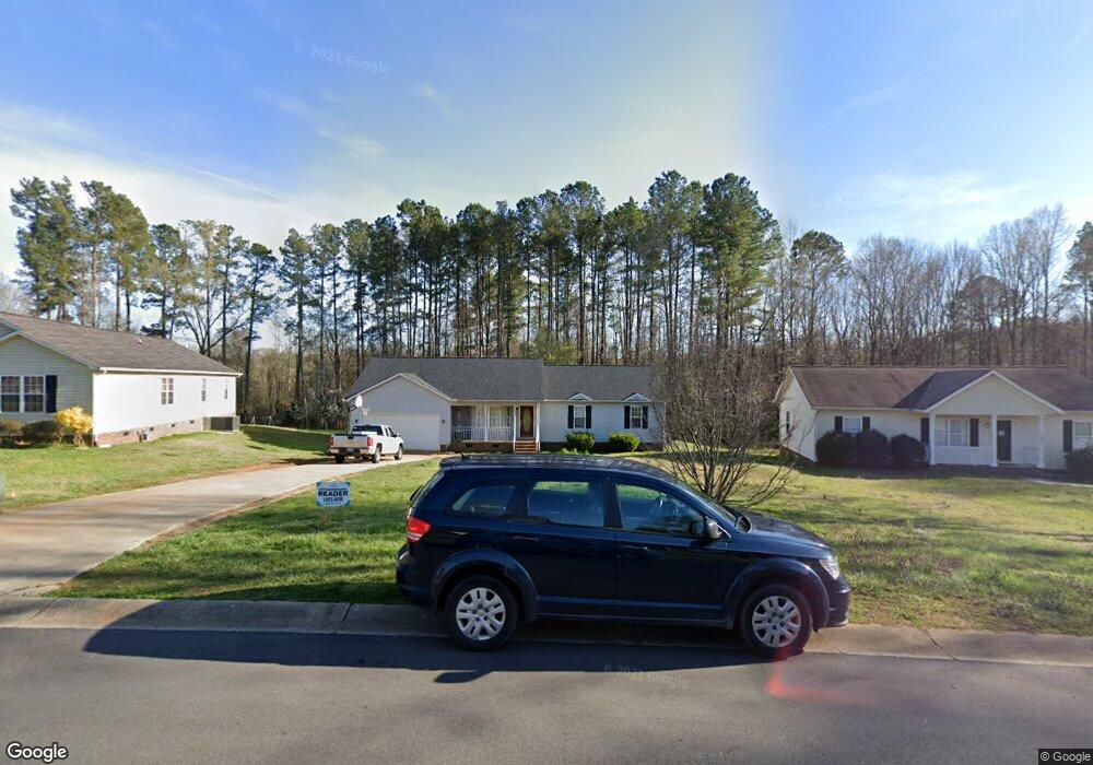
2602 Fox Fire Dr Unit 10 Salisbury, NC 28147
Estimated Value: $289,000 - $334,000
3
Beds
2
Baths
1,949
Sq Ft
$160/Sq Ft
Est. Value
About This Home
This home is located at 2602 Fox Fire Dr Unit 10, Salisbury, NC 28147 and is currently estimated at $312,165, approximately $160 per square foot. 2602 Fox Fire Dr Unit 10 is a home located in Rowan County with nearby schools including Knollwood Elementary School, Knox Middle School, and North Rowan Middle School.
Ownership History
Date
Name
Owned For
Owner Type
Purchase Details
Closed on
Sep 29, 2016
Sold by
Hairston Shonda R and Hairston Thaniel L
Bought by
Pla Julio and Pla Aracelis
Current Estimated Value
Home Financials for this Owner
Home Financials are based on the most recent Mortgage that was taken out on this home.
Original Mortgage
$142,000
Outstanding Balance
$116,602
Interest Rate
4.25%
Mortgage Type
Adjustable Rate Mortgage/ARM
Estimated Equity
$195,563
Purchase Details
Closed on
Sep 20, 1996
Bought by
Hairston Shonda R and Hairston Us
Create a Home Valuation Report for This Property
The Home Valuation Report is an in-depth analysis detailing your home's value as well as a comparison with similar homes in the area
Home Values in the Area
Average Home Value in this Area
Purchase History
| Date | Buyer | Sale Price | Title Company |
|---|---|---|---|
| Pla Julio | $140,000 | None Available | |
| Pla Julio | $140,000 | None Available | |
| Hairston Shonda R | -- | -- |
Source: Public Records
Mortgage History
| Date | Status | Borrower | Loan Amount |
|---|---|---|---|
| Open | Pla Julio | $142,000 | |
| Closed | Pla Julio | $142,000 |
Source: Public Records
Tax History Compared to Growth
Tax History
| Year | Tax Paid | Tax Assessment Tax Assessment Total Assessment is a certain percentage of the fair market value that is determined by local assessors to be the total taxable value of land and additions on the property. | Land | Improvement |
|---|---|---|---|---|
| 2025 | $2,645 | $221,142 | $28,000 | $193,142 |
| 2024 | $2,645 | $221,142 | $28,000 | $193,142 |
| 2023 | $2,645 | $221,142 | $28,000 | $193,142 |
| 2022 | $2,050 | $148,862 | $18,500 | $130,362 |
| 2021 | $2,050 | $148,862 | $18,500 | $130,362 |
| 2020 | $2,050 | $148,862 | $18,500 | $130,362 |
| 2019 | $2,050 | $148,862 | $18,500 | $130,362 |
| 2018 | $1,652 | $121,564 | $18,500 | $103,064 |
| 2017 | $1,643 | $121,564 | $18,500 | $103,064 |
| 2016 | $1,598 | $121,564 | $18,500 | $103,064 |
| 2015 | $1,608 | $121,564 | $18,500 | $103,064 |
| 2014 | $1,587 | $121,464 | $18,500 | $102,964 |
Source: Public Records
Map
Nearby Homes
- 2424 Cranberry Way
- 128 Rowan Mill Rd
- 110 Par Dr
- 282 Winston Ln
- 2248 Cranberry Way
- 2260 Cranberry Way
- 709 Sunset Dr
- 704 Colby Cir
- 0 W Jake Alexander Blvd Unit CAR4313515
- 0 W Jake Alexander Blvd Unit CAR4042762
- 402 Swaim Ct
- 0 601 Hwy Unit CAR4122412
- 153 Grants Landing Dr
- 152 Grants Landing Dr
- 1612 Mooresville Rd
- 104 Ardsley Way
- 414 E Glenview Dr
- 102 Wyndham Way
- 1618 4th St
- Woodruff II Plan at Grants Landing - Meadows
- 2602 Fox Fire Dr
- 2606 Foxfire Dr
- 2526 Fox Fire Dr
- 2606 Fox Fire Dr
- 2610 Fox Fire Dr
- 2610 Foxfire Dr
- 2601 Fox Fire Dr
- 2522 Fox Fire Dr
- 2603 Fox Fire Dr
- 2614 Fox Fire Dr
- 2518 Fox Fire Dr
- 2521 Fox Fire Dr
- 2611 Fox Fire Dr
- 2517 Fox Fire Dr
- 2517 Foxfire Dr
- 2514 Fox Fire Dr
- 2618 Fox Fire Dr
- 2621 Fox Fire Dr
- 2510 Fox Fire Dr
- 2509 Foxfire Dr