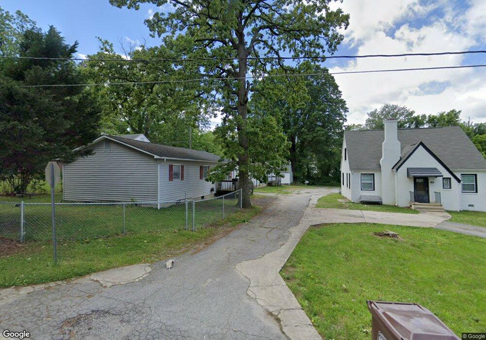
2602 Ty Cir High Point, NC 27260
Greater High Point NeighborhoodEstimated Value: $146,000 - $168,987
3
Beds
2
Baths
960
Sq Ft
$165/Sq Ft
Est. Value
About This Home
This home is located at 2602 Ty Cir, High Point, NC 27260 and is currently estimated at $157,997, approximately $164 per square foot. 2602 Ty Cir is a home located in Guilford County with nearby schools including Montlieu Academy of Technology, Welborn Academy of Science & Technology, and T.W. Andrews High School.
Ownership History
Date
Name
Owned For
Owner Type
Purchase Details
Closed on
Jul 18, 2014
Sold by
Stamper Sunni A
Bought by
Idoline Properties Llc
Current Estimated Value
Purchase Details
Closed on
Aug 19, 2011
Sold by
Citimortgage Inc
Bought by
Stamper Sunnie A
Purchase Details
Closed on
Jun 3, 2011
Sold by
Simmons Debora L
Bought by
Citimortgage Inc
Purchase Details
Closed on
Feb 25, 1998
Sold by
Snow James M and Davis William G
Bought by
Simmons Deborah L
Home Financials for this Owner
Home Financials are based on the most recent Mortgage that was taken out on this home.
Original Mortgage
$47,200
Interest Rate
6.95%
Create a Home Valuation Report for This Property
The Home Valuation Report is an in-depth analysis detailing your home's value as well as a comparison with similar homes in the area
Home Values in the Area
Average Home Value in this Area
Purchase History
| Date | Buyer | Sale Price | Title Company |
|---|---|---|---|
| Idoline Properties Llc | $17,000 | None Available | |
| Stamper Sunnie A | $15,000 | None Available | |
| Citimortgage Inc | $23,059 | None Available | |
| Simmons Deborah L | $56,000 | -- |
Source: Public Records
Mortgage History
| Date | Status | Borrower | Loan Amount |
|---|---|---|---|
| Previous Owner | Simmons Deborah L | $47,200 | |
| Closed | Simmons Deborah L | $11,800 |
Source: Public Records
Tax History
| Year | Tax Paid | Tax Assessment Tax Assessment Total Assessment is a certain percentage of the fair market value that is determined by local assessors to be the total taxable value of land and additions on the property. | Land | Improvement |
|---|---|---|---|---|
| 2025 | $1,082 | $78,500 | $8,100 | $70,400 |
| 2024 | $1,082 | $78,500 | $8,100 | $70,400 |
| 2023 | $1,082 | $78,500 | $8,100 | $70,400 |
| 2022 | $1,058 | $78,500 | $8,100 | $70,400 |
| 2021 | $825 | $59,900 | $4,100 | $55,800 |
| 2020 | $825 | $59,900 | $4,100 | $55,800 |
| 2019 | $825 | $59,900 | $0 | $0 |
| 2018 | $821 | $59,900 | $0 | $0 |
| 2017 | $821 | $59,900 | $0 | $0 |
| 2016 | $996 | $71,000 | $0 | $0 |
| 2015 | $1,001 | $71,000 | $0 | $0 |
| 2014 | $1,018 | $71,000 | $0 | $0 |
Source: Public Records
Map
Nearby Homes
- 2209 Gable Way
- 1402 Darden St
- 1451 Finsbury Ln
- 1120 Carolina St
- 2507 Suffolk Ave
- 1456 London Dr
- 1445 Bailey Cir
- 1509 & 1511 Wiltshire St
- 1707 Brockett Ave
- 1702 Brockett Ave
- 1717 Carolina St
- 504 Ellwood Dr
- 3206 Crestview Dr
- 1519 Mcguinn Dr
- 828 Circle Dr
- 1606 Boundary Ave
- 1604 Boundary Ave
- 1602 Boundary Ave
- 1012 Meadowbrook Blvd
- 1508 Boundary Ave
- 1103 Wayside St
- 2604 Ty Cir
- 1107 Wayside St
- 927 Beaumont Ave
- 2600 Ty Cir
- 1101 Wayside St
- 2601 Ty Cir
- 2603 Ty Cir
- 1111 Wayside St
- 1106 Cleveland St
- 1104 Wayside St
- 1102 Wayside St
- 1110 Cleveland St
- 1113 Wayside St
- 1100 Wayside St
- 1106 Wayside St
- 928 Beaumont Ave
- 930 Beaumont Ave
- 1115 Wayside St
- 926 Beaumont Ave
Your Personal Tour Guide
Ask me questions while you tour the home.