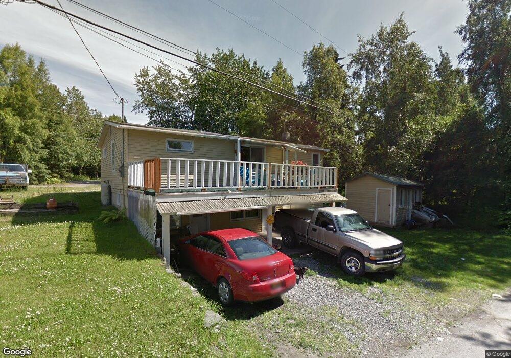
2604 Mcrae Rd Anchorage, AK 99517
Spenard NeighborhoodEstimated Value: $257,000 - $319,000
3
Beds
2
Baths
1,770
Sq Ft
$161/Sq Ft
Est. Value
About This Home
This home is located at 2604 Mcrae Rd, Anchorage, AK 99517 and is currently estimated at $285,787, approximately $161 per square foot. 2604 Mcrae Rd is a home located in Anchorage Municipality with nearby schools including Northwood Elementary School, Romig Middle School, and West High School.
Ownership History
Date
Name
Owned For
Owner Type
Purchase Details
Closed on
Jul 28, 2023
Sold by
Danger Nicholas
Bought by
Johnson John F C and Johnson Eleanor M
Current Estimated Value
Home Financials for this Owner
Home Financials are based on the most recent Mortgage that was taken out on this home.
Original Mortgage
$187,500
Outstanding Balance
$182,755
Interest Rate
6.69%
Mortgage Type
New Conventional
Estimated Equity
$103,032
Purchase Details
Closed on
Jun 17, 2019
Sold by
Lewis Henry William and Lewis Lee M
Bought by
Danger Nicholas
Home Financials for this Owner
Home Financials are based on the most recent Mortgage that was taken out on this home.
Original Mortgage
$187,500
Interest Rate
4.1%
Mortgage Type
New Conventional
Create a Home Valuation Report for This Property
The Home Valuation Report is an in-depth analysis detailing your home's value as well as a comparison with similar homes in the area
Home Values in the Area
Average Home Value in this Area
Purchase History
| Date | Buyer | Sale Price | Title Company |
|---|---|---|---|
| Johnson John F C | -- | First American Title Insurance | |
| Danger Nicholas | -- | None Available |
Source: Public Records
Mortgage History
| Date | Status | Borrower | Loan Amount |
|---|---|---|---|
| Open | Johnson John F C | $187,500 | |
| Previous Owner | Danger Nicholas | $187,500 |
Source: Public Records
Tax History
| Year | Tax Paid | Tax Assessment Tax Assessment Total Assessment is a certain percentage of the fair market value that is determined by local assessors to be the total taxable value of land and additions on the property. | Land | Improvement |
|---|---|---|---|---|
| 2025 | $4,936 | $208,000 | -- | $208,000 |
| 2024 | $4,936 | $305,700 | $99,300 | $206,400 |
| 2023 | $5,153 | $285,900 | $99,300 | $186,600 |
| 2022 | $4,700 | $279,100 | $99,300 | $179,800 |
| 2021 | $4,837 | $268,400 | $99,300 | $169,100 |
| 2020 | $4,510 | $265,300 | $99,300 | $166,000 |
| 2019 | $4,299 | $262,800 | $99,300 | $163,500 |
| 2018 | $4,105 | $250,300 | $93,600 | $156,700 |
| 2017 | $4,081 | $260,600 | $93,600 | $167,000 |
| 2016 | $3,296 | $242,900 | $87,900 | $155,000 |
| 2015 | $3,296 | $240,100 | $83,700 | $156,400 |
| 2014 | $3,296 | $224,500 | $83,700 | $140,800 |
Source: Public Records
Map
Nearby Homes
- 2511 Abbey Ln
- 3517 Vintage Cir
- 4000 Iowa Dr
- NHN Northwood Dr
- 5000 Northwood Dr
- 3240 Wiley Post Loop
- 4302 Forrest Rd
- 3409 Oregon Dr
- 3605 Oregon Dr Unit 4
- 2906 W 29th Ave
- 3105 Lakeshore Dr Unit 4062
- 2921 W 29th Ave Unit 5B
- 4420 Van Buren St
- 3406 Wyoming Dr
- 1808 Cleveland Ave
- 3333 Lakeshore Dr Unit 2
- 3333 Lakeshore Dr Unit 5
- Tr A W Northern Lights Blvd
- 3507 Greenland Dr
- 2060 Wenmatt Cir
- 2606 Mcrae Rd
- 2604 Mcrae Rd Unit 2
- 2604 Mcrae Rd Unit 1
- 2608 Mcrae Rd
- 2610 Mcrae Rd
- 3700 Forrest Rd
- 3704 Barbara Dr
- 3680 Forrest Rd
- 3706 Barbara Dr
- 3706 Barbara Dr
- 2613 Mcrae Rd
- 2616 Mcrae Rd
- 3701 Barbara Dr
- 3708 Barbara Dr
- 3705 Barbara Dr
- 3712 Barbara Dr
- 2700 Mcrae Rd
- 3707 Barbara Dr
- 3707 Barbara Dr
- 2606 Abbey Ln
Your Personal Tour Guide
Ask me questions while you tour the home.