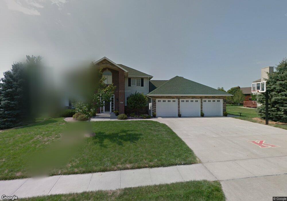
2605 Forest St Carroll, IA 51401
Estimated Value: $469,783 - $597,000
4
Beds
2
Baths
2,952
Sq Ft
$176/Sq Ft
Est. Value
About This Home
This home is located at 2605 Forest St, Carroll, IA 51401 and is currently estimated at $520,446, approximately $176 per square foot. 2605 Forest St is a home with nearby schools including Fairview Elementary School, Adams Elementary School, and Carroll Middle School.
Ownership History
Date
Name
Owned For
Owner Type
Purchase Details
Closed on
Nov 30, 2023
Sold by
John C And Doreen M Grote Revocable Trus
Bought by
Kayleemax Llc
Current Estimated Value
Purchase Details
Closed on
Jul 25, 2023
Sold by
Burton & Lois Rohrbeck Family Trust
Bought by
John C And Doreen M Grote Revocable Trust and Grote
Purchase Details
Closed on
Sep 19, 2022
Sold by
Richard Grote
Bought by
Conner Matthew J and Conner Rhonda L
Create a Home Valuation Report for This Property
The Home Valuation Report is an in-depth analysis detailing your home's value as well as a comparison with similar homes in the area
Home Values in the Area
Average Home Value in this Area
Purchase History
| Date | Buyer | Sale Price | Title Company |
|---|---|---|---|
| Kayleemax Llc | -- | None Listed On Document | |
| John C And Doreen M Grote Revocable Trust | $546,500 | None Listed On Document | |
| Conner Matthew J | $1,782,000 | -- |
Source: Public Records
Tax History Compared to Growth
Tax History
| Year | Tax Paid | Tax Assessment Tax Assessment Total Assessment is a certain percentage of the fair market value that is determined by local assessors to be the total taxable value of land and additions on the property. | Land | Improvement |
|---|---|---|---|---|
| 2025 | $5,362 | $491,870 | $48,000 | $443,870 |
| 2024 | $5,254 | $419,180 | $48,000 | $371,180 |
| 2023 | $5,785 | $419,180 | $48,000 | $371,180 |
| 2022 | $5,492 | $387,770 | $42,000 | $345,770 |
| 2021 | $5,492 | $387,770 | $42,000 | $345,770 |
| 2020 | $5,612 | $387,770 | $42,000 | $345,770 |
| 2019 | $5,716 | $387,770 | $42,000 | $345,770 |
| 2018 | $5,380 | $387,770 | $42,000 | $345,770 |
| 2017 | $5,380 | $384,323 | $48,792 | $335,531 |
| 2016 | $5,016 | $359,180 | $0 | $0 |
| 2015 | $5,016 | $327,110 | $0 | $0 |
| 2014 | $4,504 | $327,110 | $0 | $0 |
Source: Public Records
Map
Nearby Homes
- 2340 Skyline Dr
- 219 Windwood Dr
- 265 Perch St
- 746 Granada Rd
- 1546 Olive St
- 1550 Edgewood Dr
- 611 W 21st St
- 1601 N Main St
- 638 Capistrano Ave
- 1515 N Main St
- 711 W 21st St
- 1852 Quint Ave
- 1509 Birch St
- 641 Alta Vista Dr
- 1320 N Adams St
- 631 W 17th St
- 1810 Crestview Dr
- 1137 High Ridge Rd
- 1108 N Main St
- 1608 Salinger Ave
- 2615 Forest St
- 2529 Forest St
- 2608 Forest St
- 2608 Ashwood Dr
- 2530 Ashwood Dr
- 2528 Forest St
- 2625 Forest St
- 2517 Forest St
- 2626 Forest St
- 2628 Ashwood Dr
- 2518 Forest St
- 2520 Ashwood Dr
- 2603 Skyline Dr
- 2529 Skyline Dr
- 2617 Skyline Dr
- 2605 Ashwood Dr
- 2509 Forest St
- 2615 Ashwood Dr
- 2529 Ashwood Dr
- 2506 Ashwood Dr